Category:Maps of Mysore
Jump to navigation
Jump to search
Subcategories
This category has the following 2 subcategories, out of 2 total.
M
O
- Old maps of Mysore (12 F)
Media in category "Maps of Mysore"
The following 19 files are in this category, out of 19 total.
-
Agri map.jpg 1,049 × 864; 288 KB
-
Agriculture Mysore 1926.jpg 1,401 × 1,248; 451 KB
-
Distance from major cities to North Karnataka.jpg 533 × 771; 101 KB
-
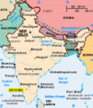
Karnataka - Mysore.PNG 379 × 451; 51 KB
-
LocationMysore.png 474 × 547; 65 KB
-
Map of Dharwar and Mysore (page 9 crop).jpg 2,467 × 3,304; 1.32 MB
-
Map of Mysore.jpg 1,336 × 969; 559 KB
-
Map of Peninsular India to Illustrate the History of Mysore.jpg 2,605 × 2,457; 1.73 MB
-
Mysore 1704.jpeg 1,400 × 1,468; 1.75 MB
-
Mysore battle map.jpg 2,000 × 1,415; 3.72 MB
-
Mysore Bowring.jpg 2,148 × 1,740; 2.3 MB
-
Mysore in India (1951).svg 980 × 1,182; 200 KB
-
Mysore in the Indian Empire with other Indian states and British India.png 1,621 × 1,401; 167 KB
-
Mysore map 1930.jpg 1,772 × 2,086; 1.57 MB
-
Mysore map.png 1,134 × 1,200; 1.94 MB
-
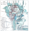
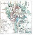
Plan of Mysore.jpg 1,137 × 1,209; 1.73 MB
-
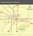
Schematic tourist map of Mysore.jpg 2,071 × 2,282; 200 KB
-
Southern India 1808.jpg 3,084 × 2,749; 8.03 MB
-
Srirangapatnam battle map.jpg 2,000 × 1,342; 2.89 MB


