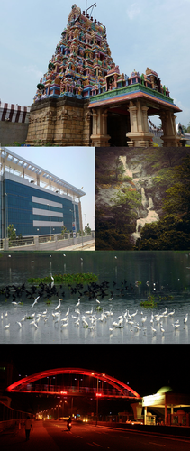
Category:Maps of Coimbatore
Jump to navigation
Jump to search
- 84 most populous urban agglomerations of India
- Agra
- Ahmedabad
- Bangalore (Bengaluru)
- Bareilly
- Bhopal
- Bhubaneswar
- Chandigarh
- Chennai
- Coimbatore
- Delhi
- Durgapur
- Guwahati
- Gwalior
- Hyderabad
- Indore
- Jaipur
- Jodhpur
- Kannur
- Kanpur
- Kochi
- Kolkata
- Kollam
- Kozhikode
- Lucknow
- Madurai
- Malappuram
- Mangalore
- Mumbai
- Mysore
- Nagpur
- Patna
- Pune
- Siliguri
- Srinagar
- Surat
- Thiruvananthapuram
- Thrissur
- Tiruchirappalli
- Varanasi
- Vijayawada
- Visakhapatnam
- National and state capitals
- Bangalore
- Bhopal
- Bhubaneswar
- Chandigarh
- Chennai
- Dharamshala
- Hyderabad
- Jaipur
- Kolkata
- Lucknow
- Mumbai
- Nagpur
- New Delhi
- Patna
- Shimla
- Srinagar
- Thiruvananthapuram
Wikimedia category | |||||
| Upload media | |||||
| Instance of | |||||
|---|---|---|---|---|---|
| Category combines topics | |||||
| Coimbatore | |||||
city in Tamil Nadu, India | |||||
| Audio | |||||
| Pronunciation audio | |||||
| Instance of | |||||
| Location |
| ||||
| Official language | |||||
| Head of government |
| ||||
| Significant event |
| ||||
| Population |
| ||||
| Area |
| ||||
| Elevation above sea level |
| ||||
| official website | |||||
 | |||||
Media in category "Maps of Coimbatore"
The following 8 files are in this category, out of 8 total.
-
CBEGolfCourse.png 991 × 729; 135 KB
-
Coimbatore circular railway.jpg 567 × 478; 41 KB
-
Coimbatore city locator.png 638 × 472; 283 KB
-
Coimbatoretidelpark Layout.jpg 560 × 1,130; 90 KB
-
Isha yoga center map.png 3,435 × 2,016; 806 KB
-
Isha yoga center map.svg 744 × 1,052; 1.27 MB
-
Map To Isha Yoga Center.png 3,262 × 2,233; 549 KB
-
Tidelparkcoimbatore Map.jpg 800 × 327; 50 KB


