Category:Maps of Italy in the 15th century
Jump to navigation
Jump to search
English: This category is about the subject of  Italy 1401-1500 CE: History maps showing all or a substantial part of the territory of Italy as it was in the 15th century.
Contemporary old maps belong into: Category:15th-century maps of Italy and its subcategories.
Contemporary old maps belong into: Category:15th-century maps of Italy and its subcategories.
Maps of the history of Italy by century: 1st century · 2nd century · 3rd century · 4th century · 5th century · 6th century · 7th century · 8th century · 9th century · 10th century · 11th century · 12th century · 13th century · 14th century · 15th century · 16th century · 17th century · 18th century · 19th century · 20th century · 21st century ·
Media in category "Maps of Italy in the 15th century"
The following 68 files are in this category, out of 68 total.
-
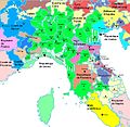
Ducato di Milano, 1402.svg 558 × 595; 174 KB
-
Duchy of Milan (1402).svg 3,264 × 3,837; 254 KB
-
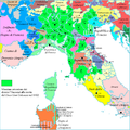
Italie du Nord 1402 fr.jpg 816 × 794; 403 KB
-
Map of Italy (1402)-fr.svg 3,264 × 3,837; 336 KB
-
Massima espansione Viscontea.png 1,000 × 1,004; 287 KB
-
Ita-tuscany-pisa-1405.png 350 × 267; 33 KB
-
Italian peninsula 1422.2.png 1,580 × 1,538; 206 KB
-
Italian peninsula 1422.png 799 × 793; 157 KB
-
Central States of the Church c 1430.png 1,900 × 3,106; 12.57 MB
-
C. 1450 Republic of Venice (Mainland region).jpg 1,156 × 594; 725 KB
-
C. 1450 Southern Europe Ecclesiastical.jpg 1,659 × 1,414; 1.65 MB
-
Italy 1454 after the Peace of Lodi.jpg 3,000 × 3,840; 8.08 MB
-
Itàlia - Patz de Lodi (1454).png 1,029 × 1,054; 362 KB
-
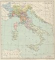
Map Italy in 1454- Touring Club Italiano CART-TRC-46.jpg 6,135 × 6,668; 4.74 MB
-
Marchesato del Monferrato nel 1454.png 1,000 × 505; 29 KB
-
The Kingdom of naples with administrative divisions as they were in 1454.png 2,126 × 2,481; 478 KB
-
The Kingdom of Naples with administrative divisions in 1454-uk.png 2,126 × 2,481; 572 KB
-
C. 1454 Italian Peninsula.jpg 3,000 × 4,000; 4.45 MB
-
Italian peninsula 1455.2.png 1,580 × 1,538; 211 KB
-
Italian peninsula 1455.png 801 × 787; 161 KB
-
Italien. 2. Hälfte 15. Jh.svg 1,276 × 1,063; 1.88 MB
-
Oostr1477.png 800 × 600; 1.38 MB
-
1490-italia-italy 1490 jpg.jpg 1,000 × 1,306; 429 KB
-
C. 1494 Italy.jpg 1,298 × 1,727; 2.71 MB
-
Historical map of Italy before reunification in 1494.png 830 × 1,072; 544 KB
-
Italia 1494 ko.svg 3,481 × 4,167; 851 KB
-
Italia 1494 topo-ru.png 2,493 × 2,168; 2.35 MB
-
Italia 1494 topo.svg 3,522 × 2,368; 2.04 MB
-
Italia 1494-es.svg 3,481 × 4,167; 1.39 MB
-
Italia 1494-it.svg 3,481 × 4,167; 849 KB
-
Italia 1494b-es.svg 688 × 930; 418 KB
-
Italy 1494 AD hu.svg 688 × 930; 417 KB
-
Italy 1494 AD-ar.png 419 × 600; 92 KB
-
Italy 1494 AD-fr.svg 576 × 812; 407 KB
-
Italy 1494 AD-hu.svg 688 × 930; 416 KB
-
Italy 1494 AD-it.svg 688 × 930; 418 KB
-
Italy 1494 AD.png 1,261 × 1,805; 144 KB
-
Italy 1494 el.png 419 × 600; 98 KB
-
Italy 1494 shepherd detail.jpg 781 × 669; 699 KB
-
Italy 1494 shepherd.jpg 1,629 × 2,282; 1.39 MB
-
Location of the Duchy of Milan-es.svg 3,245 × 3,948; 1.06 MB
-
Location of the Duchy of Milan-it-zoom.svg 2,200 × 1,800; 675 KB
-
Location of the Duchy of Milan-it.svg 3,245 × 3,948; 918 KB
-
Location of the Duchy of Milan-no.svg 3,245 × 3,948; 918 KB
-
Location of the March of Montferrat-es.svg 3,481 × 4,167; 1.39 MB
-
Location of the March of Montferrat-it.svg 3,245 × 3,948; 918 KB
-
Map of Italy (1494)-en.svg 3,461 × 4,211; 403 KB
-
Map of Italy (1494)-fr.svg 3,245 × 3,948; 534 KB
-
Map of Italy (1494)-it-2.png 493 × 600; 103 KB
-
Map of Italy (1494)-it.svg 3,245 × 3,948; 536 KB
-
Map of Italy (1494)-mk.svg 3,245 × 3,948; 1.11 MB
-
Nice 1494.png 501 × 600; 144 KB
-
Northern Italy in 1494.png 601 × 541; 811 KB
-
Battle of Seminara Ops-es.svg 752 × 789; 128 KB
-
Battle of Seminara Ops.svg 752 × 789; 345 KB
-
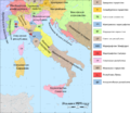
Grandi Casate Italiane nel 1499.png 1,490 × 1,372; 1.09 MB
-
Italy in 1499.png 6,600 × 5,700; 4.98 MB
-
A history of mediaeval and modern Europe for secondary schools (1914) (14597819338).jpg 3,344 × 1,992; 636 KB
-
C. 12th-15th century Italian Peninsula Ecclesiastical.jpg 3,000 × 4,000; 4.19 MB
-
Italia 1494-ca.svg 3,481 × 4,167; 1.5 MB
-
Italia 1494b-ca.svg 688 × 930; 416 KB
-
Italia. Cambiamenti territoriali (1495-1535).png 1,500 × 1,381; 372 KB
-
Italy 1450-1500.svg 1,276 × 1,063; 1.87 MB
-
Itália 1499-ben.png 1,490 × 1,372; 805 KB
-
Map of Italy (1402)-ca.svg 3,264 × 3,837; 322 KB
-
Spruner-Menke Handatlas 1880 Karte 26.jpg 10,407 × 8,681; 21.01 MB
-
The Lands of Venice in the 15th century.jpg 2,807 × 1,877; 2.75 MB


