Category:Maps of Italy in the 11th century
Jump to navigation
Jump to search
English: This category is about the subject of  Italy 1001-1100 CE: History maps showing all or a substantial part of the territory of Italy as it was in the 11th century.
Contemporary old maps belong into: Category:Old maps of Italy and its subcategories.
Contemporary old maps belong into: Category:Old maps of Italy and its subcategories.
Maps of the history of Italy by century: 1st century · 2nd century · 3rd century · 4th century · 5th century · 6th century · 7th century · 8th century · 9th century · 10th century · 11th century · 12th century · 13th century · 14th century · 15th century · 16th century · 17th century · 18th century · 19th century · 20th century · 21st century ·
Subcategories
This category has only the following subcategory.
Media in category "Maps of Italy in the 11th century"
The following 34 files are in this category, out of 34 total.
-
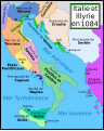
 Italy and Illyria 1084 AD-hu.svg 588 × 735; 204 KB
-
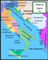
 Italy and Illyria 1084 AD-it.svg 588 × 735; 944 KB
-
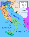
 Italy and Illyria 1084 AD-ru.svg 588 × 735; 252 KB
-
 Italy and Illyria 1084 AD-sv.png 480 × 600; 83 KB
-
 Italy and Illyria 1084 AD-zh.png 587 × 735; 173 KB
-
 Italy and Illyria 1084 AD-zh.svg 512 × 641; 220 KB
-
 Italy and Illyria 1084 AD.svg 586 × 735; 522 KB
-

-
 ItalieIllyrie1084-fr.PNG 480 × 600; 118 KB
-
 Italien och Illyrien 1084 heb.png 480 × 600; 102 KB
-
 Italy 1000 AD pl.svg 565 × 811; 961 KB
-
 Italy and Illyria 1084 AD-ca.svg 964 × 1,206; 430 KB
-
 Italy and Illyria 1084 AD-es.svg 964 × 1,206; 419 KB
-
 Italy and Illyria 1084 AD-fr.svg 964 × 1,206; 139 KB
-
 Italy and Illyria 1084 AD-vi.svg 512 × 640; 57 KB
-
 Italy and Illyria 1084 v2 nl.svg 588 × 735; 637 KB
-
 Italy and Illyria 1084 v2 pt.svg 588 × 735; 78 KB
-
 Italy and Illyria 1084 v2-ar.svg 588 × 735; 147 KB
-
 Italy and Illyria 1084 v2-es.svg 588 × 735; 204 KB
-
 Italy and Illyria 1084.png 2,000 × 2,500; 919 KB
-
 Italy in the 10th-11th centuries.png 2,249 × 2,881; 13.57 MB
-

-
 Modern history; Europe (1904) (14579040970).jpg 2,016 × 3,004; 1.92 MB
-
 Modern history; Europe (1904) (14765415832).jpg 2,028 × 3,008; 2.05 MB
-
 Norman conquest of Italy-fr.svg 2,335 × 2,890; 757 KB
-
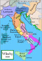
 Putz86.jpg 690 × 800; 141 KB
-
 Spruner-Menke Handatlas 1880 Karte 22.jpg 3,487 × 2,955; 1.32 MB
-
 Syditalien vid den normandiska erövringen.jpg 907 × 700; 290 KB
-

-
 Италия 1000 год.jpg 1,312 × 1,588; 103 KB
-
 Южная Италия, 1025 год.gif 280 × 349; 18 KB
-
 Южная Италия, 1042 год.gif 280 × 349; 23 KB
-
 Южная Италия, 1071 год.gif 281 × 349; 22 KB
-
 Южная Италия, 1092 год.gif 281 × 349; 15 KB


.jpg)


.jpg)
_(14579040970).jpg)
_(14765415832).jpg)


.jpg)


