Category:Maps of Italy in the 20th century
Jump to navigation
Jump to search
English: This category is about the subject of  Italy 1901-2000 CE: History maps showing all or a substantial part of the territory of Italy as it was in the 20th century.
Contemporary old maps belong into: Category:20th-century maps of Italy and its subcategories.
Contemporary old maps belong into: Category:20th-century maps of Italy and its subcategories.
Maps of the history of Italy by century: 1st century · 2nd century · 3rd century · 4th century · 5th century · 6th century · 7th century · 8th century · 9th century · 10th century · 11th century · 12th century · 13th century · 14th century · 15th century · 16th century · 17th century · 18th century · 19th century · 20th century · 21st century ·
Subcategories
This category has the following 2 subcategories, out of 2 total.
W
Media in category "Maps of Italy in the 20th century"
The following 39 files are in this category, out of 39 total.
-
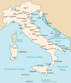
Kingdom of Italy (1914).svg 450 × 456; 468 KB
-
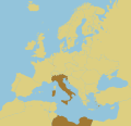
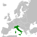
LocationItaly 1914.png 250 × 115; 7 KB
-
Italiansko kralstvo 1919 map.svg 3,360 × 3,950; 849 KB
-
Kingdom of Italy 1919 map-es.svg 3,360 × 3,950; 972 KB
-
Kingdom of Italy 1919 map.svg 3,360 × 3,950; 856 KB
-
Kingdom of Italy (1920) location.svg 2,845 × 2,737; 457 KB
-
Kingdom of Italy 1923 map.png 3,360 × 3,950; 1.29 MB
-
Kingdom of Italy 1924 map blank.svg 3,360 × 3,950; 960 KB
-
Kingdom of Italy 1924 map.png 3,360 × 3,950; 1.3 MB
-
Kingdom of Italy 1924 map.svg 3,360 × 3,950; 1,022 KB
-
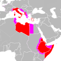
Italian empire 1935.PNG 344 × 241; 8 KB
-
Kingdom of Italy 1935 map.png 3,360 × 3,950; 1.39 MB
-
Kingdom of Italy (1936).svg 450 × 456; 462 KB
-
GreaterItalia.jpg 759 × 625; 201 KB
-
Kingdom of Italy 1941 map.png 3,360 × 3,950; 1.41 MB
-
Grande Italia.jpg 1,306 × 714; 506 KB
-
Imperio italiano es.svg 500 × 501; 355 KB
-
Impero italiano.svg 500 × 501; 816 KB
-
ItalianMareNostrum.jpg 1,254 × 630; 319 KB
-
Litorale Adriatico.svg 3,360 × 3,950; 924 KB
-
Regno d Italia 1943.png 4,000 × 4,690; 2.21 MB
-
Repubblica Sociale Italiana 1943 Mappa.png 4,000 × 4,117; 1.83 MB
-
Republic of Italy 1947 map.png 3,360 × 3,950; 1.32 MB
-
Republic of Italy 1954 map.png 3,360 × 3,950; 1.32 MB
-
Deutschösterreich.PNG 788 × 560; 19 KB
-
GovernatoratoDalmazia.jpg 846 × 637; 134 KB
-
Italian referendum 1946 support for republic fr.svg 1,200 × 1,500; 608 KB
-
Italian referendum 1946 support for republic.svg 1,200 × 1,500; 607 KB
-
Italian referendum 1946-hu.svg 1,200 × 1,500; 609 KB
-
Italien Referendum 1946.svg 850 × 905; 552 KB
-
Jupiter Deployment Italy.jpg 842 × 600; 84 KB
-
Jupiter missile deployment in Italy.jpg 584 × 416; 44 KB
-
Litorale 1.png 2,264 × 2,221; 203 KB
-
Litorale 3.png 744 × 972; 74 KB
-
Nesvobodni rajoni Italija.png 636 × 878; 33 KB
-
Rapallo nuovo confine.JPG 262 × 304; 17 KB
-
SalernoDDayPlans1943.jpg 1,200 × 829; 342 KB
-
Zona d'operazioni delle Prealpi.svg 3,360 × 3,950; 923 KB


