Category:Maps of Poland in the 15th century
Jump to navigation
Jump to search
English: This category is about the subject of  Poland 1401-1500 CE: History maps showing all or a substantial part of the territory of Poland as it was in the 15th century.
Contemporary old maps belong into: Category:15th-century maps of Poland and its subcategories.
Contemporary old maps belong into: Category:15th-century maps of Poland and its subcategories.
Subcategories
This category has the following 2 subcategories, out of 2 total.
Media in category "Maps of Poland in the 15th century"
The following 6 files are in this category, out of 6 total.
-
C. 1450 Poland and Prussia.jpg 1,413 × 1,817; 2.14 MB
-
IRP 1466.PNG 2,420 × 2,232; 1.24 MB
-
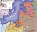
Teutonic Order 1466.png 1,200 × 1,043; 744 KB
-
Teutonic Order 1466-es.svg 1,210 × 1,053; 1.79 MB
-
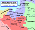
Polish and Lithuanian Conflict with Prussia. 1377-1435..png 968 × 834; 182 KB
-
Spruner-Menke Handatlas 1880 Karte 69.jpg 3,469 × 2,880; 1.48 MB


