Category:Maps of the history of Montenegro in ancient times
Jump to navigation
Jump to search
Subcategories
This category has the following 8 subcategories, out of 8 total.
Media in category "Maps of the history of Montenegro in ancient times"
The following 48 files are in this category, out of 48 total.
-
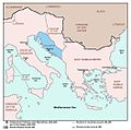
Ancient balkans 4thcentury-es.svg 2,039 × 1,823; 854 KB
-
Ancient balkans 4thcentury-sr.png 1,113 × 845; 88 KB
-
Ancient balkans 4thcentury-zh.svg 2,039 × 1,823; 318 KB
-
Ancient balkans 4thcentury.png 1,113 × 845; 88 KB
-
Ancient Epirus & Modern Borders (Colored)-pt.svg 688 × 1,002; 168 KB
-
Ancient Epirus & Modern Borders (Colored).svg 688 × 1,002; 175 KB
-
Ancient Epirus & Modern Borders zh (Colored).svg 860 × 1,252; 252 KB
-
Ancient Epirus & Modern Borders.svg 688 × 1,002; 200 KB
-
Anticka Doclea.jpg 855 × 701; 113 KB
-
Bay of Kotor and fortresses (English).png 762 × 659; 858 KB
-
Bay of Kotor and fortresses.jpg 1,666 × 613; 125 KB
-
Blank map roman roads in Montenegro 1d.svg 1,663 × 1,769; 21 KB
-
Blank roman roads Montenegro 1a.svg 744 × 1,052; 21 KB
-
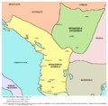
Illyria and Dardania Kingdoms-sr.png 1,596 × 1,576; 118 KB
-
Illyria and Dardania Kingdoms.png 1,596 × 1,576; 118 KB
-
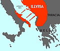
Illyrian colonies in Italy 550 BC (English) (simple map).svg 675 × 579; 259 KB
-
Illyrian colonies in Italy 550 BCE.jpg 675 × 579; 55 KB
-
Illyrian Kingdom of Agron in 231 BC (Hungarian).png 1,731 × 1,015; 2.44 MB
-
KingdomofTeuta.png 2,000 × 2,000; 3.95 MB
-
Kolovrat ostaci rimskog naselja.svg 306 × 296; 40 KB
-
Kolovrat rimsko nalaziste.svg 306 × 277; 36 KB
-
Map of the Kingdom of Agron of the Ardiaei (English).png 2,000 × 2,000; 3.95 MB
-
Map of the Kingdom of Agron of the Ardiaei (English).svg 1,600 × 1,600; 6.46 MB
-
Map of the Kingdom of Agron of the Ardiaei (Portuguese).svg 1,600 × 1,600; 6.46 MB
-
Map of the Kingdom of Gentius in 169 BC (Hungarian).png 1,731 × 1,015; 2.39 MB
-
Map of the Kingdom of Gentius of the Ardiaei (English).svg 1,600 × 1,600; 6.39 MB
-
Map of the Kingdom of Gentius of the Ardiaei (Portuguese).svg 1,600 × 1,600; 6.39 MB
-
Map of the Kingdom of Pinnes in 228 BC (Hungarian).png 1,731 × 1,015; 2.5 MB
-
Map of the Kingdom of Teuta of the Ardiaei (English).svg 1,600 × 1,600; 6.46 MB
-
Map of the Kingdom of Teuta of the Ardiaei (Portuguese).svg 1,600 × 1,600; 6.46 MB
-
Map of the territory of Demetrius of Pharos (English).png 2,000 × 2,000; 3.95 MB
-
Map of the territory of Demetrius of Pharos (English).svg 1,600 × 1,600; 6.43 MB
-
Map of the territory of Demetrius of Pharos (Portuguese).svg 1,600 × 1,600; 6.43 MB
-
Marcellinus Dalmatia-it.svg 822 × 750; 118 KB
-
Marcellinus Dalmatia.jpg 1,054 × 1,041; 98 KB
-
Medieval Balec and ancient roman roads.png 1,717 × 1,951; 372 KB
-
Meteon Labeatidis terrae.svg 319 × 209; 51 KB
-
Municipij S u Kominima kod Pljevalja.svg 306 × 296; 40 KB
-
PAEONIAN ARDIAEAN (ILLYRIAN) DARDANIAN KINGDOMS EXTENT DURING 230 BC.png 1,049 × 938; 1.88 MB
-
Praevalitana in the Roman Emp.jpg 1,177 × 881; 98 KB
-
Praevalitana in The Roman Empire.jpg 1,064 × 801; 89 KB
-
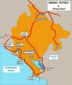
Rimski putevi u CG.png 700 × 824; 420 KB
-
Rivolta pannonica 9.jpg 1,127 × 777; 244 KB
-
Roman Doclea.gif 855 × 701; 64 KB
-
Roman roads 3a.svg 1,681 × 1,853; 139 KB
-
Roman Roads in Montenegro 6a-es.svg 1,019 × 1,147; 139 KB
-
Roman Roads in Montenegro 6a.svg 1,019 × 1,147; 173 KB
-
Roman Roads in Montenegro 800.jpg 800 × 942; 134 KB


