Category:Maps of Greenland
Jump to navigation
Jump to search
Wikimedia category | |||||
| Upload media | |||||
| Instance of | |||||
|---|---|---|---|---|---|
| Category combines topics | |||||
| Greenland | |||||
autonomous country within the Kingdom of Denmark on several islands including world's largest island by the same name | |||||
| Pronunciation audio | |||||
| Instance of |
| ||||
| Part of | |||||
| Location | Denmark | ||||
| Capital | |||||
| Basic form of government |
| ||||
| Legislative body | |||||
| Official language | |||||
| Anthem |
| ||||
| Currency | |||||
| Head of state |
| ||||
| Head of government |
| ||||
| Inception |
| ||||
| Time of discovery or invention |
| ||||
| Highest point |
| ||||
| Population |
| ||||
| Area |
| ||||
| Replaces |
| ||||
| Top-level Internet domain | |||||
| Different from | |||||
| Maximum temperature record |
| ||||
| Minimum temperature record |
| ||||
| official website | |||||
 | |||||
Subcategories
This category has the following 27 subcategories, out of 27 total.
!
*
- Geological maps of Greenland (14 F)
C
- Climate maps of Greenland (10 F)
D
- Divisions of Greenland (5 F)
E
G
L
M
- Maps of Greenland ice sheet (17 F)
O
S
T
- Travel maps of Greenland (7 F)
Pages in category "Maps of Greenland"
This category contains only the following page.
Media in category "Maps of Greenland"
The following 154 files are in this category, out of 154 total.
-
134721main3 seaice min 1979 250.jpg 250 × 188; 51 KB
-
134723main3 seaice min 2005 250.jpg 250 × 188; 51 KB
-
2012 Area & Projection Comparisons Calendar (30885483375).jpg 3,300 × 2,550; 1.6 MB
-
20190625 E.Nielsenvej 9820 (48478144722).jpg 5,304 × 7,952; 28.34 MB
-
20190625 E.Nielsenvej 9822 (48478142542).jpg 5,304 × 7,952; 26.6 MB
-
20190628 TasiilaqMap 1879 (48495380921).jpg 2,194 × 2,346; 1.32 MB
-
20190628 TasiilaqMap 1880 (48495549192).jpg 3,984 × 2,275; 3.8 MB
-
20190630 Kulusuk 2088 (48502705476).jpg 4,032 × 3,024; 3.29 MB
-
20190630 Kulusuk 2089 (48502704991).jpg 4,032 × 3,024; 2.82 MB
-
20190630 KulusukHike 4126 (48502611661).jpg 7,952 × 5,304; 22.72 MB
-
20190630 KulusukMap 1881 (48502654712).jpg 2,288 × 3,777; 3.16 MB
-
20190703 KulusukMap 2090 (48511451032).jpg 2,711 × 2,220; 1.25 MB
-
20190703 KulusukMap 2091 (48511450857).jpg 2,891 × 2,373; 1.11 MB
-
Aasiaat archipelago.png 553 × 640; 94 KB
-
AFSPC leadership visits Thule (4030114).jpeg 5,463 × 3,408; 10.18 MB
-
Amdrup Expedition.png 1,486 × 1,199; 769 KB
-
Angmagssalik map.jpg 9,267 × 6,963; 16.68 MB
-
Angmagssalik map.tiff 9,267 × 6,963, 2 pages; 184.84 MB
-
Angmagssalik.png 9,267 × 6,963; 95.47 MB
-
Arctic-umiaq-line-ports-of-call-Arabic.png 2,000 × 3,333; 475 KB
-
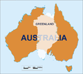
Australia-Greenland Overlay.png 520 × 463; 23 KB
-
Baffin Bay, Canada uk.png 2,000 × 1,697; 552 KB
-
Big info tugtupite 02.jpg 779 × 448; 159 KB
-
BlueOutlineGreenland.png 450 × 750; 21 KB
-
Brugsen in Sisimiut in 2010.JPG 3,456 × 2,304; 2.47 MB
-
Cambios en la capa de hielo de Groenlandia.jpg 540 × 450; 56 KB
-
Carte vestiges archéos Vatnahverfi D Bruun3.jpg 220 × 175; 21 KB
-
Climatic variation in historic and prehistoric time ((1914)) (20663581301).jpg 6,432 × 4,404; 4.9 MB
-
COVID-19 outbreak in Greenland by municipalities.svg 300 × 500; 21 KB
-
Crown Prince Frederick Range-pclmaps-oclc-8322829 c 13.jpg 1,692 × 1,165; 741 KB
-
Crown Prince Frederik's Land.png 2,048 × 1,536; 711 KB
-
Deformed Greenland.jpg 296 × 444; 137 KB
-
Denmark expedition map of Queen Louise Land ca 1908.png 505 × 694; 305 KB
-
Disko Bay.PNG 307 × 599; 23 KB
-
DiskoCloseup.png 501 × 418; 12 KB
-
Dronning Louise Land-NE Greenland.jpg 1,207 × 839; 254 KB
-
Dronning Margrethe II Land.jpg 1,064 × 877; 734 KB
-
ECDM 2019 Arctic Wildfires.pdf 1,625 × 1,125; 1.17 MB
-
ECDM 2020021 Actic Antarctic.pdf 2,479 × 1,754; 759 KB
-
ECDM 20200617 Actic Antarctic.pdf 2,479 × 1,754; 752 KB
-
ECDM 20200717 Arctic Wildfires.pdf 1,625 × 1,125; 602 KB
-
Eskimonaes C501 map sheet.tif 8,933 × 6,795, 2 pages; 173.9 MB
-
F1 large2.JPG 432 × 232; 33 KB
-
Fiskenaesfjorden.png 560 × 494; 506 KB
-
Fram Strait map.png 1,500 × 1,677; 281 KB
-
Gardar, Greenland -location map.png 1,181 × 1,669; 315 KB
-
Geological map of Andrees Land - panoramio.jpg 3,072 × 2,304; 1.9 MB
-
German Greenland Expedition stations 1930-1931.png 719 × 365; 65 KB
-
Germania Land - crop of Operational Navigation Chart B-9, 1st edition.jpg 1,734 × 1,695; 1,000 KB
-
Godhavn v2 C501 map sheet.tif 5,544 × 7,390, 2 pages; 117.45 MB
-
Godthaabsfjord.jpg 990 × 664; 568 KB
-
Greenland - DPLA - 0d53ffc5ba3a0b7c86881ffd6368ee2f.jpg 8,392 × 11,458; 7.06 MB
-
Greenland - DPLA - d7cd9242831d7086b143b9dfc91eb956.jpg 2,406 × 3,122; 6.55 MB
-
Greenland - Itterajivit.PNG 720 × 1,404; 33 KB
-
Greenland - Nuuk.png 2,000 × 2,191; 653 KB
-
Greenland - Nuussuaq peninsula.PNG 720 × 1,404; 33 KB
-
Greenland big.png 367 × 599; 154 KB
-
Greenland camp.png 138 × 216; 9 KB
-
Greenland counties mk.png 738 × 1,383; 50 KB
-
Greenland counties-ar.png 738 × 1,383; 63 KB
-
Greenland counties.PNG 738 × 1,383; 33 KB
-
Greenland Disko Bay.PNG 720 × 1,404; 33 KB
-
Greenland district map.jpg 588 × 888; 131 KB
-
Greenland east-ar.png 968 × 1,602; 74 KB
-
Greenland east.PNG 968 × 1,602; 38 KB
-
Greenland Ice Mass Loss 2002-2023 (SVS31156 - gris with velocity 200204-202304).tiff 3,840 × 2,160; 3.01 MB
-
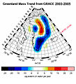
Greenland Ice Mass Trend.jpg 1,268 × 1,392; 613 KB
-
Greenland ice sheet thinning rate.jpg 253 × 430; 91 KB
-
Greenland ice sheet thinning rate.png 334 × 568; 381 KB
-
Greenland Ittoqqortoormiit.PNG 720 × 1,404; 32 KB
-
Greenland map.png 172 × 306; 65 KB
-
Greenland nat park.PNG 720 × 1,404; 32 KB
-
Greenland national park.png 434 × 646; 15 KB
-
Greenland north-ar.png 968 × 1,602; 41 KB
-
Greenland north.PNG 968 × 1,602; 39 KB
-
Greenland protected areas.jpg 1,181 × 1,669; 529 KB
-
Greenland Qullissat.PNG 720 × 1,404; 33 KB
-
Greenland Thule.png 309 × 507; 35 KB
-
Greenland west-ar.png 968 × 1,602; 76 KB
-
Greenland west.PNG 968 × 1,602; 39 KB
-
Greenlandlocatormap.png 678 × 264; 38 KB
-
GreenlandWorldMap.png 1,427 × 628; 13 KB
-
Grienland ru.png 329 × 609; 589 KB
-
Groenlandia-Mappa.png 295 × 481; 76 KB
-
Grønland norsk okkupation 1931-33.jpg 744 × 1,043; 563 KB
-
HansIslandLocator.png 1,500 × 1,500; 112 KB
-
Hochstetter Foreland map.jpg 1,064 × 877; 220 KB
-
Ice Sheet Mass Balance from GRACE.ogv 21 s, 1,920 × 1,080; 21.6 MB
-
Ikka-map.webp 740 × 472; 36 KB
-
James Hall Christian IV Fjord map.jpg 1,219 × 961; 938 KB
-
Jameson Land.PNG 307 × 599; 23 KB
-
JanMayenlocation.PNG 2,119 × 2,170; 919 KB
-
Kartegraenland.png 540 × 720; 54 KB
-
KeewatinNIEdot400.jpg 960 × 752; 157 KB
-
King Christian X Land.PNG 307 × 599; 23 KB
-
King Frederic VI Coast.PNG 307 × 599; 23 KB
-
King Frederic VIII Land.PNG 307 × 599; 23 KB
-
Kort yvir nordurlond.jpg 734 × 594; 62 KB
-
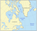
Labrador sea map with state labels.png 500 × 426; 189 KB
-
Labrador sea map.png 500 × 426; 165 KB
-
Location map Greenland Disko Bay.png 762 × 748; 43 KB
-
Location map Greenland Southern.png 786 × 767; 56 KB
-
Location map Nuuk.png 648 × 716; 101 KB
-
LocationGreenland.png 1,427 × 628; 36 KB
-
LocationGreenland.PNG 1,427 × 628; 35 KB
-
Map indicating Baffin Bay-ar.png 566 × 487; 388 KB
-
Map indicating Baffin Bay.png 425 × 365; 68 KB
-
Map indicating Davis Strait.png 340 × 330; 47 KB
-
Map indicating Nares Strait.png 428 × 380; 53 KB
-
Map of Greenland with municipalities and districts.png 15,469 × 25,391; 73.99 MB
-
Map of Greenland.png 14,570 × 25,118; 73.81 MB
-
Map of North Greenland with municipality borders (1911).png 4,610 × 16,433; 21.87 MB
-
Map of Qeqertarsuatsiaat.png 2,192 × 1,818; 510 KB
-
Map of Qeqertarsuatsiaq.png 818 × 909; 360 KB
-
Map of South Greenland with municipality borders (1911).png 8,229 × 16,693; 36.03 MB
-
Map of the municipalities and districts of Greenland 2009-2017.jpg 2,460 × 3,477; 4.94 MB
-
Map of the municipalities and districts of Greenland.jpg 2,460 × 3,477; 4.95 MB
-
Map of Tuttilik.jpg 1,889 × 1,469; 764 KB
-
Mapa de Groenlandia.jpg 800 × 1,113; 208 KB
-
Mylius-Erichsen-Land Karte.png 1,772 × 1,850; 238 KB
-
Nansen Greenland Crossing Map af.png 626 × 682; 67 KB
-
Nansen Greenland Crossing Map no labels.png 626 × 682; 54 KB
-
Nansen Greenland Crossing Map.png 626 × 682; 55 KB
-
Nerlerit-inaat-airport-destinations.svg 240 × 400; 25 KB
-
Nielsen 2016 fig 1.png 552 × 856; 167 KB
-
Nordostrundingen C 501 map sheet.tif 8,890 × 6,755, 2 pages; 172.04 MB
-
North Greenland section-txu-pclmaps-oclc-8322829 a 1.jpg 3,056 × 3,641; 3.39 MB
-
Nuuk Location.jpg 317 × 540; 58 KB
-
Nuussuaq Uummannaq.png 339 × 351; 7 KB
-
Operational Navigation Chart A-1, 1st edition.jpg 9,254 × 6,693; 10.46 MB
-
Operational Navigation Chart A-5, 3rd edition.jpg 9,254 × 6,613; 15.38 MB
-
Operational Navigation Chart D-15, 4th edition.jpg 9,254 × 6,666; 16.56 MB
-
Orthographic projection over Qaanaag.png 488 × 487; 12 KB
-
PAT - Greenland and Iceland.gif 1,440 × 1,800; 331 KB
-
Population density of Greenland municipalities.png 5,028 × 2,932; 578 KB
-
Ramsar Groenlandia.jpg 1,181 × 1,669; 566 KB
-
Schizonella elynae (10.3897-mycokeys.64.47380) Figure 31.jpg 1,512 × 2,008; 2.12 MB
-
SigguupNunaaLocationKallaalitNunaat.png 869 × 711; 200 KB
-
Skjoldungen v2-ed.jpg 2,487 × 3,000; 1.24 MB
-
Southern Greenland.png 776 × 754; 130 KB
-
Søndre Sermilik.JPG 448 × 437; 24 KB
-
Terres Arctiques. Figure xcix. Continent Arctique (13903442298).jpg 1,354 × 2,000; 1 MB
-
Thule AB, Greenland (27256261909).jpeg 3,000 × 2,160; 4.12 MB
-
Topographic map of Greenland bedrock.jpg 802 × 1,042; 267 KB
-
Velocity flow over Greenland.tif 3,840 × 2,160; 12.42 MB
-
VerneGlobal global connectivity.gif 330 × 511; 19 KB
-
Wandel Sea map de.png 2,000 × 2,000; 198 KB
-
Wandel Sea map.png 2,000 × 2,000; 215 KB
-
Westsiedlung.png 720 × 540; 61 KB
-
Κανάκ.png 249 × 354; 36 KB


