Category:Geological maps of Greenland
Jump to navigation
Jump to search
Media in category "Geological maps of Greenland"
The following 14 files are in this category, out of 14 total.
-
Carte géologique de Groenland 2.jpg 496 × 614; 62 KB
-
Carte géologique de Groenland 3.jpg 491 × 608; 59 KB
-
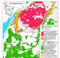
Fig 1. Map of Isua Area.png 886 × 854; 451 KB
-
Greenland-geologymap-Henriksen-2002.png 579 × 899; 258 KB
-
Henriksen-2002-Fig17.png 897 × 1,146; 356 KB
-
Henriksen-2002-Fig21.png 839 × 1,365; 512 KB
-
Henriksen-2002-Fig3.png 891 × 1,199; 2.07 MB
-
Isua2.png 886 × 777; 133 KB
-
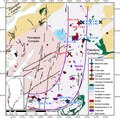
Map of the Maniitsoq Norite Belt.pdf 1,202 × 1,179; 1.44 MB
-
Northern Canada and Greenland Paleogene tectonics.jpg 448 × 1,613; 304 KB
-
Nw europe grav plot 2.png 742 × 841; 880 KB
-
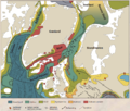
Pedersen og Pedersen 2012 side 4.png 1,100 × 936; 473 KB
-
Regional map of the North East Atlantic Ocean.jpg 603 × 480; 71 KB
-
Sirius Passet Geologic Map - Buen & Portfjeld Formations and Polkorridoren Group.png 1,518 × 776; 3.38 MB


