
Category:Geography of Greenland
geography of the world's largest island  | |||||
| Upload media | |||||
| Instance of |
| ||||
|---|---|---|---|---|---|
| Subclass of | |||||
| Facet of | |||||
| Location |
| ||||
| Area |
| ||||
 | |||||
Subcategories
This category has the following 18 subcategories, out of 18 total.
Pages in category "Geography of Greenland"
This category contains only the following page.
Media in category "Geography of Greenland"
The following 8 files are in this category, out of 8 total.
-
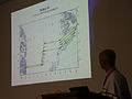 Geikie Flight Plan Map.jpg 4,280 × 3,210; 7.19 MB
-
 Geography-of-greenland.svg 300 × 500; 26 KB
-
 King Frederick VI Coast 2005-08-22 01.jpg 2,048 × 1,536; 1.42 MB
-
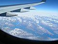
 King Frederick VI Coast 2005-08-22 02.jpg 2,048 × 1,536; 1.24 MB
-
 King Frederick VI Coast 2005-08-22 03.jpg 2,048 × 1,536; 1.26 MB
-
 PSM V37 D325 View of upernavik.jpg 3,710 × 2,107; 2.49 MB
-
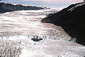 Rinksglacier.jpg 640 × 431; 156 KB
-
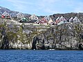 View from Nuuk Fiord.JPG 4,000 × 3,000; 3.78 MB


