Category:Maps of Gila County, Arizona
Jump to navigation
Jump to search
Wikimedia category | |||||
| Upload media | |||||
| Instance of | |||||
|---|---|---|---|---|---|
| Category combines topics | |||||
| Gila County | |||||
county in Arizona, United States | |||||
| Instance of | |||||
| Named after | |||||
| Location | Arizona | ||||
| Capital | |||||
| Inception |
| ||||
| Population |
| ||||
| Area |
| ||||
| official website | |||||
 | |||||
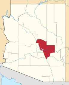
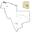
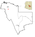
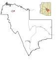
English: Maps of Gila County in Arizona.
- Settlement maps show incorporated planning areas and unincorporated area boundaries as black lines and currently incorporated areas in gray.
Also shown are the Indian reservations in the county.
A highlighted city or area will appear in red.
- Settlement maps show incorporated planning areas and unincorporated area boundaries as black lines and currently incorporated areas in gray.

Subcategories
This category has the following 3 subcategories, out of 3 total.
Media in category "Maps of Gila County, Arizona"
The following 89 files are in this category, out of 89 total.
-
Gila County Incorporated and Unincorporated areas.svg 800 × 850; 96 KB
-
Map of Arizona highlighting Gila County.svg 893 × 1,099; 260 KB
-
Gila County Arizona.png 260 × 300; 4 KB
-
Map of Tonto National Monument.png 909 × 690; 168 KB
-
AZMap-doton-Canyon Day.png 260 × 300; 22 KB
-
AZMap-doton-Central Heights-Midland City.png 260 × 300; 22 KB
-
AZMap-doton-Claypool.png 260 × 300; 22 KB
-
AZMap-doton-Gisela.png 260 × 300; 22 KB
-
AZMap-doton-Globe.png 260 × 300; 22 KB
-
AZMap-doton-Hayden.png 260 × 300; 22 KB
-
AZMap-doton-Miami.png 260 × 300; 22 KB
-
AZMap-doton-Payson.png 260 × 300; 22 KB
-
AZMap-doton-Peridot.png 260 × 300; 22 KB
-
AZMap-doton-Pine.png 260 × 300; 22 KB
-
AZMap-doton-San Carlos.png 260 × 300; 22 KB
-
AZMap-doton-Star Valley.png 260 × 300; 22 KB
-
AZMap-doton-Tonto Basin.png 260 × 300; 22 KB
-
AZMap-doton-Top-of-the-World.png 260 × 300; 22 KB
-
AZMap-doton-Winkelman.png 260 × 300; 22 KB
-
TontoNatlMnmt L7 15jun00.jpg 540 × 540; 115 KB

