Category:Maps of Pima County, Arizona
Jump to navigation
Jump to search
Wikimedia category | |||||
| Upload media | |||||
| Instance of | |||||
|---|---|---|---|---|---|
| Category combines topics | |||||
| Pima County | |||||
county in Arizona, United States | |||||
| Instance of | |||||
| Named after | |||||
| Location | Arizona | ||||
| Capital | |||||
| Inception |
| ||||
| Population |
| ||||
| Area |
| ||||
| Different from | |||||
| official website | |||||
 | |||||
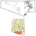
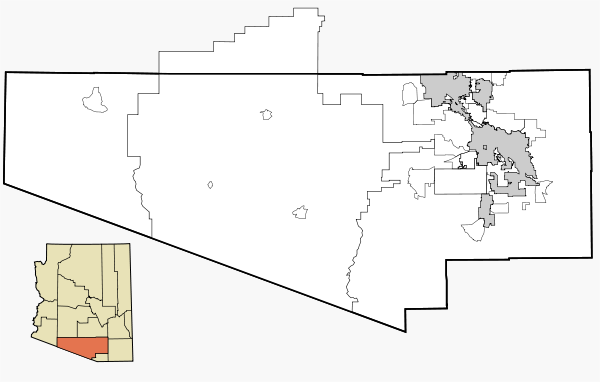
Maps of Pima County, Arizona showing incorporated planning areas or Indian Reservation boundaries as black lines and currently incorporated areas in gray. A highlighted city or area will appear in red.
Map data is based on the following three files:
- 2000/2030 PAG Transportation Analysis Zone Map
- Census 2000 Pima County Tract Outline Index Map (PDF)
- ITCA Map of Tribal Homelands in Arizona (.jpg)
All maps are a variation of the map displayed below:
Subcategories
This category has only the following subcategory.
T
Media in category "Maps of Pima County, Arizona"
The following 117 files are in this category, out of 117 total.
-
Pima County Incorporated and Unincorporated areas.svg 1,100 × 700; 60 KB
-
Map of Arizona highlighting Pima County.svg 893 × 1,099; 260 KB
-
AZ-08.png 633 × 378; 23 KB
-
AZMap-doton-Drexel Heights.png 260 × 300; 22 KB
-
AZMap-doton-Drexel-Alvernon.png 260 × 300; 22 KB
-
AZMap-doton-East Sahuarita.png 260 × 300; 22 KB
-
AZMap-doton-Green Valley.png 260 × 300; 22 KB
-
AZMap-doton-Littletown.png 260 × 300; 22 KB
-
AZMap-doton-Marana.png 260 × 300; 22 KB
-
AZMap-doton-Oro Valley.png 260 × 300; 22 KB
-
AZMap-doton-Picture Rocks.png 260 × 300; 22 KB
-
AZMap-doton-Pisinemo.png 260 × 300; 22 KB
-
AZMap-doton-Sahuarita.png 260 × 300; 22 KB
-
AZMap-doton-Santa Rosa.png 260 × 300; 22 KB
-
AZMap-doton-Sells.png 260 × 300; 22 KB
-
AZMap-doton-South Tucson.png 260 × 300; 22 KB
-
AZMap-doton-Summit.png 260 × 300; 22 KB
-
AZMap-doton-Tanque Verde.png 260 × 300; 22 KB
-
AZMap-doton-Three Points.png 260 × 300; 22 KB
-
AZMap-doton-Tucson Estates.png 260 × 300; 22 KB
-
AZMap-doton-Vail.png 260 × 300; 22 KB
-
AZMap-doton-Valencia West.png 260 × 300; 22 KB
-
Las Cienegas National Conservation Area (26632538161).jpg 5,241 × 3,494; 6.79 MB
-
Map of Ironwood Forest National Monument.png 558 × 810; 436 KB
-
Map of the Districts of the Tohono O'odham Nation.svg 512 × 441; 1.21 MB
-
Official map of Pima County, Arizona. LOC 77692954.jpg 16,420 × 8,872; 23.44 MB
-
Pia Machita Arizona 1940 to 1941.jpg 543 × 529; 30 KB
-
Pima County Arizona USA Casas Adobes highlighted.svg 1,100 × 1,455; 160 KB
-
Pima County Incorporated and Unincorporated areas Ajo highlighted.svg 1,100 × 700; 60 KB
-
Pima County Incorporated and Unincorporated areas Catalina highlighted.svg 1,100 × 700; 60 KB
-
Pima County Incorporated and Unincorporated areas Littletown highlighted.svg 1,100 × 700; 60 KB
-
Pima County Incorporated and Unincorporated areas Lukeville located.svg 1,100 × 700; 60 KB
-
Pima County Incorporated and Unincorporated areas Marana highlighted.svg 1,100 × 700; 60 KB
-
Pima County Incorporated and Unincorporated areas Oro Valley highlighted.svg 1,100 × 700; 60 KB
-
Pima County Incorporated and Unincorporated areas Pisinemo highlighted.svg 1,100 × 700; 60 KB
-
Pima County Incorporated and Unincorporated areas Sahuarita highlighted.svg 1,100 × 700; 60 KB
-
Pima County Incorporated and Unincorporated areas Santa Rosa highlighted.svg 1,100 × 700; 60 KB
-
Pima County Incorporated and Unincorporated areas Sells highlighted.svg 1,100 × 700; 60 KB
-
Pima County Incorporated and Unincorporated areas Summerhaven located.svg 1,100 × 700; 60 KB
-
Pima County Incorporated and Unincorporated areas Summit highlighted.svg 1,100 × 700; 60 KB
-
Pima County Incorporated and Unincorporated areas Tortolita highlighted.svg 1,100 × 700; 60 KB
-
Pima County Incorporated and Unincorporated areas Tucson highlighted.svg 1,100 × 700; 60 KB
-
Pima County Incorporated and Unincorporated areas Vail highlighted.svg 1,100 × 700; 60 KB
-
Pima County Incorporated and Unincorporated areas Why located.svg 1,100 × 700; 60 KB
-
Pima County, Arizona circa 1883 (Harshaw).jpg 1,263 × 598; 873 KB
-
Southeast Cochise County 1880.png 1,647 × 982; 3.99 MB


