Category:Maps of Maricopa County, Arizona
Wikimedia category | |||||
| Upload media | |||||
| Instance of | |||||
|---|---|---|---|---|---|
| Category combines topics | |||||
| Maricopa County | |||||
county in Arizona, United States | |||||
| Instance of | |||||
| Named after | |||||
| Location | Arizona | ||||
| Capital | |||||
| Inception |
| ||||
| Population |
| ||||
| Area |
| ||||
| Different from | |||||
| official website | |||||
 | |||||
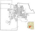
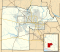
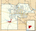
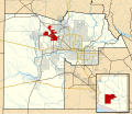
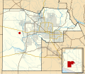
Maps of Maricopa County, Arizona showing incorporated planning areas or Indian Reservation boundaries as gray lines and currently incorporated areas in gray. A highlighted city or area will appear in dark red.
Map data is based on the following Webpage:
Changes since last version: Apart from updating the map to show newly-incorporated area, the style of the maps has also been overhauled. Colors were changed to match the standards of the WikiProject Maps conventions. Major freeways and roads are shown as well as bodies of water. These changes are based on discussions here. If you have any comments about the changes, please discuss them there.
Here is a comparison of the changes in the map files.


Subcategories
This category has the following 6 subcategories, out of 6 total.
P
S
Media in category "Maps of Maricopa County, Arizona"
The following 126 files are in this category, out of 126 total.
-
Maricopa County Incorporated and Planning areas April 2008.png 675 × 600; 64 KB
-
Maricopa County Incorporated and Planning areas GRIC highlighted.svg 900 × 800; 127 KB
-
Maricopa County Incorporated and Planning areas Tonopah location.svg 940 × 812; 1.05 MB
-
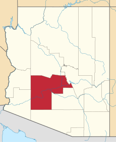
Map of Arizona highlighting Maricopa County.svg 893 × 1,099; 260 KB
-
Phoenix Urban Villages.svg 502 × 1,005; 34 KB
-
Apache Junction in Maricopa County map.png 834 × 584; 34 KB
-
AZ-districts-109-03.png 639 × 378; 22 KB
-
AZMap-doton-Chandler.PNG 834 × 584; 34 KB
-
AZMap-doton-Chandler.png 260 × 300; 22 KB
-
AZMap-doton-Gila Bend.png 260 × 300; 22 KB
-
AZMap-doton-New River.png 260 × 300; 22 KB
-
AZMap-doton-Rio Verde.png 260 × 300; 22 KB
-
AZMap-doton-Sun City West.png 260 × 300; 22 KB
-
AZMap-doton-Sun City.png 260 × 300; 22 KB
-
Buckeye in Maricopa County map.png 834 × 584; 34 KB
-
Carefree in Maricopa County map.png 834 × 584; 33 KB
-
Cave Creek in Maricopa County map.png 834 × 584; 34 KB
-
District Map Blue 2016.jpg 2,429 × 3,152; 2.12 MB
-
El Mirage in Maricopa County map.png 834 × 584; 34 KB
-
Fountain Hills in Maricopa County map.png 834 × 584; 34 KB
-
Guadalupe in Maricopa County map.png 834 × 584; 34 KB
-
MAG planning-and-incorporated-areas 20130910.png 3,300 × 2,550; 2.49 MB
-
Map of the Districts of the Tohono O'odham Nation.svg 512 × 441; 1.21 MB
-
Map of the USA highlighting the Phoenix Metropolitan Area.gif 4,200 × 3,105; 1.64 MB
-
Maricopa County Arizona Annex Timeline Map.gif 1,800 × 1,700; 598 KB
-
Maricopa County Arizona Incorporated and Unincorporated areas.svg 940 × 812; 1.05 MB
-
Maricopa County Board of Supervisor District shapes as of 2024.svg 810 × 810; 445 KB
-
Maricopa County Incorporated and Planning areas Aguila location.svg 940 × 812; 1.05 MB
-
Maricopa County Incorporated and Planning areas Anthem location.svg 940 × 812; 1.05 MB
-
Maricopa County Incorporated and Planning areas Avondale highlighted.svg 940 × 812; 1.05 MB
-
Maricopa County Incorporated and Planning areas Buckeye highlighted.svg 940 × 812; 1.05 MB
-
Maricopa County Incorporated and Planning areas Carefree highlighted.svg 940 × 812; 1.05 MB
-
Maricopa County Incorporated and Planning areas Cave Creek highlighted.svg 940 × 812; 1.05 MB
-
Maricopa County Incorporated and Planning areas Chandler highlighted.svg 940 × 812; 1.05 MB
-
Maricopa County Incorporated and Planning areas Circle City location.svg 940 × 812; 1.11 MB
-
Maricopa County Incorporated and Planning areas El Mirage highlighted.svg 940 × 812; 1.05 MB
-
Maricopa County Incorporated and Planning areas FMYN highlighted.svg 940 × 812; 1.11 MB
-
Maricopa County Incorporated and Planning areas Gila Bend highlighted.svg 940 × 812; 1.05 MB
-
Maricopa County Incorporated and Planning areas Gilbert highlighted.svg 940 × 812; 1.05 MB
-
Maricopa County Incorporated and Planning areas Glendale highlighted.svg 940 × 812; 1.05 MB
-
Maricopa County Incorporated and Planning areas Goodyear highlighted.svg 940 × 812; 1.05 MB
-
Maricopa County Incorporated and Planning areas Guadalupe highlighted.svg 940 × 812; 1.05 MB
-
Maricopa County Incorporated and Planning areas Higley highlighted.svg 900 × 780; 164 KB
-
Maricopa County Incorporated and Planning areas Higley location.svg 940 × 812; 1.05 MB
-
Maricopa County Incorporated and Planning areas Komatke location.svg 940 × 812; 1.05 MB
-
Maricopa County Incorporated and Planning areas LAFB location.svg 940 × 812; 1.05 MB
-
Maricopa County Incorporated and Planning areas Liberty location.svg 940 × 812; 1.05 MB
-
Maricopa County Incorporated and Planning areas Mesa highlighted.svg 940 × 812; 1.05 MB
-
Maricopa County Incorporated and Planning areas Mobile location.svg 940 × 812; 1.05 MB
-
Maricopa County Incorporated and Planning areas Morristown location.svg 940 × 812; 1.05 MB
-
Maricopa County Incorporated and Planning areas New River location.svg 940 × 812; 1.05 MB
-
Maricopa County Incorporated and Planning areas Palo Verde location.svg 940 × 812; 1.05 MB
-
Maricopa County Incorporated and Planning areas Paloma location.svg 940 × 812; 1.05 MB
-
Maricopa County Incorporated and Planning areas Peoria highlighted.svg 940 × 812; 1.05 MB
-
Maricopa County Incorporated and Planning areas Phoenix highlighted.svg 940 × 812; 1.05 MB
-
Maricopa County Incorporated and Planning areas Queen Creek highlighted.svg 940 × 812; 1.05 MB
-
Maricopa County Incorporated and Planning areas Rio Verde location.svg 940 × 812; 1.05 MB
-
Maricopa County Incorporated and Planning areas Rock Springs location.svg 940 × 812; 1.05 MB
-
Maricopa County Incorporated and Planning areas Scottsdale highlighted.svg 940 × 812; 1.05 MB
-
Maricopa County Incorporated and Planning areas Sentinel location.svg 940 × 812; 1.05 MB
-
Maricopa County Incorporated and Planning areas SRPMIC highlighted.svg 940 × 812; 1.05 MB
-
Maricopa County Incorporated and Planning areas Sun City highlighted.svg 940 × 812; 1.05 MB
-
Maricopa County Incorporated and Planning areas Sun Lakes highlighted.svg 940 × 812; 1.05 MB
-
Maricopa County Incorporated and Planning areas Sunflower location.svg 940 × 812; 1.05 MB
-
Maricopa County Incorporated and Planning areas Surprise highlighted.svg 940 × 812; 1.05 MB
-
Maricopa County Incorporated and Planning areas Tempe highlighted.svg 940 × 812; 1.05 MB
-
Maricopa County Incorporated and Planning areas Tolleson highlighted.svg 940 × 812; 1.05 MB
-
Maricopa County Incorporated and Planning areas Tortilla Flat location.svg 940 × 812; 1.05 MB
-
Maricopa County Incorporated and Planning areas Waddell location.svg 940 × 812; 1.05 MB
-
Maricopa County Incorporated and Planning areas wHighways.svg 900 × 800; 221 KB
-
Maricopa County Incorporated and Planning areas Wickenburg highlighted.svg 940 × 812; 1.05 MB
-
Maricopa County Incorporated and Planning areas Wintersburg location.svg 940 × 812; 1.05 MB
-
Maricopa County Incorporated and Planning areas Wittmann location.svg 940 × 812; 1.05 MB
-
Maricopa County Incorporated and Planning areas Youngtown highlighted.svg 940 × 812; 1.11 MB
-
Maricopa county roads test.svg 1,093 × 880; 118 KB
-
NIBW Superfund 2005 map.svg 900 × 1,391; 239 KB
-
Phoenix MPA Incorporated and Planning areas.svg 1,175 × 820; 224 KB
-
Poverty in Maricopa County.png 785 × 641; 211 KB
-
Pueblo Grande SW01.jpg 4,928 × 3,264; 4.42 MB
-
Queen Creek in Maricopa County map.png 834 × 584; 34 KB
-
Race and ethnicity Mesa (2000).png 3,009 × 3,009; 3.36 MB
-
Shereth Maricopa Test Generated.svg 1,104 × 907; 1.29 MB
-
Surprise in Maricopa County map.png 834 × 584; 34 KB


