Category:Gila River
Jump to navigation
Jump to search
river in the United States | |||||
| Upload media | |||||
| Instance of | |||||
|---|---|---|---|---|---|
| Location |
| ||||
| Length |
| ||||
| Origin of the watercourse | |||||
| Mouth of the watercourse | |||||
| Drainage basin |
| ||||
| Basin country | |||||
| Tributary |
| ||||
 | |||||
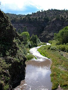
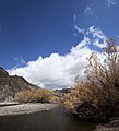
- English: The Gila River — a tributary of the Colorado River, flowing from New Mexico through Arizona, in the Southwestern United States.
Subcategories
This category has the following 20 subcategories, out of 20 total.
Media in category "Gila River"
The following 62 files are in this category, out of 62 total.
-
Gilarivermap.png 499 × 500; 382 KB
-
10thINFrivercrossing.png 1,538 × 634; 1,004 KB
-
A beaver dam spans a section of the Middle Fork of the Gila River.jpg 6,000 × 4,000; 14.69 MB
-
Arizona - Duncan through Gila Bend - NARA - 23933675.jpg 4,385 × 3,286; 4.27 MB
-
AS09-21-3291 (21889932916).jpg 4,400 × 4,600; 1.58 MB
-
Avondale-Gila River.jpg 3,264 × 2,448; 1.91 MB
-
Bartlett Arizona Pimo Village.png 2,112 × 1,504; 5.58 MB
-
Bartlett Colorado Gila Rivers.png 2,092 × 1,456; 5.51 MB
-
Bartlett Gila River.png 2,134 × 1,503; 5.57 MB
-
BrushDam.jpg 884 × 508; 59 KB
-
Dicoria canescens.jpg 600 × 450; 131 KB
-
Dipsosaurus dorsalis distribution.png 1,259 × 944; 1.95 MB
-
Gila box nca.jpg 345 × 259; 21 KB
-
Gila River 3 (4186528986).jpg 7,308 × 8,025; 11.49 MB
-
Gila River @ Florence-Kelvin Bridge, A View from the Bridge - panoramio.jpg 2,048 × 1,536; 1.2 MB
-
Gila River @ Florence-Kelvin Bridge, A View from Under the Bridge - panoramio.jpg 2,048 × 1,536; 3.16 MB
-
Gila River at Komatke Arizona.jpg 1,449 × 2,488; 1.01 MB
-
Gila River behind Coolidge Dam1.jpg 267 × 181; 10 KB
-
GILA RIVER BRIDGE.jpg 4,956 × 3,624; 2.11 MB
-
Gila River From Above 1 (4468101709).jpg 2,981 × 2,093; 2.72 MB
-
Gila River From Above 2 (4468878452).jpg 4,427 × 2,767; 5.46 MB
-
Gila River near town of Riverside1.jpg 222 × 158; 8 KB
-
Gila river.jpg 5,184 × 3,456; 8.88 MB
-
GilaRiverAtUS95.jpg 713 × 387; 183 KB
-
Looking East from Yuma's Ocean to Ocean Highway Bridge - panoramio.jpg 2,560 × 1,920; 2.96 MB
-
Map of Arizona Precipitation NA.png 1,073 × 781; 222 KB
-
Minor drainage divide south of Buckeye Arizona aerial.jpg 2,688 × 1,512; 3.07 MB
-
PaintedRock.jpg 350 × 229; 25 KB
-
PSM V37 D768 Map of ancient dwellings of the verde valley.jpg 2,139 × 3,168; 477 KB
-
Rainbow over the gila river.jpg 500 × 275; 19 KB
-
Resource inventory for the Gila River Complex, eastern Arizona - final report (IA resourceinventor3003minc).pdf 635 × 831, 598 pages; 110.89 MB
-
Scouting by horseback (7158046763).jpg 4,320 × 3,240; 1.37 MB
-
Scouting by horseback (7343254186).jpg 4,320 × 3,240; 1.71 MB
-
Spires, E Fork Gila R.jpg 600 × 444; 82 KB
-
Chain of Spires Along the Gila River by John Mix Stanley.jpg 4,000 × 2,850; 1.11 MB
-
Südwesten01.png 2,000 × 1,406; 4.13 MB
-
Thirty years on the frontier (1906) (14775070564).jpg 2,896 × 1,832; 1.05 MB
-
Two boys and a dog along the Gila River, 04-1974. (7066029009).jpg 3,000 × 2,044; 529 KB
-
Valley by Yuma Prison - panoramio.jpg 3,888 × 2,592; 3.51 MB
-
Waterman Wash, Goodyear, Arizona.jpg 2,688 × 1,512; 1.38 MB
-
Wpdms nasa topo gila river.jpg 300 × 300; 60 KB
Categories:
- Rivers of Arizona
- Rivers of New Mexico
- Tributaries of the Colorado River in Arizona
- Tributaries of the Colorado River in New Mexico
- Catron County, New Mexico
- Bodies of water in Gila County, Arizona
- Grant County, New Mexico
- Bodies of water in Graham County, Arizona
- Bodies of water in Pinal County, Arizona
- Sierra County, New Mexico
- Bodies of water in Yuma County, Arizona
- Black Hills (Greenlee County)
- Lower Colorado River Valley
- Gila Valley (Yuma County)
- Rivers of the United States by name
- Gila Valley


