Category:Maps of East Flanders
Jump to navigation
Jump to search
Provinces of Belgium: Province of Antwerp · Brussels-Capital Region · East Flanders · Flemish Brabant · Province of Liege · Luxembourg · Province of Namur · Walloon Brabant · West Flanders
Wikimedia category | |||||
| Upload media | |||||
| Instance of | |||||
|---|---|---|---|---|---|
| Category combines topics | |||||
| East Flanders | |||||
province in Flanders, Belgium | |||||
| Pronunciation audio | |||||
| Instance of | |||||
| Named after | |||||
| Location | Flemish Region, Belgium | ||||
| Capital | |||||
| Official language | |||||
| Head of government |
| ||||
| Headquarters location | |||||
| Legal form |
| ||||
| Highest point | |||||
| Population |
| ||||
| Area |
| ||||
| official website | |||||
 | |||||
Subcategories
This category has the following 53 subcategories, out of 53 total.
A
- Maps of Aalter (17 F)
- Maps of Assenede (13 F)
B
- Maps of Beveren (11 F)
D
- Maps of Destelbergen (6 F)
E
- Maps of Erpe-Mere (18 F)
- Maps of Evergem (12 F)
G
- Maps of Gavere (11 F)
H
- Maps of Herzele (4 F)
K
- Maps of Kaprijke (12 F)
- Maps of Kluisbergen (7 F)
- Maps of Knesselare (10 F)
- Maps of Kruibeke (7 F)
L
- Maps of Lebbeke (3 F)
- Maps of Lede (8 F)
- Maps of Lievegem (2 F)
- Maps of Lochristi (8 F)
- Maps of Lovendegem (8 F)
M
- Maps of Maldegem (13 F)
- Maps of Melle, Belgium (6 F)
- Maps of Merelbeke (13 F)
- Maps of Moerbeke (4 F)
N
- Maps of Nevele (9 F)
- Maps of Ninove (3 F)
O
- Maps of Oosterzele (11 F)
R
S
- Maps of Sint-Gillis-Waas (7 F)
- Maps of Sint-Laureins (17 F)
- Maps of Sint-Niklaas (12 F)
- Maps of Stekene (5 F)
W
- Maps of Waarschoot (7 F)
Z
- Maps of Zomergem (11 F)
- Maps of Zottegem (74 F)
- Maps of Zulte (6 F)
Media in category "Maps of East Flanders"
The following 88 files are in this category, out of 88 total.
-
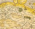
"Wasia T Land van Waes - Antonius Sanderus" (22069208478).jpg 3,243 × 2,740; 2.04 MB
-
Afbeelding bevolkingsdichtheid 2016.png 832 × 591; 195 KB
-
Belgieovl.png 398 × 335; 6 KB
-
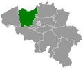
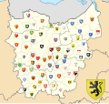
Belgium East Flanders location map with COA.svg 468 × 442; 6.11 MB
-
Belgium East Flanders location map.svg 468 × 442; 105 KB
-
BelgiumEastFlanders.png 398 × 335; 7 KB
-
Bevolkingsdichtheid 2017 - Gemeenten van Provincie.png 497 × 298; 44 KB
-
Denderende steden lusvormig.png 618 × 644; 59 KB
-
Denderende steden niet-lusvormig.png 600 × 678; 14 KB
-
Denderroute zuid.png 579 × 607; 18 KB
-
Denderstreek.gif 540 × 406; 17 KB
-
Everbeek 1922.jpg 2,689 × 3,843; 7.87 MB
-
Flobecq - Geraardsbergen 1922.png 8,110 × 3,923; 58.25 MB
-
Gemeenten Vlaamse Ardennen.png 270 × 203; 5 KB
-
Maldegemvelt.jpg 600 × 500; 150 KB
-
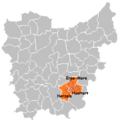
Meetjeslandlocatie.png 181 × 178; 5 KB
-
MnpAalstLocation2025.png 655 × 462; 8 KB
-
MnpAalterLocation2025.png 655 × 462; 8 KB
-
MnpAssenedeLocation2025.png 655 × 462; 8 KB
-
MnpBerlareLocation2025.png 655 × 462; 8 KB
-
MnpBeveren-Kruibeke-ZwijndrechtLocation2025.png 655 × 462; 8 KB
-
MnpBrakelLocation2025.png 655 × 462; 8 KB
-
MnpBuggenhoutLocation2025.png 655 × 462; 8 KB
-
MnpDeinzeLocation2025.png 655 × 462; 8 KB
-
MnpDenderleeuwLocation2025.png 655 × 462; 8 KB
-
MnpDendermondeLocation2025.png 655 × 462; 8 KB
-
MnpDestelbergenLocation2025.png 655 × 462; 8 KB
-
MnpEekloLocation2025.png 655 × 462; 8 KB
-
MnpErpre-MereLocation2025.png 655 × 462; 8 KB
-
MnpEvergemLocation2025.png 655 × 462; 8 KB
-
MnpGavereLocation2025.png 655 × 462; 8 KB
-
MnpGentLocation2025.png 655 × 462; 8 KB
-
MnpGeraardsbergenLocation2025.png 655 × 462; 8 KB
-
MnpHaaltertLocation2025.png 655 × 462; 8 KB
-
MnpHammeLocation2025.png 655 × 462; 8 KB
-
MnpHerzeleLocation2025.png 655 × 462; 8 KB
-
MnpHorebekeLocation2025.png 655 × 462; 8 KB
-
MnpKaprijkeLocation2025.png 655 × 462; 8 KB
-
MnpKluisbergenLocation2025.png 655 × 462; 8 KB
-
MnpKruisemLocation2025.png 655 × 462; 8 KB
-
MnpLaarneLocation2025.png 655 × 462; 8 KB
-
MnpLebbekeLocation2025.png 655 × 462; 8 KB
-
MnpLedeLocation2025.png 655 × 462; 8 KB
-
MnpLierdeLocation2025.png 655 × 462; 8 KB
-
MnpLievegemLocation2025.png 655 × 462; 8 KB
-
MnpLochristiLocation2025.png 655 × 462; 8 KB
-
MnpLokerenLocation2025.png 655 × 462; 8 KB
-
MnpMaarkedalLocation2025.png 655 × 462; 8 KB
-
MnpMaldegemLocation2025.png 655 × 462; 8 KB
-
MnpMerelbeke-MelleLocation2025.png 655 × 462; 8 KB
-
MnpNazareth-De PinteLocation2025.png 655 × 462; 8 KB
-
MnpNinoveLocation2025.png 655 × 462; 8 KB
-
MnpOosterzeleLocation2025.png 655 × 462; 8 KB
-
MnpOudenaardeLocation2025.png 655 × 462; 8 KB
-
MnpRonseLocation2025.png 655 × 462; 8 KB
-
MnpSint-Gillis-WaasLocation2025.png 655 × 462; 8 KB
-
MnpSint-LaureinsLocation2025.png 655 × 462; 8 KB
-
MnpSint-Lievens-HoutemLocation2025.png 655 × 462; 8 KB
-
MnpSint-Martens-LatemLocation2025.png 655 × 462; 8 KB
-
MnpSint-NiklaasLocation2025.png 655 × 462; 8 KB
-
MnpStekeneLocation2025.png 655 × 462; 8 KB
-
MnpTemseLocation2025.png 655 × 462; 8 KB
-
MnpWaasmunsterLocation2025.png 655 × 462; 8 KB
-
MnpWetterenLocation2025.png 655 × 462; 8 KB
-
MnpWichelenLocation2025.png 655 × 462; 8 KB
-
MnpWortegem-PetegemLocation2025.png 655 × 462; 8 KB
-
MnpZeleLocation2025.png 655 × 462; 8 KB
-
MnpZelzateLocation2025.png 655 × 462; 8 KB
-
MnpZottegemLocation2025.png 655 × 462; 8 KB
-
MnpZulteLocation2025.png 655 × 462; 8 KB
-
MnpZwalmLocation2025.png 655 × 462; 8 KB
-
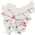
Molenbeekroute Oost-Vlaanderen.png 547 × 549; 28 KB
-
Oost-Vlaanderen Gemeentekaart Met Nummers.png 392 × 382; 31 KB
-
Oost-VlaanderenGemeenten2022.png 270 × 203; 13 KB
-
Oost-VlaanderenLocation2.png 398 × 335; 6 KB
-
OostVlaanderenbevolkingsdichtheid.PNG 832 × 624; 175 KB
-
Project stationsfotografie Oost-Vlaanderen (Westermarck).svg 390 × 390; 87 KB
-
Province of East Flanders (Belgium) location.svg 1,136 × 945; 150 KB
-
Provincie Oost-Vlaanderen in Belgium.svg 1,136 × 988; 371 KB
-
Provinz Ostflandern 2019.png 1,136 × 990; 329 KB
-
Stations Oost-Vlaanderen, toestand 21 april 2009.svg 390 × 390; 94 KB
-
WaaslandKaart.png 655 × 462; 8 KB
-
Westermarck-ovl.png 270 × 203; 5 KB


