Category:Maps of Erpe-Mere
Jump to navigation
Jump to search
Wikimedia category | |||||
| Upload media | |||||
| Instance of | |||||
|---|---|---|---|---|---|
| Category combines topics | |||||
| Erpe-Mere | |||||
municipality in East Flanders, Belgium | |||||
| Instance of | |||||
| Part of |
| ||||
| Named after | |||||
| Location | Arrondissement of Aalst, East Flanders, Flemish Region, Belgium | ||||
| Capital | |||||
| Official language |
| ||||
| Head of government |
| ||||
| Legal form |
| ||||
| Inception |
| ||||
| Population |
| ||||
| Area |
| ||||
| official website | |||||
 | |||||
Media in category "Maps of Erpe-Mere"
The following 18 files are in this category, out of 18 total.
-
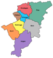
Aaigem Bambrugge Burst Erondegem Erpe Mere Ottergem Vlekkem.png 549 × 597; 31 KB
-
Erpe-Mere East-Flanders Belgium Map.svg 730 × 732; 2.75 MB
-
Ligging van Aaigem in Oost-Vlaanderen.png 486 × 488; 14 KB
-
Ligging van Bambrugge in Oost-Vlaanderen.png 486 × 488; 11 KB
-
Ligging van Burst in Oost-Vlaanderen.png 486 × 488; 11 KB
-
Ligging van Egem in Bambrugge.png 722 × 658; 32 KB
-
Ligging van Egem in Erpe-Mere.png 547 × 597; 31 KB
-
Ligging van Egem in Oost-Vlaanderen.png 505 × 942; 49 KB
-
Ligging van Erondegem in Oost-Vlaanderen.png 486 × 488; 11 KB
-
Ligging van Erpe in Oost-Vlaanderen.png 486 × 488; 11 KB
-
Ligging van Mere in Oost-Vlaanderen.png 486 × 488; 11 KB
-
Ligging van Ottergem in Oost-Vlaanderen.png 486 × 488; 11 KB
-
Ligging van Vlekkem in Oost-Vlaanderen.png 486 × 488; 11 KB
-
MnpErpe-Mere LedeLocation.png 270 × 203; 6 KB
-
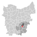
MnpErpe-MereLocation.png 655 × 462; 8 KB
-
Stroomgebied Molenbeek.PNG 270 × 203; 6 KB
-
Stroomgebiedmolenbeektesw5.png 270 × 203; 6 KB


