Category:Maps of Lokeren
Jump to navigation
Jump to search
Wikimedia category | |||||
| Upload media | |||||
| Instance of | |||||
|---|---|---|---|---|---|
| Category combines topics | |||||
| Lokeren | |||||
city in East Flanders, Belgium | |||||
| Instance of | |||||
| Location | Arrondissement of Sint-Niklaas, East Flanders, Flemish Region, Belgium | ||||
| Located in or next to body of water | |||||
| Capital |
| ||||
| Official language |
| ||||
| Head of government |
| ||||
| Legal form |
| ||||
| Population |
| ||||
| Area |
| ||||
| official website | |||||
 | |||||
Subcategories
This category has only the following subcategory.
O
Media in category "Maps of Lokeren"
The following 23 files are in this category, out of 23 total.
-
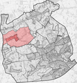
DaknamLocation.svg 449 × 457; 82 KB
-
Doorslaar ligging.png 3,827 × 4,140; 15.62 MB
-
Durmeloop.png 12,798 × 6,398; 125.41 MB
-
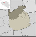
EksaardeLocation.svg 449 × 457; 84 KB
-
Evolutie Marktplein Lokeren.gif 1,200 × 849; 994 KB
-
Expansie van Lokeren.gif 1,236 × 655; 818 KB
-
Ferraris Lokeren Kaart.png 4,824 × 3,072; 26.05 MB
-
Heiende ligging.png 3,827 × 4,140; 15.62 MB
-
Hillare ligging.png 3,827 × 4,140; 15.45 MB
-
Kaart Lokeren en Kernen.png 1,700 × 1,803; 164 KB
-
Kaart natuur Lokeren.png 2,118 × 1,841; 2.53 MB
-
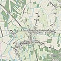
Kaart van Daknam.jpg 798 × 798; 306 KB
-
Kaart van Lokeren (2398x2398).jpg 2,398 × 2,398; 3.04 MB
-
Lokeren 1569.png 1,924 × 1,500; 1.44 MB
-
Lokeren East-Flanders Belgium Map.svg 730 × 732; 2.75 MB
-
Lokeren Flandria Illustrata.jpg 3,040 × 2,056; 1.18 MB
-
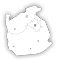
LokerenDeelgemeenten.png 1,394 × 1,509; 465 KB
-
LokerenLocatie.png 655 × 462; 8 KB
-
LokerenLocation.svg 449 × 457; 84 KB
-
LokerenMap.svg 449 × 457; 76 KB
-
Markt Lokeren Map.png 2,105 × 1,888; 922 KB
-
Molenhoek ligging.png 3,827 × 4,140; 15.57 MB
-
Oudenbos ligging.png 3,827 × 4,140; 15.54 MB


