Category:Maps of Beveren
Jump to navigation
Jump to search
Wikimedia category | |||||
| Upload media | |||||
| Instance of | |||||
|---|---|---|---|---|---|
| Category combines topics | |||||
| Category contains | |||||
| Beveren | |||||
municipality in East Flanders, Belgium | |||||
| Instance of | |||||
| Part of | |||||
| Location | Arrondissement of Sint-Niklaas, East Flanders, Flemish Region, Belgium | ||||
| Located in or next to body of water | |||||
| Capital |
| ||||
| Official language | |||||
| Head of government |
| ||||
| Legal form |
| ||||
| Population |
| ||||
| Area |
| ||||
| official website | |||||
 | |||||
Media in category "Maps of Beveren"
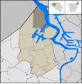
The following 11 files are in this category, out of 11 total.
-
BerevenMap.svg 449 × 457; 154 KB
-
Beveren East-Flanders Belgium Map.svg 730 × 732; 2.75 MB
-
BeverenLocatie.png 655 × 462; 8 KB
-
BeverenLocation.svg 449 × 457; 179 KB
-
DoelLocation.svg 449 × 457; 176 KB
-
HaasdonkLocation.svg 449 × 457; 177 KB
-
KalloLocation.svg 449 × 457; 177 KB
-
KieldrechtLocation.svg 449 × 457; 176 KB
-
MelseleLocation.svg 449 × 457; 179 KB
-
VerrebroekLocation.svg 449 × 457; 177 KB
-
VraseneLocation.svg 449 × 457; 178 KB


