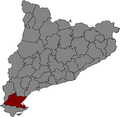
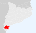
Category:Maps of Baix Ebre
Jump to navigation
Jump to search
Alt Camp · Alt Empordà · Alt Penedès · Alt Urgell · Alta Ribagorça · Anoia · Bages · Baix Camp · Baix Ebre · Baix Empordà · Baix Llobregat · Baix Penedès · Baixa Cerdanya · Barcelonès · Berguedà · Conca de Barberà · Garraf · Garrigues · Garrotxa · Gironès · Lluçanès · Maresme · Moianès · Montsià · Noguera · Osona · Pallars Jussà · Pallars Sobirà · Pla d'Urgell · Pla de l'Estany · Priorat · Ribera d'Ebre · Ripollès · Segarra · Segrià · Selva · Solsonès · Tarragonès · Terra Alta · Urgell · Val d'Aran · Vallès Occidental · Vallès Oriental

in Catalonia
Wikimedia category | |||||
| Upload media | |||||
| Instance of | |||||
|---|---|---|---|---|---|
| Category combines topics | |||||
| Baix Ebre | |||||
Catalan comarca (county) in Terres de l'Ebre | |||||
| Instance of | |||||
| Location | Terres de l'Ebre, Province of Tarragona, Catalonia | ||||
| Capital | |||||
| Population |
| ||||
| Area |
| ||||
| Elevation above sea level |
| ||||
| official website | |||||
 | |||||
Subcategories
This category has the following 14 subcategories, out of 14 total.
M
- Maps of Aldover (4 F)
- Maps of Alfara de Carles (6 F)
- Maps of Benifallet (7 F)
- Maps of Camarles (5 F)
- Maps of Deltebre (12 F)
- Maps of El Perelló (9 F)
- Maps of l'Aldea (5 F)
- Maps of L'Ametlla de Mar (8 F)
- Maps of L'Ampolla (8 F)
- Maps of Paüls (4 F)
- Maps of Roquetes (4 F)
- Maps of Tivenys (4 F)
- Maps of Tortosa (19 F)
- Maps of Xerta (8 F)
Media in category "Maps of Baix Ebre"
The following 6 files are in this category, out of 6 total.
-
Localització del Baix Ebre.png 240 × 234; 20 KB
-
Catalunya Baix Ebre.png 650 × 600; 69 KB
-
Localització del Baix Ebre.svg 791 × 764; 1.01 MB
-
Baix Ebre.png 1,219 × 821; 228 KB
-
Map Baix Ebre.png 1,234 × 823; 155 KB
-
Municipis de les Terres de l'Ebre.svg 997 × 1,384; 453 KB


