Category:Maps of Alt Empordà
Jump to navigation
Jump to search
Alt Camp · Alt Empordà · Alt Penedès · Alt Urgell · Alta Ribagorça · Anoia · Bages · Baix Camp · Baix Ebre · Baix Empordà · Baix Llobregat · Baix Penedès · Baixa Cerdanya · Barcelonès · Berguedà · Conca de Barberà · Garraf · Garrigues · Garrotxa · Gironès · Lluçanès · Maresme · Moianès · Montsià · Noguera · Osona · Pallars Jussà · Pallars Sobirà · Pla d'Urgell · Pla de l'Estany · Priorat · Ribera d'Ebre · Ripollès · Segarra · Segrià · Selva · Solsonès · Tarragonès · Terra Alta · Urgell · Val d'Aran · Vallès Occidental · Vallès Oriental

Wikimedia category | |||||
| Upload media | |||||
| Instance of | |||||
|---|---|---|---|---|---|
| Category combines topics | |||||
| Alt Empordà | |||||
Catalan comarca (county) in the vegueria (region) of Girona | |||||
| Instance of | |||||
| Named after | |||||
| Location |
| ||||
| Capital | |||||
| Head of government |
| ||||
| Population |
| ||||
| Area |
| ||||
| official website | |||||
 | |||||
Subcategories
This category has the following 67 subcategories, out of 67 total.
L
- Maps of Llançà (7 F)
M
- Maps of Agullana (8 F)
- Maps of Albanyà (3 F)
- Maps of Biure (4 F)
- Maps of Borrassà (4 F)
- Maps of Bàscara (3 F)
- Maps of Cabanelles (3 F)
- Maps of Cabanes (4 F)
- Maps of Cantallops (4 F)
- Maps of Capmany (3 F)
- Maps of Castelló d'Empúries (11 F)
- Maps of Cistella (3 F)
- Maps of Colera (3 F)
- Maps of Darnius (4 F)
- Maps of El Far d'Empordà (3 F)
- Maps of Espolla (3 F)
- Maps of Figueres (14 F)
- Maps of Font-rubí (3 F)
- Maps of Fortià (3 F)
- Maps of Garriguella (6 F)
- Maps of Garrigàs (3 F)
- Maps of L'Armentera (3 F)
- Maps of L'Escala (8 F)
- Maps of La Jonquera (9 F)
- Maps of La Selva de Mar (3 F)
- Maps of La Vajol (3 F)
- Maps of Lladó (4 F)
- Maps of Llers (4 F)
- Maps of Masarac (4 F)
- Maps of Navata (6 F)
- Maps of Ordis (4 F)
- Maps of Palau-saverdera (3 F)
- Maps of Pedret i Marzà (3 F)
- Maps of Peralada (4 F)
- Maps of Pont de Molins (3 F)
- Maps of Pontós (3 F)
- Maps of Portbou (9 F)
- Maps of Rabós (3 F)
- Maps of Riumors (3 F)
- Maps of Roses (12 F)
- Maps of Sant Mori (3 F)
- Maps of Siurana (3 F)
- Maps of Terrades (4 F)
- Maps of Ventalló (3 F)
- Maps of Vila-sacra (3 F)
- Maps of Vilabertran (3 F)
- Maps of Viladamat (4 F)
- Maps of Vilafant (4 F)
- Maps of Vilajuïga (3 F)
- Maps of Vilamacolum (3 F)
- Maps of Vilamalla (3 F)
- Maps of Vilamaniscle (3 F)
- Maps of Vilanant (3 F)
- Maps of Vilaür (3 F)
Media in category "Maps of Alt Empordà"
The following 10 files are in this category, out of 10 total.
-
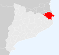
Localització de l'Alt Empordà.png 240 × 234; 9 KB
-
Catalunya Alt Empordà.png 650 × 600; 70 KB
-
Localització de l'Alt Empordà 2.png 2,000 × 1,882; 229 KB
-
Localització de l'Alt Empordà.svg 791 × 764; 1.01 MB
-
Alt Empordà.png 1,347 × 924; 257 KB
-
Alt Empordà.svg 990 × 765; 237 KB
-
Hàbitats per la connectivitat.JPG 1,367 × 966; 101 KB
-
Municipis dins dels Aspres.jpg 643 × 454; 34 KB
-
Xarxa d'infraestructures de transport de l'Alt Empordà.JPG 684 × 463; 35 KB
-
Zones Connectivitat de l'Alt Empordà.JPG 1,328 × 860; 86 KB


