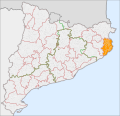
Category:Maps of Baix Empordà
Jump to navigation
Jump to search
Wikimedia category | |||||
| Upload media | |||||
| Instance of | |||||
|---|---|---|---|---|---|
| Category combines topics | |||||
| Baix Empordà | |||||
Catalan comarca (county) in the vegueria (region) of Girona | |||||
| Instance of | |||||
| Named after | |||||
| Location |
| ||||
| Capital | |||||
| Head of government |
| ||||
| Population |
| ||||
| Area |
| ||||
| official website | |||||
 | |||||
Subcategories
This category has the following 36 subcategories, out of 36 total.
A
- Maps of Albons (4 F)
B
- Maps of Begur (7 F)
C
- Maps of Calonge (5 F)
- Maps of Colomers (3 F)
- Maps of Corçà (3 F)
F
- Maps of Foixà (3 F)
- Maps of Fontanilles (3 F)
- Maps of Forallac (4 F)
G
- Maps of Garrigoles (3 F)
- Maps of Gualta (3 F)
J
- Maps of Jafre (3 F)
L
- Maps of La Pera (4 F)
M
- Maps of Mont-ras (3 F)
P
- Maps of Palafrugell (10 F)
- Maps of Palamós (15 F)
- Maps of Palau-sator (3 F)
- Maps of Pals (5 F)
- Maps of Parlavà (3 F)
R
- Maps of Regencós (4 F)
- Maps of Rupià (3 F)
S
- Maps of Serra de Daró (4 F)
T
U
- Maps of Ullastret (3 F)
- Maps of Ullà (3 F)
- Maps of Ultramort (3 F)
V
- Maps of Vall-llobrega (3 F)
- Maps of Verges, Girona (3 F)
- Maps of Vilopriu (3 F)
Media in category "Maps of Baix Empordà"
The following 7 files are in this category, out of 7 total.
-
Localització del Baix Empordà.png 240 × 234; 9 KB
-
Catalunya Baix Empordà.png 650 × 600; 69 KB
-
Localització del Baix Empordà 2.png 2,000 × 1,882; 229 KB
-
Localització del Baix Empordà.svg 791 × 764; 1.01 MB
-
Baix Emporda.svg 364 × 500; 16 KB
-
Baix Empordà.png 702 × 975; 132 KB
-
Localització de la Vall d'Aro 2.png 2,000 × 1,882; 264 KB


