Category:Maps of Val d'Aran
Jump to navigation
Jump to search
Wikimedia category | |||||
| Upload media | |||||
| Instance of | |||||
|---|---|---|---|---|---|
| Category combines topics | |||||
| Val d'Aran | |||||
Occitan-speaking unique territorial entity in Catalonia | |||||
| Instance of |
| ||||
| Location |
| ||||
| Located in or next to body of water | |||||
| Capital | |||||
| Legislative body | |||||
| Official language | |||||
| Anthem |
| ||||
| Head of government |
| ||||
| Mountain range | |||||
| Population |
| ||||
| Area |
| ||||
 | |||||
Subcategories
This category has the following 11 subcategories, out of 11 total.
M
- Maps of Arres (4 F)
- Maps of Bausen (5 F)
- Maps of Bossòst (7 F)
- Maps of Canejan (5 F)
- Maps of Es Bòrdes (3 F)
- Maps of Les, Catalonia (4 F)
- Maps of Vilamòs (2 F)
Media in category "Maps of Val d'Aran"
The following 23 files are in this category, out of 23 total.
-
Localització de la Vall d'Aran.png 240 × 234; 20 KB
-
Catalunya Val d'Aran.png 650 × 600; 69 KB
-
Localització de la Vall d'Aran 2.png 2,000 × 1,882; 271 KB
-
Localització de la Vall d'Aran.svg 791 × 764; 1.01 MB
-
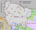
Aran deutsch.png 794 × 690; 87 KB
-
Aran Municipis 1860 Fons.svg 243 × 189; 60 KB
-
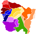
Aran Municipis 1860.svg 201 × 187; 15 KB
-
Aran Municipis 1885 Fons.svg 201 × 187; 20 KB
-
Aran Municipis 1968 Fons.svg 201 × 187; 18 KB
-
Aran Municipis 1970 Fons.svg 243 × 189; 52 KB
-
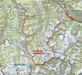
Circo de Saboredo.jpg 1,265 × 1,147; 2.25 MB
-
Estacions d'esquí de l'Alt Pirineu i Aran.svg 472 × 455; 207 KB
-
Homes observant un mapa de la Vall d'Aran.jpeg 1,024 × 741; 82 KB
-
Map Val d’Aran.png 1,062 × 894; 225 KB
-
Occitania aranes map.png 573 × 397; 11 KB
-
Placa al naixement del Noguera Pallaresa - Pla de Beret.JPG 1,536 × 2,048; 1.35 MB
-
Plànol de la Vall d'Aran de l'enginyer S . S . Reig.jpeg 580 × 768; 65 KB
-
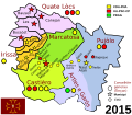
Terçons and Communes of the Val d'Aran with Ruling Parties (2015).svg 800 × 698; 133 KB
-
Terçons d'Aran.svg 800 × 698; 47 KB
-
Val d'Aran.png 794 × 690; 88 KB
-
Val d'AranOc.png 794 × 690; 84 KB

