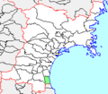
Category:Locator maps of municipalities in Miyagi prefecture
Jump to navigation
Jump to search
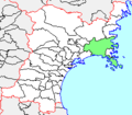
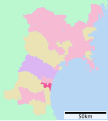
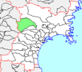
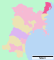
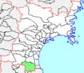
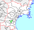
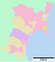
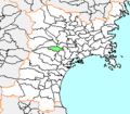
日本語: 宮城県の市町村の位置図
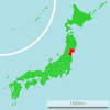
| Location maps of municipalities in Japan by prefecture | |||
|---|---|---|---|
|
| ||
Media in category "Locator maps of municipalities in Miyagi prefecture"
The following 80 files are in this category, out of 80 total.
-
Map of Miyagi Prefecture Ja.svg 484 × 538; 18 KB
-
Aoba-ku in Sendai City.svg 600 × 452; 9 KB
-
Furukawa-Miyagi.png 253 × 222; 4 KB
-
Higashimatsushima in Miyagi Prefecture Ja.svg 484 × 538; 8 KB
-
Ishinomaki in Miyagi Prefecture Ja.svg 484 × 538; 8 KB
-
Ishinomaki-Miyagi.png 253 × 222; 4 KB
-
Ishinomaki-Miyagi.PNG 253 × 222; 5 KB
-
Iwanuma in Miyagi Prefecture Ja.svg 484 × 538; 8 KB
-
Izumi-ku in Sendai City.svg 600 × 452; 9 KB
-
Kakuda in Miyagi Prefecture Ja.svg 484 × 538; 8 KB
-
Kakuda-Miyagi.png 253 × 222; 4 KB
-
Kami in Miyagi Prefecture Ja.svg 484 × 538; 8 KB
-
Kami-Miyagi.png 253 × 222; 4 KB
-
Kawasaki in Miyagi Prefecture Ja.svg 484 × 538; 8 KB
-
Kawasaki-Miyagi.png 253 × 222; 4 KB
-
Kesennuma in Miyagi Prefecture Ja.svg 484 × 538; 8 KB
-
Kurihara in Miyagi Prefecture Ja.svg 484 × 538; 8 KB
-
Maps of Matsushima-Miyagi.png 253 × 222; 4 KB
-
Marumori in Miyagi Prefecture Ja.svg 484 × 538; 8 KB
-
Marumori-Miyagi.png 253 × 222; 4 KB
-
Marumori-Miyagi.PNG 253 × 222; 5 KB
-
Matsushima in Miyagi Prefecture Ja.svg 484 × 538; 8 KB
-
Matsushima-Miyagi.png 253 × 222; 10 KB
-
Minamisanriku in Miyagi Prefecture Ja.svg 484 × 538; 8 KB
-
Minamisanriku-town.png 253 × 222; 4 KB
-
Misato in Miyagi Prefecture Ja.svg 484 × 538; 8 KB
-
Misato-Miyagi.png 253 × 222; 4 KB
-
Miyagino-ku in Sendai City.svg 600 × 452; 9 KB
-
Motoyoshi-Miyagi.png 253 × 222; 4 KB
-
Murata in Miyagi Prefecture Ja.svg 484 × 538; 8 KB
-
Murata-Miyagi.png 253 × 222; 4 KB
-
Natori in Miyagi Prefecture Ja.svg 484 × 538; 8 KB
-
Natori in Miyagi Prefecture.png 901 × 901; 41 KB
-
Natori-Miyagi.png 253 × 222; 4 KB
-
Ogawara in Miyagi Prefecture Ja.svg 484 × 538; 8 KB
-
Ogawara-Miyagi.png 253 × 222; 4 KB
-
Ohira in Miyagi Prefecture Ja.svg 484 × 538; 8 KB
-
Onagawa in Miyagi Prefecture Ja.svg 484 × 538; 8 KB
-
Oohira-Miyagi.PNG 253 × 222; 5 KB
-
Oohira-Miyagi.png 253 × 222; 4 KB
-
Oosato-Miyagi.png 253 × 222; 4 KB
-
Osaki in Miyagi Ja.svg 484 × 538; 8 KB
-
Osaki-city.png 253 × 222; 4 KB
-
Osato in Miyagi Prefecture Ja.svg 484 × 538; 8 KB
-
Rifu in Miyagi Prefecture Ja.svg 484 × 538; 8 KB
-
Rifu-Miyagi.PNG 253 × 222; 5 KB
-
Rifu-Miyagi.png 253 × 222; 4 KB
-
Shibata in Miyagi Prefecture Ja.svg 484 × 538; 8 KB
-
Shibata-Miyagi.png 253 × 222; 4 KB
-
Shichigahama in Miyagi Prefecture Ja.svg 484 × 538; 8 KB
-
Shichigahama-Miyagi.png 253 × 222; 4 KB
-
Shichikashuku in Miyagi Prefecture Ja.svg 484 × 538; 8 KB
-
Shikama in Miyagi Prefecture Ja.svg 484 × 538; 8 KB
-
Shikama-Miyagi.png 253 × 222; 4 KB
-
Shiogama in Miyagi Prefecture Ja.svg 484 × 538; 8 KB
-
Shiogama-city.png 253 × 222; 4 KB
-
Shiroishi in Miyagi Prefecture Ja.svg 484 × 538; 8 KB
-
Shiroishi in Miyagi Prefecture.png 901 × 901; 41 KB
-
Tagajo in Miyagi Prefecture - Ja.svg 484 × 538; 8 KB
-
Tagajo-Miyagi.PNG 253 × 222; 5 KB
-
Tagajo-Miyagi.png 253 × 222; 4 KB
-
Taihaku-ku in Sendai City.svg 600 × 452; 9 KB
-
Taiwa in Miyagi Prefecture Ja.svg 484 × 538; 8 KB
-
Taiwa-Miyagi.PNG 253 × 222; 5 KB
-
Taiwa-Miyagi.png 253 × 222; 4 KB
-
Tome in Miyagi Prefecture - Ja.svg 484 × 538; 8 KB
-
Tome MiyagiMap.PNG 600 × 600; 87 KB
-
Tome-Miyagi.png 253 × 222; 4 KB
-
Tomiya in Miyagi Prefecture Ja.svg 484 × 538; 8 KB
-
Tomiya-Miyagi.PNG 253 × 222; 5 KB
-
Tomiya-Miyagi.png 253 × 222; 4 KB
-
Wakabayashi-ku in Sendai City.svg 600 × 452; 9 KB
-
Wakuya in Miyagi Prefecture Ja.svg 484 × 538; 8 KB
-
Wakuya-Miyagi.png 253 × 222; 4 KB
-
Watari in Miyagi Prefecture Ja.svg 484 × 538; 8 KB
-
Watari-Miyagi.png 253 × 222; 4 KB
-
Yamamoto in Miyagi Prefecture Ja.svg 484 × 538; 8 KB
-
Yamamoto-Miyagi.png 253 × 222; 4 KB
-
Zao in Miyagi Prefecture Ja.svg 484 × 538; 8 KB
-
Zao-Miyagi.png 253 × 222; 4 KB


