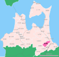
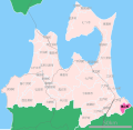
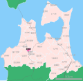
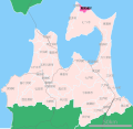
Category:Locator maps of municipalities in Aomori prefecture
Jump to navigation
Jump to search
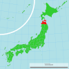
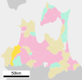
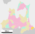
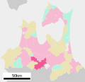
日本語: 青森県の市町村の位置図
Media in category "Locator maps of municipalities in Aomori prefecture"
The following 175 files are in this category, out of 175 total.
-
Ajigasawa in Aomori Prefecture Ja.svg 800 × 770; 30 KB
-
Ajigasawa in Aomori Prefecture.png 1,081 × 801; 38 KB
-
Aomori Ajigasawa.png 328 × 241; 5 KB
-
Aomori Goshogawara.png 328 × 241; 6 KB
-
Aomori Hachinohe.png 328 × 241; 5 KB
-
Aomori Hirosaki.png 328 × 241; 5 KB
-
Aomori in Aomori Prefecture Ja.svg 800 × 770; 29 KB
-
Aomori in Aomori Prefecture.png 1,081 × 801; 38 KB
-
Aomori Nishimeya.png 328 × 241; 5 KB
-
Aomori Rokkasho.png 328 × 241; 8 KB
-
Aomori Tsugaru.png 328 × 241; 10 KB
-
Aomori-hachinohe-city.svg 779 × 755; 16 KB
-
Fujisaki in Aomori Prefecture Ja.svg 800 × 770; 30 KB
-
Fujisaki in Aomori Prefecture.png 1,081 × 801; 38 KB
-
Fukaura in Aomori Prefecture Ja.svg 800 × 770; 30 KB
-
Fukaura in Aomori Prefecture.png 1,081 × 801; 38 KB
-
Gonohe in Aomori Prefecture Ja.svg 800 × 770; 30 KB
-
Gonohe in Aomori Prefecture.png 1,081 × 801; 38 KB
-
Goshogawara in Aomori Prefecture Ja.svg 800 × 770; 29 KB
-
Goshogawara in Aomori Prefecture.png 1,081 × 801; 38 KB
-
Hachinohe in Aomori Prefecture Ja.svg 800 × 770; 29 KB
-
Hachinohe in Aomori Prefecture.png 1,081 × 801; 38 KB
-
Hashikami in Aomori Prefecture Ja.svg 800 × 770; 31 KB
-
Hashikami in Aomori Prefecture.png 1,081 × 801; 38 KB
-
Higashidori in Aomori Prefecture Ja.svg 800 × 770; 31 KB
-
Higashidori in Aomori Prefecture.png 1,081 × 801; 38 KB
-
Hirakawa in Aomori Prefecture Ja.svg 800 × 770; 29 KB
-
Hirakawa in Aomori Prefecture.png 1,081 × 801; 38 KB
-
Hiranai in Aomori Prefecture Ja.svg 800 × 770; 29 KB
-
Hiranai in Aomori Prefecture.png 1,081 × 801; 38 KB
-
Hiranai, Aomori.svg 779 × 755; 17 KB
-
Hirosaki in Aomori Prefecture Ja.svg 800 × 770; 29 KB
-
Hirosaki in Aomori Prefecture.png 1,081 × 801; 38 KB
-
Imabetsu in Aomori Prefecture Ja.svg 800 × 770; 30 KB
-
Imabetsu in Aomori Prefecture.png 1,081 × 801; 38 KB
-
Imabetsu town, Aomori prefecture Japan.svg 779 × 755; 17 KB
-
Imabetsutown.PNG 328 × 241; 7 KB
-
Inakadate in Aomori Prefecture Ja.svg 800 × 842; 635 KB
-
Inakadate in Aomori Prefecture.png 1,081 × 801; 38 KB
-
Itayanagi in Aomori Prefecture Ja.svg 800 × 770; 30 KB
-
Itayanagi in Aomori Prefecture.png 1,081 × 801; 38 KB
-
JP Aomori Aomori City Location.png 1,495 × 1,060; 49 KB
-
JP Aomori Goshogawara City Location.png 1,495 × 1,060; 150 KB
-
JP Aomori Hachinohe City Location.png 1,495 × 1,060; 49 KB
-
JP Aomori Hirosaki City Location.png 1,495 × 1,060; 49 KB
-
Kazamaura in Aomori Prefecture Ja.svg 800 × 770; 30 KB
-
Kazamaura in Aomori Prefecture.png 1,081 × 801; 38 KB
-
Kuroishi in Aomori Prefecture Ja.svg 800 × 770; 29 KB
-
Kuroishi in Aomori Prefecture.png 1,081 × 801; 38 KB
-
Location of Ajigasawa town, Aomori prefecture, Japan.svg 779 × 755; 17 KB
-
Location of Aomori city, Aomori prefecture, Japan.svg 779 × 755; 17 KB
-
Location of Aomori oirase town.svg 779 × 755; 17 KB
-
Location of Aomori tsugaru city.svg 779 × 755; 17 KB
-
Location of Fujisaki town, Aomori prefecture, Japan.svg 779 × 755; 17 KB
-
Location of Fukaura town, Aomori prefecture, Japan.svg 779 × 755; 17 KB
-
Location of Gonohe town, Aomori prefecture, Japan.svg 779 × 755; 17 KB
-
Location of Goshogawara city, Aomori prefecture, Japan.svg 779 × 755; 17 KB
-
Location of Hashikami town, Aomori prefecture, Japan.svg 779 × 755; 17 KB
-
Location of Higashidori village, Aomori prefecture, Japan.svg 779 × 755; 17 KB
-
Location of Hirakawa city, Aomori prefecture, Japan.svg 779 × 755; 17 KB
-
Location of Hirosaki city, Aomori prefecture, Japan.svg 779 × 755; 16 KB
-
Location of Itayanagi town, Aomori prefecture, Japan.svg 779 × 755; 16 KB
-
Location of Kazamaura village, Aomori prefecture, Japan.svg 779 × 755; 17 KB
-
Location of Kuroishi city, Aomori prefecture, Japan.svg 779 × 755; 16 KB
-
Location of Misawa city, Aomori prefecture, Japan.svg 779 × 755; 17 KB
-
Location of Mutsu city, Aomori prefecture, Japan.svg 779 × 755; 16 KB
-
Location of nakadomari town, Aomori prefecture, Japan.svg 779 × 755; 16 KB
-
Location of Nishimeya village, Aomori prefecture, Japan.svg 779 × 755; 17 KB
-
Location of Noheji town, Aomori prefecture, Japan.svg 779 × 755; 17 KB
-
Location of Oma town, Aomori prefecture, Japan.svg 779 × 755; 16 KB
-
Location of Owani town, Aomori prefecture, Japan.svg 779 × 755; 17 KB
-
Location of Rokkasho village, Aomori prefecture, Japan.svg 779 × 755; 17 KB
-
Location of Rokunohe town, Aomori prefecture, Japan.svg 779 × 755; 17 KB
-
Location of Sai village, Aomori prefecture, Japan.svg 779 × 755; 16 KB
-
Location of Shichinohe town, Aomori prefecture, Japan.svg 779 × 755; 16 KB
-
Location of Shingo village, Aomori prefecture, Japan.svg 779 × 755; 17 KB
-
Location of Sotogahama town, Aomori prefecture, Japan.svg 779 × 755; 17 KB
-
Location of Takko town, Aomori prefecture, Japan.svg 779 × 755; 17 KB
-
Location of Tohoku town, Aomori prefecture, Japan.svg 779 × 755; 16 KB
-
Location of Tsuruta town, Aomori prefecture, Japan.svg 779 × 755; 17 KB
-
Location of Yokohama town, Aomori prefecture, Japan.svg 779 × 755; 17 KB
-
Location of Yomogita village, Aomori prefecture, Japan.svg 779 × 755; 16 KB
-
Misawa in Aomori Prefecture Ja.svg 800 × 770; 29 KB
-
Misawa in Aomori Prefecture.png 1,081 × 801; 38 KB
-
Mutsu in Aomori Prefecture Ja.svg 800 × 770; 29 KB
-
Mutsu in Aomori Prefecture.PNG 1,081 × 801; 53 KB
-
Nakadomari in Aomori Prefecture Ja.svg 800 × 770; 30 KB
-
Nakadomari in Aomori Prefecture.png 1,081 × 801; 38 KB
-
Nakadomaritown.PNG 328 × 241; 7 KB
-
Nanbu in Aomori Prefecture Ja.svg 800 × 770; 30 KB
-
Nanbu in Aomori Prefecture.png 1,081 × 801; 38 KB
-
Nishimeya in Aomori Prefecture Ja.svg 800 × 842; 633 KB
-
Nishimeya in Aomori Prefecture.png 1,081 × 801; 38 KB
-
Noheji in Aomori Prefecture Ja.svg 800 × 770; 30 KB
-
Noheji in Aomori Prefecture.png 1,081 × 801; 38 KB
-
Oirase in Aomori Prefecture Ja.svg 800 × 770; 30 KB
-
Oirase in Aomori Prefecture.png 1,081 × 801; 38 KB
-
Oma in Aomori Prefecture Ja.svg 800 × 770; 30 KB
-
Oma in Aomori Prefecture.PNG 1,081 × 801; 53 KB
-
Oma in Aomori Prefecture.png 1,081 × 801; 38 KB
-
Owani in Aomori Prefecture Ja.svg 800 × 770; 30 KB
-
Owani in Aomori Prefecture.png 1,081 × 801; 38 KB
-
Rokkasho in Aomori Prefecture Ja.svg 800 × 770; 30 KB
-
Rokkasho in Aomori Prefecture.PNG 1,081 × 801; 53 KB
-
Rokkasho in Aomori Prefecture.png 1,081 × 801; 38 KB
-
Rokunohe in Aomori Prefecture Ja.svg 800 × 770; 30 KB
-
Rokunohe in Aomori Prefecture.png 1,081 × 801; 38 KB
-
Sai in Aomori Prefecture Ja.svg 800 × 770; 30 KB
-
Sai in Aomori Prefecture.png 1,081 × 801; 38 KB
-
Sannohe in Aomori Prefecture Ja.svg 800 × 770; 30 KB
-
Sannohe in Aomori Prefecture.png 1,081 × 801; 38 KB
-
Shichinohe in Aomori Prefecture Ja.svg 800 × 770; 30 KB
-
Shichinohe in Aomori Prefecture.png 1,081 × 801; 38 KB
-
Shingo in Aomori Prefecture Ja.svg 800 × 770; 31 KB
-
Shingo in Aomori Prefecture.png 1,081 × 801; 38 KB
-
Sotogahama in Aomori Prefecture Ja.svg 800 × 770; 30 KB
-
Sotogahama in Aomori Prefecture.png 1,081 × 801; 38 KB
-
Sotogahamatown.PNG 328 × 241; 7 KB
-
Takko in Aomori Prefecture Ja.svg 800 × 770; 30 KB
-
Takko in Aomori Prefecture.png 1,081 × 801; 38 KB
-
Tohoku in Aomori Prefecture Ja.svg 800 × 770; 30 KB
-
Tohoku in Aomori Prefecture.png 1,081 × 801; 38 KB
-
Location of Towada city, Aomori prefecture, Japan.svg 779 × 755; 17 KB
-
Towada in Aomori Prefecture Ja.svg 800 × 770; 29 KB
-
Towada in Aomori Prefecture.png 1,081 × 801; 38 KB
-
Tsugaru in Aomori Prefecture Ja.svg 800 × 770; 29 KB
-
Tsugaru in Aomori Prefecture.png 1,081 × 801; 38 KB
-
Tsuruta in Aomori Prefecture Ja.svg 800 × 770; 30 KB
-
Tsuruta in Aomori Prefecture.png 1,081 × 801; 38 KB
-
Yokohama in Aomori Prefecture Ja.svg 800 × 770; 30 KB
-
Yokohama in Aomori Prefecture.png 1,081 × 801; 38 KB
-
Yomogita in Aomori Prefecture Ja.svg 800 × 770; 31 KB
-
Yomogita in Aomori Prefecture.png 1,081 × 801; 38 KB
-
十和田市.png 328 × 241; 5 KB
-
地図-青森県おいらせ町-2006.png 389 × 260; 7 KB
-
地図-青森県つがる市-2006.png 389 × 260; 7 KB
-
地図-青森県むつ市-2006.png 389 × 260; 7 KB
-
地図-青森県七戸町-2006.png 389 × 260; 7 KB
-
地図-青森県三戸町-2006.png 389 × 260; 7 KB
-
地図-青森県三沢市-2006.png 389 × 260; 7 KB
-
地図-青森県中泊町-2006.png 389 × 260; 7 KB
-
地図-青森県五戸町-2006.png 389 × 260; 7 KB
-
地図-青森県五所川原市-2006.png 389 × 260; 7 KB
-
地図-青森県今別町-2006.png 389 × 260; 7 KB
-
地図-青森県佐井村-2006.png 389 × 260; 7 KB
-
地図-青森県八戸市-2006.png 389 × 260; 7 KB
-
地図-青森県六ヶ所村-2006.png 389 × 260; 7 KB
-
地図-青森県六戸町-2006.png 389 × 260; 7 KB
-
地図-青森県十和田市-2006.png 389 × 260; 7 KB
-
地図-青森県南部町-2006.png 389 × 260; 7 KB
-
地図-青森県外ヶ浜町-2006.png 389 × 260; 7 KB
-
地図-青森県大間町-2006.png 389 × 260; 7 KB
-
地図-青森県大鰐町-2006.png 389 × 260; 7 KB
-
地図-青森県平内町-2006.png 389 × 260; 7 KB
-
地図-青森県平川市-2006.png 389 × 260; 7 KB
-
地図-青森県弘前市-2006.png 389 × 260; 7 KB
-
地図-青森県新郷村-2006.png 389 × 260; 7 KB
-
地図-青森県東北町-2006.png 389 × 260; 7 KB
-
地図-青森県東通村-2006.png 389 × 260; 7 KB
-
地図-青森県板柳町-2006.png 389 × 260; 7 KB
-
地図-青森県横浜町-2006.png 389 × 260; 7 KB
-
地図-青森県深浦町-2006.png 389 × 260; 7 KB
-
地図-青森県田子町-2006.png 389 × 260; 7 KB
-
地図-青森県田舎館村-2006.png 389 × 260; 7 KB
-
地図-青森県蓬田村-2006.png 389 × 260; 7 KB
-
地図-青森県藤崎町-2006.png 389 × 260; 7 KB
-
地図-青森県西目屋村-2006.png 389 × 260; 7 KB
-
地図-青森県野辺地町-2006.png 389 × 260; 7 KB
-
地図-青森県階上町-2006.png 389 × 260; 7 KB
-
地図-青森県青森市-2006.png 389 × 260; 7 KB
-
地図-青森県風間浦村-2006.png 389 × 260; 7 KB
-
地図-青森県鰺ヶ沢町-2006.png 389 × 260; 7 KB
-
地図-青森県鶴田町-2006.png 389 × 260; 7 KB
-
地図-青森県黒石市-2006.png 389 × 260; 7 KB
-
青森県十和田市位置図.svg 800 × 842; 631 KB
