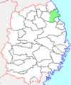
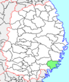
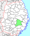
Category:Locator maps of municipalities in Iwate prefecture
Jump to navigation
Jump to search
日本語: 岩手県の市町村の位置図
Media in category "Locator maps of municipalities in Iwate prefecture"
The following 127 files are in this category, out of 127 total.
-
IwateMapCurrent-pt.png 981 × 801; 30 KB
-
IwateMapCurrent.png 981 × 801; 32 KB
-
Map of Iwate Prefecture Ja.svg 400 × 604; 20 KB
-
Fudai in Iwate Prefecture Ja.svg 400 × 604; 12 KB
-
Fudai in Iwate Prefecture.png 981 × 801; 34 KB
-
Fudai village Iwate prefecture Japan.svg 621 × 964; 19 KB
-
Fujisawa in Iwate Prefecture Ja.svg 500 × 812; 16 KB
-
Fujisawa in Iwate Prefecture.png 981 × 801; 34 KB
-
Fujisawa town Iwate prefecture Japan.svg 621 × 964; 19 KB
-
Hachimantai city, Iwate prefecture Japan.svg 621 × 964; 19 KB
-
Hachimantai in Iwate Prefecture Ja.svg 400 × 604; 12 KB
-
Hachimantai in Iwate Prefecture.png 981 × 801; 18 KB
-
Hanamaki city, Iwate prefecture Japan.svg 621 × 964; 19 KB
-
Hanamaki in Iwate Prefecture Ja.svg 400 × 604; 12 KB
-
Hanamaki in Iwate Prefecture.png 981 × 801; 34 KB
-
Hiraizumi in Iwate Prefecture Ja.svg 400 × 604; 12 KB
-
Hiraizumi in Iwate Prefecture.png 981 × 801; 34 KB
-
Hiraizumi town, Iwate prefecture Japan.svg 621 × 964; 19 KB
-
Hirono in Iwate Prefecture Ja.svg 400 × 604; 12 KB
-
Hirono in Iwate Prefecture.png 981 × 801; 34 KB
-
Hirono town Iwate prefecture Japan.svg 621 × 964; 19 KB
-
Ichinohe in Iwate Prefecture Ja.svg 400 × 604; 12 KB
-
Ichinohe in Iwate Prefecture.png 981 × 801; 34 KB
-
Ichinohe town Iwate prefecture Japan.svg 621 × 964; 19 KB
-
Ichinoseki city, Iwate prefecture Japan.svg 621 × 964; 19 KB
-
Ichinoseki in Iwate Prefecture Ja.svg 400 × 604; 16 KB
-
Ichinoseki in Iwate Prefecture.png 981 × 801; 33 KB
-
Iwaizumi in Iwate Prefecture Ja.svg 400 × 604; 12 KB
-
Iwaizumi in Iwate Prefecture.png 981 × 801; 34 KB
-
Iwaizumi town Iwate prefecture Japan.svg 621 × 964; 19 KB
-
Iwate in Iwate Prefecture Ja.svg 400 × 604; 12 KB
-
Iwate in Iwate Prefecture.png 981 × 801; 34 KB
-
Iwate Kuji-city.png 256 × 306; 5 KB
-
Iwate Miyako-city.png 256 × 306; 5 KB
-
Iwate Morioka-city.png 256 × 306; 6 KB
-
Iwate Ninohe-city.png 256 × 306; 6 KB
-
Iwate Nishiwaga-town.png 256 × 306; 6 KB
-
Iwate Ofunato-city.png 256 × 306; 6 KB
-
Iwate Otsuchi-town.png 256 × 306; 6 KB
-
Iwate Rikuzentakata-city.png 256 × 306; 6 KB
-
Iwate Takizawa-vil.png 256 × 306; 6 KB
-
Iwate Tono-city.png 256 × 306; 6 KB
-
Iwate town, Iwate prefecture Japan.svg 621 × 964; 19 KB
-
Iwate Yamada-town.png 256 × 306; 6 KB
-
Iwate-Hiraizumi.svg 374 × 439; 515 KB
-
JP Iwate Oshu City Location.png 1,496 × 1,108; 46 KB
-
Kamaishi city, Iwate prefecture Japan.svg 621 × 964; 19 KB
-
Kamaishi in Iwate Prefecture Ja.svg 400 × 604; 12 KB
-
Kamaishi in Iwate Prefecture.png 981 × 801; 34 KB
-
Kanegasaki in Iwate Prefecture Ja.svg 400 × 604; 12 KB
-
Kanegasaki in Iwate Prefecture.png 981 × 801; 34 KB
-
Kanegasaki town, Iwate prefecture Japan.svg 621 × 964; 19 KB
-
Karumai in Iwate Prefecture Ja.svg 400 × 604; 12 KB
-
Karumai in Iwate Prefecture.png 981 × 801; 34 KB
-
Karumai town Iwate prefecture Japan.svg 621 × 964; 19 KB
-
Kawai in Iwate Prefecture Ja.svg 600 × 970; 38 KB
-
Kawai in Iwate Prefecture.png 981 × 801; 34 KB
-
Kawai village Iwate prefecture Japan.svg 621 × 964; 19 KB
-
Kitakami city, Iwate prefecture Japan.svg 621 × 964; 19 KB
-
Kitakami in Iwate Prefecture Ja.svg 400 × 604; 12 KB
-
Kitakami in Iwate Prefecture.png 981 × 801; 34 KB
-
Kuji city, Iwate prefecture Japan.svg 621 × 964; 19 KB
-
Kuji in Iwate Prefecture Ja.svg 400 × 604; 12 KB
-
Kuji in Iwate Prefecture.png 981 × 801; 34 KB
-
Kunohe in Iwate Prefecture Ja.svg 400 × 604; 12 KB
-
Kunohe in Iwate Prefecture.png 981 × 801; 34 KB
-
Kunohe village Iwate prefecture Japan.svg 621 × 964; 19 KB
-
Kuzumaki in Iwate Prefecture Ja.svg 400 × 604; 12 KB
-
Kuzumaki in Iwate Prefecture.png 981 × 801; 34 KB
-
Kuzumaki town, Iwate prefecture Japan.svg 621 × 964; 19 KB
-
Location of Morioka city, Iwate prefecture Japan.svg 621 × 964; 19 KB
-
Miyako in Iwate Prefecture Ja.svg 400 × 604; 12 KB
-
Miyako in Iwate Prefecture.png 981 × 801; 33 KB
-
基礎自治体位置図 03201.png 397 × 600; 60 KB
-
Morioka in Iwate Prefecture Ja.svg 400 × 604; 12 KB
-
Morioka in Iwate Prefecture.png 981 × 801; 34 KB
-
Ninohe city, Iwate prefecture Japan.svg 621 × 964; 19 KB
-
Ninohe in Iwate Prefecture Ja.svg 400 × 604; 12 KB
-
Ninohe in Iwate Prefecture.png 981 × 801; 34 KB
-
Nishiwaga in Iwate Prefecture Ja.svg 400 × 604; 12 KB
-
Nishiwaga in Iwate Prefecture.png 981 × 801; 34 KB
-
Nishiwaga town, Iwate prefecture Japan.svg 621 × 964; 19 KB
-
Noda in Iwate Prefecture Ja.svg 400 × 604; 12 KB
-
Noda in Iwate Prefecture.png 981 × 801; 34 KB
-
Noda Iwate Map.png 981 × 801; 34 KB
-
Noda village Iwate prefecture Japan.svg 621 × 964; 19 KB
-
Ofunato city Iwate prefecture Japan.svg 621 × 964; 19 KB
-
Ofunato in Iwate Prefecture ja.svg 400 × 604; 12 KB
-
Ofunato in Iwate Prefecture.png 981 × 801; 34 KB
-
Oshu city, Iwate prefecture Japan.svg 621 × 964; 19 KB
-
Oshu in Iwate Prefecture Ja.svg 400 × 604; 12 KB
-
Oshu in Iwate Prefecture.png 981 × 801; 34 KB
-
Otsuchi in Iwate Prefecture Ja.svg 400 × 604; 12 KB
-
Otsuchi in Iwate Prefecture.png 981 × 801; 34 KB
-
Otsuchi town Iwate prefecture Japan.svg 621 × 964; 19 KB
-
Rikuzentakata city, Iwate prefecture Japan.svg 621 × 964; 19 KB
-
Rikuzentakata in Iwate Prefecture Ja.svg 400 × 604; 12 KB
-
Rikuzentakata in Iwate Prefecture.png 981 × 801; 34 KB
-
Shiwa in Iwate Prefecture Ja.svg 400 × 604; 12 KB
-
Shiwa in Iwate Prefecture.png 981 × 801; 34 KB
-
Shiwa town, Iwate prefecture Japan.svg 621 × 964; 19 KB
-
Shizukuishi city, Iwate prefecture Japan.svg 621 × 964; 19 KB
-
Shizukuishi in Iwate Prefecture Ja.svg 400 × 604; 12 KB
-
Shizukuishi in Iwate Prefecture.png 981 × 801; 34 KB
-
Sumita in Iwate Prefecture Ja.svg 400 × 604; 12 KB
-
Sumita in Iwate Prefecture.png 981 × 801; 34 KB
-
Sumita town Iwate prefecture Japan.svg 621 × 964; 19 KB
-
Takizawa in Iwate Prefecture Ja.svg 400 × 604; 20 KB
-
Takizawa in Iwate Prefecture.png 981 × 801; 34 KB
-
Takizawa village, Iwate prefecture Japan.svg 621 × 964; 19 KB
-
Tanohata in Iwate Prefecture Ja.svg 500 × 812; 16 KB
-
Tanohata in Iwate Prefecture.png 981 × 801; 34 KB
-
Tanohata village Iwate prefecture Japan.svg 621 × 964; 19 KB
-
Tono City, Iwate prefecture Japan.svg 621 × 964; 19 KB
-
Tono in Iwate Prefecture Ja.svg 400 × 604; 12 KB
-
Tono in Iwate Prefecture.png 981 × 801; 34 KB
-
Yahaba in Iwate Prefecture Ja.svg 400 × 604; 12 KB
-
Yahaba in Iwate Prefecture.png 981 × 801; 34 KB
-
Yahaba town, Iwate prefecture Japan.svg 621 × 964; 19 KB
-
Yamada in Iwate Prefecture Ja.svg 400 × 604; 12 KB
-
Yamada in Iwate Prefecture.png 981 × 801; 34 KB
-
Yamada in the Iwate prefecture.png 981 × 801; 34 KB
-
Yamada town Iwate prefecture Japan.svg 621 × 964; 19 KB
-
基礎自治体位置図 03203 (2014–).svg 600 × 970; 37 KB
-
基礎自治体位置図 03209.svg 600 × 970; 37 KB
-
基礎自治体位置図 03484.svg 600 × 970; 37 KB
-
基礎自治体位置図 03503 20140101.svg 600 × 970; 37 KB


