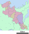
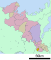
Category:Locator maps of municipalities in Kyoto prefecture
Jump to navigation
Jump to search
日本語: 京都府の市町村の位置図
| Prefectures of Japan 域内の市町村位置図 | |||
|---|---|---|---|
|

| ||
Media in category "Locator maps of municipalities in Kyoto prefecture"
The following 79 files are in this category, out of 79 total.
-
Japan Kyoto Prefecture location map.svg 590 × 640; 24 KB
-
Map of Kyoto Prefecture Ja.svg 490 × 533; 17 KB
-
26 municipalities in Kyoto, 2020.png 1,960 × 2,132; 119 KB
-
Ayabe in Kyoto Prefecture Ja.svg 600 × 712; 15 KB
-
Ayabe in Kyoto-fu.png 1,181 × 901; 42 KB
-
Fukuchiyama in Kyoto Prefecture Ja.svg 600 × 712; 15 KB
-
Fukuchiyama in Kyoto-fu.png 1,181 × 901; 43 KB
-
Fushimi-ku in Kyoto City.svg 460 × 812; 10 KB
-
Higashiyama-ku in Kyoto City.svg 460 × 812; 10 KB
-
Ide in Kyoto Prefecture Ja.svg 600 × 712; 15 KB
-
Ide in Kyoto-fu.png 1,181 × 901; 42 KB
-
Ine in Kyoto Prefecture Ja.svg 600 × 712; 15 KB
-
Ine in Kyoto-fu.png 1,181 × 901; 42 KB
-
Ine Kyoto Map.png 786 × 600; 77 KB
-
Joyo in Kyoto Prefecture Ja.svg 600 × 712; 15 KB
-
Joyo in Kyoto-fu.png 1,181 × 901; 42 KB
-
JP Kyoto Kyotanabe City Location.png 1,066 × 688; 31 KB
-
Kameoka in Kyoto Prefecture Ja.svg 600 × 712; 15 KB
-
Kameoka in Kyoto-fu.png 1,181 × 901; 42 KB
-
Kameoka map.svg 600 × 712; 19 KB
-
Kamigyo-ku in Kyoto City.svg 460 × 812; 10 KB
-
Kasagi in Kyoto Prefecture Ja.svg 600 × 712; 15 KB
-
Kasagi in Kyoto-fu.png 1,181 × 901; 42 KB
-
Kita-ku in Kyoto City.svg 460 × 812; 10 KB
-
Kizugawa in Kyoto Prefecture Ja.svg 600 × 712; 15 KB
-
Kizugawa in Kyoto-fu.PNG 1,181 × 901; 56 KB
-
Kumiyama in Kyoto Prefecture Ja.svg 600 × 712; 15 KB
-
Kumiyama in Kyoto-fu 2.png 1,181 × 901; 42 KB
-
Kumiyama in Kyoto-fu.png 220 × 200; 6 KB
-
Kyotamba in Kyoto Prefecture Ja.svg 600 × 712; 15 KB
-
Kyotamba in Kyoto-fu 2.png 1,181 × 901; 42 KB
-
Kyotamba in Kyoto-fu.png 220 × 200; 6 KB
-
Kyotanabe in Kyoto Prefecture Ja.svg 600 × 712; 15 KB
-
Kyotanabe in Kyoto-fu.png 1,181 × 901; 42 KB
-
Kyotango in Kyoto Prefecture Ja.svg 600 × 712; 15 KB
-
Kyotango in Kyoto-fu.png 1,181 × 901; 43 KB
-
Kyoto in Kyoto Prefecture Ja.svg 600 × 712; 15 KB
-
Kyoto in Kyoto-fu.png 1,181 × 901; 43 KB
-
Kyoto Kyotango-city.png 216 × 196; 4 KB
-
Kyoto Map.png 786 × 600; 77 KB
-
Kyoto-Kyoto.svg 575 × 633; 18 KB
-
Kyoto-Tanba-cho.png 432 × 390; 9 KB
-
Maizuru in Kyoto Prefecture Ja.svg 600 × 712; 15 KB
-
Maizuru in Kyoto-fu.png 1,181 × 901; 43 KB
-
Maizurumap.PNG 432 × 390; 11 KB
-
Map of Ayabe.PNG 432 × 390; 11 KB
-
Mapafukuchiyama.gif 538 × 513; 44 KB
-
Minami-ku in Kyoto City.svg 460 × 812; 10 KB
-
Minamiyamashiro in Kyoto Prefecture Ja.svg 600 × 712; 15 KB
-
Minamiyamashiro in Kyoto-fu.png 1,181 × 901; 42 KB
-
Miyazu in Kyoto Prefecture Ja.svg 600 × 712; 15 KB
-
Miyazu in Kyoto-fu.png 1,181 × 901; 43 KB
-
Muko in Kyoto Prefecture Ja.svg 600 × 712; 15 KB
-
Muko in Kyoto-fu.png 1,181 × 901; 42 KB
-
Nagaokakyo in Kyoto Prefecture Ja.svg 600 × 712; 15 KB
-
Nagaokakyo in Kyoto-fu.png 1,181 × 901; 42 KB
-
Nakagyo-ku in Kyoto City.svg 460 × 812; 10 KB
-
Nantan in Kyoto Prefecture Ja.svg 600 × 712; 15 KB
-
Nantan in Kyoto-fu.png 1,181 × 901; 42 KB
-
Nishikyo-ku in Kyoto City.svg 460 × 812; 10 KB
-
Oyamazaki in Kyoto Prefecture Ja.svg 600 × 712; 15 KB
-
Oyamazaki in Kyoto-fu 2.png 1,181 × 901; 42 KB
-
Oyamazaki in Kyoto-fu.png 220 × 200; 6 KB
-
Sakyo-ku in Kyoto-shi Ja.svg 460 × 812; 10 KB
-
Seika in Kyoto Prefecture Ja.svg 600 × 712; 15 KB
-
Seika in Kyoto-fu.png 1,181 × 901; 42 KB
-
Shimogyo-ku in Kyoto City.svg 460 × 812; 10 KB
-
Uji in Kyoto Prefecture Ja.svg 600 × 712; 15 KB
-
Uji in Kyoto-fu.png 1,181 × 901; 42 KB
-
Ujitawara in Kyoto Prefecture Ja.svg 600 × 712; 15 KB
-
Ujitawara in Kyoto-fu.png 1,181 × 901; 42 KB
-
Ukyo-ku in Kyoto-shi Ja.svg 460 × 812; 10 KB
-
Wazuka in Kyoto Prefecture Ja.svg 600 × 712; 15 KB
-
Wazuka in Kyoto-fu.png 1,181 × 901; 42 KB
-
Yamashina-ku in Kyoto City.svg 460 × 812; 10 KB
-
Yawata in Kyoto Prefecture Ja.svg 600 × 712; 15 KB
-
Yawata in Kyoto-fu.png 1,181 × 901; 42 KB
-
Yosano in Kyoto Prefecture Ja.svg 600 × 712; 15 KB
-
Yosano in Kyoto-fu.png 1,181 × 901; 42 KB
