Category:Locator maps of municipalities in Landkreis Eichsfeld
Jump to navigation
Jump to search
Districts of Thuringia:
Urban districts (cities):
Subcategories
This category has the following 18 subcategories, out of 18 total.
Media in category "Locator maps of municipalities in Landkreis Eichsfeld"
The following 57 files are in this category, out of 57 total.
-
 Municipalities in EIC.svg 1,149 × 1,140; 509 KB
-
 Am Ohmberg in EIC.svg 1,149 × 1,140; 510 KB
-
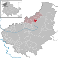
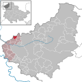
 Arenshausen in EIC.svg 1,149 × 1,140; 510 KB
-
 Asbach-Sickenberg in EIC.svg 1,149 × 1,140; 510 KB
-
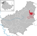
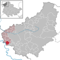
 Berlingerode in EIC.svg 1,149 × 1,140; 510 KB
-
 Bodenrode-Westhausen in EIC.svg 1,149 × 1,140; 510 KB
-
 Bornhagen in EIC.svg 1,149 × 1,140; 510 KB
-
 Brehme in EIC.svg 1,149 × 1,140; 510 KB
-
 Breitenworbis in EIC.svg 1,149 × 1,140; 510 KB
-
 Buhla in EIC.svg 1,149 × 1,140; 510 KB
-
 Burgwalde in EIC.svg 1,149 × 1,140; 510 KB
-
 Büttstedt in EIC.svg 1,149 × 1,140; 510 KB
-
 Dieterode in EIC.svg 1,149 × 1,140; 510 KB
-
 Dietzenrode-Vatterode in EIC.svg 1,149 × 1,140; 510 KB
-
 Dingelstädt in EIC.svg 1,149 × 1,140; 510 KB
-
 Ecklingerode in EIC.svg 1,149 × 1,140; 510 KB
-
 Effelder in EIC.svg 1,149 × 1,140; 510 KB
-
 Ferna in EIC.svg 1,149 × 1,140; 510 KB
-
 Freienhagen in EIC.svg 1,149 × 1,140; 510 KB
-
 Fretterode in EIC.svg 1,149 × 1,140; 510 KB
-
 Geisleden in EIC.svg 1,149 × 1,140; 510 KB
-
 Geismar in EIC.svg 1,149 × 1,140; 510 KB
-
 Gerbershausen in EIC.svg 1,149 × 1,140; 510 KB
-
 Gernrode in EIC.svg 1,149 × 1,140; 510 KB
-
 Großbartloff in EIC.svg 1,149 × 1,140; 510 KB
-
 Haynrode in EIC.svg 1,149 × 1,140; 510 KB
-
 Heiligenstadt in EIC.svg 1,149 × 1,140; 573 KB
-
 Heuthen in EIC.svg 1,149 × 1,140; 510 KB
-
 Hohengandern in EIC.svg 1,149 × 1,140; 510 KB
-
 Kella in EIC.svg 1,149 × 1,140; 510 KB
-
 Kirchgandern in EIC.svg 1,149 × 1,140; 510 KB
-
 Kirchworbis in EIC.svg 1,149 × 1,140; 510 KB
-
 Krombach in EIC.svg 1,149 × 1,140; 510 KB
-
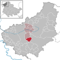
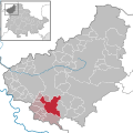
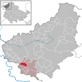
 Küllstedt in EIC.svg 1,149 × 1,140; 510 KB
-
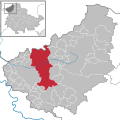
 Leinefelde-Worbis in EIC.svg 1,149 × 1,140; 510 KB
-
 Lindewerra in EIC.svg 1,149 × 1,140; 510 KB
-
 Marth in EIC.svg 1,149 × 1,140; 510 KB
-
 Niederorschel in EIC.svg 1,149 × 1,140; 510 KB
-
 Pfaffschwende in EIC.svg 1,149 × 1,140; 510 KB
-
 Reinholterode in EIC.svg 1,149 × 1,140; 510 KB
-
 Rohrberg in EIC.svg 1,149 × 1,140; 510 KB
-
 Rustenfelde in EIC.svg 1,149 × 1,140; 510 KB
-
 Schachtebich in EIC.svg 1,149 × 1,140; 510 KB
-
 Schimberg in EIC.svg 1,149 × 1,140; 510 KB
-
 Schwobfeld in EIC.svg 1,149 × 1,140; 510 KB
-
 Sickerode in EIC.svg 1,149 × 1,140; 510 KB
-
 Sonnenstein in EIC.svg 1,149 × 1,140; 510 KB
-
 Steinbach in EIC.svg 1,149 × 1,140; 510 KB
-
 Tastungen in EIC.svg 1,149 × 1,140; 510 KB
-
 Teistungen in EIC.svg 1,149 × 1,140; 510 KB
-
 Uder in EIC.svg 1,149 × 1,140; 510 KB
-
 Volkerode in EIC.svg 1,149 × 1,140; 510 KB
-
 Wachstedt in EIC.svg 1,149 × 1,140; 510 KB
-
 Wahlhausen in EIC.svg 1,149 × 1,140; 510 KB
-
 Wehnde in EIC.svg 1,149 × 1,140; 510 KB
-
 Wiesenfeld in EIC.svg 1,149 × 1,140; 510 KB
-
 Wingerode in EIC.svg 1,149 × 1,140; 510 KB


