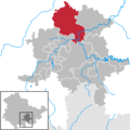
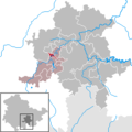
Category:Locator maps of municipalities in the Landkreis Saalfeld-Rudolstadt
Jump to navigation
Jump to search
Districts of Thuringia:
Urban districts (cities):
Subcategories
This category has the following 3 subcategories, out of 3 total.
Media in category "Locator maps of municipalities in the Landkreis Saalfeld-Rudolstadt"
The following 28 files are in this category, out of 28 total.
-
Municipalities in SLF.png 299 × 299; 5 KB
-
Allendorf in SLF.png 299 × 299; 5 KB
-
Altenbeuthen in SLF.png 299 × 299; 5 KB
-
Bad Blankenburg in SLF.png 299 × 299; 5 KB
-
Bechstedt in SLF.png 299 × 299; 5 KB
-
Cursdorf in SLF.png 299 × 299; 5 KB
-
Deesbach in SLF.png 299 × 299; 5 KB
-
Döschnitz in SLF.png 299 × 299; 5 KB
-
Drognitz in SLF.png 299 × 299; 5 KB
-
Gräfenthal in SLF.png 299 × 299; 5 KB
-
Hohenwarte in SLF.png 299 × 299; 5 KB
-
Katzhütte in SLF.png 299 × 299; 5 KB
-
Kaulsdorf in SLF.png 299 × 299; 5 KB
-
Königsee (2019) in SLF.png 299 × 299; 5 KB
-
Lehesten in SLF.png 299 × 299; 5 KB
-
Leutenberg in SLF.png 299 × 299; 5 KB
-
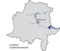
LK SLF RU Remschuetz.png 664 × 572; 34 KB
-
Meura in SLF.png 299 × 299; 5 KB
-
Probstzella in SLF.png 299 × 299; 5 KB
-
Rohrbach in SLF.png 299 × 299; 5 KB
-
Rudolstadt in SLF.png 299 × 299; 5 KB
-
Saalfeld-Saale in SLF.png 299 × 299; 5 KB
-
Schwarzatal in SLF.png 299 × 299; 5 KB
-
Schwarzburg in SLF.png 299 × 299; 5 KB
-
Sitzendorf in SLF.png 299 × 299; 5 KB
-
Uhlstädt-Kirchhasel in SLF.png 299 × 299; 5 KB
-
Unterweißbach in SLF.png 299 × 299; 5 KB
-
Unterwellenborn in SLF.png 299 × 299; 5 KB
