Category:District-Maps of Sonnenstein
Jump to navigation
Jump to search
Media in category "District-Maps of Sonnenstein"
The following 15 files are in this category, out of 15 total.
-
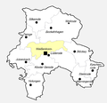
 Sonnenstein (Districts).png 2,293 × 2,211; 241 KB
-
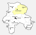
 Sonnenstein, OT Bockelnhagen.png 2,293 × 2,211; 237 KB
-
 Sonnenstein, OT Epschenrode.png 2,293 × 2,211; 239 KB
-
 Sonnenstein, OT Holungen.png 2,293 × 2,211; 240 KB
-
 Sonnenstein, OT Jützenbach.png 2,293 × 2,211; 238 KB
-
 Sonnenstein, OT Kloster Gerode.png 2,293 × 2,211; 238 KB
-
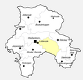 Sonnenstein, OT Lüderode.png 2,293 × 2,211; 239 KB
-
 Sonnenstein, OT Silkerode.png 2,293 × 2,211; 238 KB
-
 Sonnenstein, OT Steinrode.png 2,293 × 2,211; 236 KB
-
 Sonnenstein, OT Stöckey.png 2,293 × 2,211; 239 KB
-
 Sonnenstein, OT Weilrode.png 2,293 × 2,211; 237 KB
-
 Sonnenstein, OT Weißenborn-Lüderode.png 2,293 × 2,211; 237 KB
-
 Sonnenstein, OT Weißenborn.png 2,293 × 2,211; 238 KB
-
 Sonnenstein, OT Wernigerode.png 2,293 × 2,211; 239 KB
-
 Sonnenstein, OT Zwinge.png 2,293 × 2,211; 239 KB
.png)


