Category:Locator maps of Canada
Jump to navigation
Jump to search
Countries of the Americas: Antigua and Barbuda · Argentina · The Bahamas · Barbados · Belize · Bolivia · Brazil · Canada · Chile · Colombia · Costa Rica · Cuba · Dominica · Dominican Republic · Ecuador · El Salvador · Grenada · Guatemala · Guyana · Haiti · Honduras · Jamaica · Mexico · Nicaragua · Panama · Paraguay · Peru · Saint Kitts and Nevis · Saint Lucia · Saint Vincent and the Grenadines · Suriname · Trinidad and Tobago · United States of America · Uruguay · Venezuela
Other areas: Anguilla · Aruba · Bermuda · British Virgin Islands · Cayman Islands · Curaçao · Dutch Caribbean · Falkland Islands · French Guiana · Greenland · Guadeloupe · Martinique · Montserrat · Puerto Rico · Saint Barthélemy · Saint-Martin · Saint Pierre and Miquelon · Sint Maarten · South Georgia and the South Sandwich Islands · Turks and Caicos Islands · United States Virgin Islands
Other areas: Anguilla · Aruba · Bermuda · British Virgin Islands · Cayman Islands · Curaçao · Dutch Caribbean · Falkland Islands · French Guiana · Greenland · Guadeloupe · Martinique · Montserrat · Puerto Rico · Saint Barthélemy · Saint-Martin · Saint Pierre and Miquelon · Sint Maarten · South Georgia and the South Sandwich Islands · Turks and Caicos Islands · United States Virgin Islands
Subcategories
This category has the following 6 subcategories, out of 6 total.
Media in category "Locator maps of Canada"
The following 72 files are in this category, out of 72 total.
-
Alberta-woodbuffalo.PNG 215 × 353; 7 KB
-
ARR-LA BAIE.png 1,411 × 834; 78 KB
-
Bathurst East-Nepisiguit-Saint-Isodore (2014-).png 615 × 609; 79 KB
-
Bathurst West-Beresford (2014-).png 615 × 609; 79 KB
-
Campbellton-Dalhousie (2014-).png 615 × 609; 79 KB
-
CAN orthographic.svg 551 × 551; 1.83 MB
-
Canada - Location Map (2013) - CAN - UNOCHA.svg 250 × 250; 2.66 MB
-
Canada Argentina Locator.svg 940 × 415; 1.76 MB
-
Canada featured lists of municipalities.png 639 × 541; 111 KB
-
Canada United Kingdom Locator.png 2,000 × 883; 224 KB
-
CanadaWorldMap.png 1,427 × 628; 28 KB
-
Caraquet (2014-).png 615 × 609; 79 KB
-
Carleton (2014-).png 615 × 609; 79 KB
-
Carleton-Victoria (2014-).png 615 × 609; 79 KB
-
Charlotte-Campobello (2014-).png 615 × 609; 79 KB
-
Charlotte-The Isles (2014-).png 615 × 609; 79 KB
-
Durclr.PNG 157 × 164; 3 KB
-
Durpck.PNG 157 × 164; 3 KB
-
Edmundston-Madawaska Centre (2014-).png 615 × 609; 79 KB
-
Educational institutions in Canada map, 1957.jpg 4,124 × 3,071; 1.22 MB
-
FIFA World Cup 2026 - Canada Potential venues.jpg 2,000 × 1,937; 195 KB
-
Fredericton North (2014-).png 412 × 423; 26 KB
-
Fredericton South (2014-).png 412 × 423; 26 KB
-
Fredericton West-Hanwell (2014-).png 412 × 423; 26 KB
-
Fredericton-Grand Lake (2014-).png 412 × 423; 25 KB
-
Fredericton-York (2014-).png 412 × 423; 26 KB
-
Gagetown-Petitcodiac (2014-).png 615 × 609; 79 KB
-
Hampton (2014-).png 388 × 372; 38 KB
-
Jasper Park Location.JPG 800 × 631; 56 KB
-
Kanada cb.png 1,407 × 760; 50 KB
-
Kings Centre (2014-).png 388 × 372; 38 KB
-
La Salle (division sénatoriale).png 986 × 636; 67 KB
-
Labrador-Peninsula.PNG 280 × 230; 14 KB
-
Labrador.png 280 × 230; 39 KB
-
LLWS Canada.svg 1,084 × 920; 126 KB
-
Location Canada Red.svg 940 × 477; 2.26 MB
-
LocationCanada.png 250 × 115; 17 KB
-
LocationCanada.svg 1,000 × 500; 2.53 MB
-
LocationCanada2.svg 1,000 × 500; 2.54 MB
-
Locmap-DiscoveryPassage.png 330 × 273; 38 KB
-
Locmap-Haro-Boundary additional labels.png 384 × 309; 61 KB
-
Locmap-Haro-Boundary without border.png 384 × 309; 73 KB
-
Locmap-Haro-Boundary.png 384 × 309; 58 KB
-
Locmap-Sechelt.png 527 × 393; 60 KB
-
Locmap-Sechelt2.png 508 × 393; 63 KB
-
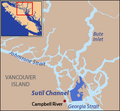
Locmap-SutilChannel.png 296 × 273; 34 KB
-
Map depicting the location where the SS Cornwallis was sunk.png 907 × 907; 126 KB
-
Memramcook-Tantramar (2014-).png 666 × 570; 55 KB
-
Miramichi (2014-).png 615 × 609; 79 KB
-
Miramichi district vs city (2014).png 247 × 193; 12 KB
-
Moncton Southwest (2014-).png 666 × 570; 56 KB
-
Mushkegowuk Council Map (North America Orthographic Projection).svg 541 × 543; 206 KB
-
NATO-Canada location map.png 616 × 247; 66 KB
-
New Zealand-Canada relations map2.PNG 1,425 × 625; 57 KB
-
Northeast Blackout of 1965.svg 1,789 × 2,154; 377 KB
-
ON 401 Canada inset.svg 1,084 × 920; 68 KB
-
Ontario-blindriver.PNG 377 × 379; 9 KB
-
Oromocto-Lincoln (2014-).png 412 × 423; 26 KB
-
PRBO2.gif 250 × 208; 15 KB
-
Quebec and Labrador (North America orthographic projection) 2.png 2,000 × 2,000; 741 KB
-
Quebec and Labrador (North America orthographic projection).svg 541 × 541; 163 KB
-
Quebec-victoriaville.png 424 × 483; 15 KB
-
Relief-map-of-Richardson-Mountains.png 776 × 580; 732 KB
-
Riding of Dieppe (2014-).png 666 × 570; 56 KB
-
Riding of Riverview (2014-).png 666 × 570; 56 KB
-
RiviereDuNord (Canadian electoral district).svg 512 × 288; 38 KB
-
Rothesay (2014-).png 388 × 372; 38 KB
-
Saint John East (2014-).png 388 × 372; 38 KB
-
Saint John Harbour (2014-).png 388 × 372; 38 KB
-
Saint John Lancaster (2014-).png 388 × 372; 38 KB
-
Saint John Portland (2014-).png 388 × 372; 38 KB


