Category:Locator maps of islands of Canada
Jump to navigation
Jump to search
Subcategories
This category has only the following subcategory.
Media in category "Locator maps of islands of Canada"
The following 121 files are in this category, out of 121 total.
-
 Airforceisland.JPG 320 × 329; 28 KB
-
 Airforceisland.png 320 × 329; 13 KB
-
 Akimiskiisland.png 457 × 376; 58 KB
-
 Alexanderisland.png 320 × 329; 12 KB
-
 Amund Ringnes Island.png 668 × 536; 135 KB
-
 Amund Ringnes Island.svg 668 × 536; 534 KB
-
 Axel Heiberg Island de.svg 668 × 536; 541 KB
-
 Axel Heiberg Island, Canada.svg 1,084 × 920; 51 KB
-
 Axel Heiberg Island.png 668 × 536; 138 KB
-
 Axel Heiberg Island.svg 605 × 527; 139 KB
-
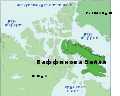
 Baffin Island location map.svg 600 × 400; 530 KB
-
 Baffin Island, Canada.svg 1,084 × 920; 51 KB
-
 BaffinIsland de.svg 668 × 536; 368 KB
-
 BaffinIsland eo.svg 668 × 536; 1.16 MB
-
 BaffinIsland ja.svg 668 × 536; 1.17 MB
-
 BaffinIsland ru.svg 668 × 536; 1.09 MB
-
 Baffinisland.png 320 × 329; 11 KB
-
 BaffinIsland.svg 668 × 536; 1.17 MB
-
 Bailliehamiltonisland.png 320 × 329; 12 KB
-
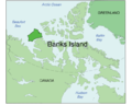
 Banks (Canada).PNG 747 × 492; 15 KB
-
 Banks Island de.svg 668 × 536; 541 KB
-
 Banks Island, Canada.svg 808 × 686; 51 KB
-
 Banks Island.png 668 × 536; 133 KB
-
 Banks Island.svg 599 × 524; 143 KB
-
 Banks.png 280 × 230; 12 KB
-
 Banksisland.png 320 × 329; 11 KB
-
 Bathurst Island.svg 668 × 536; 534 KB
-
 Belcherislands.png 457 × 376; 58 KB
-
 Bordensisland.png 320 × 329; 13 KB
-
 Brockisland.png 320 × 329; 13 KB
-
 Byammartinisland.png 320 × 329; 13 KB
-
 PT Bylot Island.svg 668 × 536; 541 KB
-
 Bylot Island de.svg 668 × 536; 369 KB
-
 Bylot Island.png 668 × 536; 132 KB
-
 Cameronisland.png 320 × 329; 13 KB
-
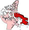
 Canada - Ellesmere Island - Jeopardy.jpg 1,084 × 920; 110 KB
-
 Carte localisation ile Galiano.png 600 × 942; 1.12 MB
-
 Charltonisland.png 457 × 376; 59 KB
-
 Coats Island.png 668 × 536; 134 KB
-
 Coatsisland.png 320 × 329; 8 KB
-
 CoburgIsland.png 320 × 329; 13 KB
-
 Cornwallis Island.png 617 × 530; 63 KB
-
 Cornwallis Island.svg 605 × 526; 159 KB
-
 Cornwallis.png 617 × 530; 104 KB
-
 CornwallisIsland.jpg 1,249 × 1,067; 182 KB
-
 Cornwallisland.png 320 × 329; 13 KB
-
 PT Devon Island.svg 668 × 536; 541 KB
-
 Devon Island de.svg 668 × 536; 534 KB
-
 Devon Island tr.svg 668 × 536; 138 KB
-
 Devon Island, Canada.svg 1,084 × 920; 51 KB
-
 Devon Island.svg 668 × 536; 534 KB
-
 Eglintonisland.png 320 × 329; 12 KB
-
 Ellef Ringnes Island-sr.svg 668 × 536; 534 KB
-
 Ellef Ringnes Island.png 668 × 536; 135 KB
-
 Ellesmere Island - Tiktaalik discovery site.png 606 × 526; 135 KB
-
 Ellesmere Island de.svg 668 × 536; 368 KB
-
 Ellesmere Island, Canada.svg 1,084 × 920; 51 KB
-
 Ellesmere Island.svg 668 × 536; 534 KB
-
 Ellesmere-sziget.svg 668 × 536; 534 KB
-
 Ellesmereisland.png 320 × 329; 11 KB
-
 Emeraldisland.png 320 × 329; 12 KB
-
 Grahamisland.png 320 × 329; 12 KB
-
 Helenaisland.png 320 × 329; 13 KB
-
 King William Island ES.svg 605 × 525; 553 KB
-
 King William Island.png 668 × 536; 135 KB
-
 King William Island.svg 668 × 536; 534 KB
-
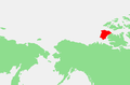
 Location Canadian Arctic Archipelago.png 640 × 326; 17 KB
-
 LocationBaffinIsland.png 250 × 115; 4 KB
-
 Locmap McCauleyIsland.png 500 × 392; 142 KB
-
 Locmap-BanksIsland.png 331 × 251; 34 KB
-
 Locmap-CortesIsland.png 330 × 273; 35 KB
-
 Locmap-GilIsland.PNG 301 × 236; 25 KB
-
 Locmap-MaurelleIsland.png 330 × 273; 37 KB
-
 Locmap-PittIsland.png 331 × 251; 34 KB
-
 Locmap-PorcherIsland.png 400 × 303; 82 KB
-
 Locmap-PriceIsland.png 301 × 236; 35 KB
-
 Locmap-PrincessRoyalIsland.png 301 × 236; 36 KB
-
 Locmap-quadraisland.png 334 × 277; 35 KB
-
 Locmap-Redonda.png 330 × 273; 38 KB
-
 Locmap-SonoraIsland.png 330 × 273; 38 KB
-
 Locmap-StuartIsland.png 311 × 273; 36 KB
-
 Locmap-Texada.png 396 × 256; 36 KB
-
 Locmap-Texada2.png 396 × 256; 42 KB
-
 Locmap-ThurlowIslands.png 330 × 273; 38 KB
-
 Longislandnunavut.png 457 × 376; 60 KB
-
 Lougheedisland.png 320 × 329; 12 KB
-
 Mackenzie King Island.png 668 × 536; 136 KB
-
 Manitoulin Island in Lake Huron.png 581 × 406; 16 KB
-
 Mattyisland.png 320 × 329; 13 KB
-
 Meighenisland.png 320 × 329; 12 KB
-
 Melville Island de.svg 604 × 522; 127 KB
-
 Melville Island, Canada.svg 1,084 × 920; 51 KB
-
 Melville island.jpg 939 × 814; 80 KB
-
 Melville Island.svg 668 × 536; 534 KB
-
 Moresby Island (Gulf Island) location.png 600 × 409; 363 KB
-
 Northkentisland.png 320 × 329; 13 KB
-
 Nottinghamisland.png 320 × 329; 13 KB
-
 Nunavut Axel Heiberg Island.png 320 × 329; 7 KB
-
 Nunavut King William Island.png 320 × 329; 10 KB
-
 Nunavut Mansel Island.png 320 × 329; 10 KB
-
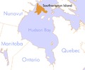
 Nunavut Southampton Island.png 320 × 329; 10 KB
-
 Prescottisland.png 320 × 329; 13 KB
-
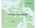 Prince Charles Island.png 668 × 536; 136 KB
-
 Prince Edward Island-map.png 280 × 230; 15 KB
-
 Prince of Wales Island de.svg 668 × 536; 369 KB
-
 Prince of Wales Island.png 668 × 536; 136 KB
-
 Prince Patrick Island-sr.svg 668 × 536; 534 KB
-
 Prince Patrick Island.svg 668 × 536; 534 KB
-
 Resolutionisland.png 320 × 329; 12 KB
-
 Russellisland.png 320 × 329; 13 KB
-
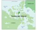 Somerset Island.svg 668 × 536; 534 KB
-
 Southampton Island.png 457 × 376; 56 KB
-
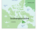 Southampton Island.svg 668 × 536; 534 KB
-
 Stefansson Island.png 668 × 536; 136 KB
-
 Ilevanier.png 320 × 329; 12 KB
-
 Victoria Island de.svg 668 × 536; 368 KB
-
 Victoria Island.png 668 × 536; 127 KB
-
 Victoria Island.svg 573 × 499; 138 KB
-
 Victoriaisland.png 320 × 329; 11 KB
-
 Корнволис.svg 668 × 536; 534 KB
-
 Острво Амунд Рингнес.svg 668 × 536; 534 KB


.PNG)


_location.png)


