Category:Locator maps of Panama
Jump to navigation
Jump to search
Subcategories
This category has the following 4 subcategories, out of 4 total.
Media in category "Locator maps of Panama"
The following 13 files are in this category, out of 13 total.
-
Distrito de Panamá Ubicación 2019.svg 512 × 651; 46 KB
-
Location of Nargana.png 2,508 × 1,362; 208 KB
-
LocationPanama.png 250 × 115; 6 KB
-
LocationPanama.svg 1,000 × 500; 2.76 MB
-
LocMap of WH panama viejo.pngb.png 137 × 190; 3 KB
-
Mapa de ubicacion.jpg 985 × 422; 48 KB
-
Panama - Caribbean.svg 3,690 × 2,323; 3.26 MB
-
Panama - Location Map (2011) - PAN - UNOCHA.svg 250 × 250; 269 KB
-
Panama locator map.png 633 × 323; 39 KB
-
Panama Nicaragua Canals.png 798 × 426; 21 KB
-
Países Bolivarianos.jpg 535 × 750; 144 KB
-
Países de Bolivar.jpg 360 × 360; 19 KB
-
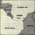
World Factbook (1982) Panama.jpg 586 × 586; 68 KB


