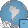
Category:Locator maps of the Falkland Islands
Jump to navigation
Jump to search
Media in category "Locator maps of the Falkland Islands"
The following 14 files are in this category, out of 14 total.
-
Falkland Islands - Choiseul Sound.PNG 952 × 523; 91 KB
-
Falkland Islands - Eddystone Rock.PNG 952 × 523; 95 KB
-
Falkland Islands - Golding Island.PNG 952 × 523; 36 KB
-
Falkland Islands - Great Island.PNG 952 × 523; 87 KB
-
Falkland Islands - Port San Carlos.PNG 952 × 523; 92 KB
-
Falkland Islands - Ruggles.PNG 800 × 439; 61 KB
-
Falkland Islands - Salvador Water.PNG 952 × 523; 91 KB
-
Falkland Islands - Salvador.PNG 952 × 523; 88 KB
-
Falkland Islands - Sedge Island.PNG 952 × 523; 91 KB
-
Falkland Islands - Tea Island.PNG 800 × 439; 201 KB
-
Falkland Islands - Tyssen Islands.PNG 952 × 523; 86 KB
-
Falklandislands w1 locator.svg 1,000 × 1,000; 80 KB
-
Falklandislands w2 locator.svg 1,000 × 1,000; 183 KB
-
Tierra del fuego Argentine Map.svg 1,418 × 2,412; 1.03 MB


