Category:Linguistic maps of Morocco
Jump to navigation
Jump to search
Countries of Africa: Algeria · Angola · Benin · Burkina Faso · Cameroon · Central African Republic · Chad · Democratic Republic of the Congo · Republic of the Congo · Equatorial Guinea · Eritrea · Ethiopia · Gabon · The Gambia · Ghana · Guinea · Ivory Coast · Kenya · Libya · Malawi · Mali · Morocco · Namibia · Niger · Nigeria · Senegal · South Africa · Sudan · Tanzania · Togo · Tunisia · Uganda · Zambia · Zimbabwe
Limited recognition: Ambazonia
Limited recognition: Ambazonia
Subcategories
This category has the following 2 subcategories, out of 2 total.
Media in category "Linguistic maps of Morocco"
The following 47 files are in this category, out of 47 total.
-
Berber dialects in Morocco.PNG 480 × 447; 13 KB
-
Carte des tribus du Rif.PNG 407 × 347; 15 KB
-
Carthe ethnolinguistique - Nord et Est du Maroc.PNG 686 × 742; 61 KB
-
Central Atlas Tamazight - EN.PNG 480 × 454; 13 KB
-
Central Morocco Tamazight.png 166 × 154; 11 KB
-
Central Morocco Tamazight.svg 166 × 154; 14 KB
-
Communes of Tachelhit.png 1,149 × 1,004; 284 KB
-
Darija of Morocco.png 446 × 350; 8 KB
-
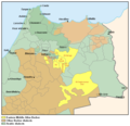
Eastern Middle Atlas Berber.PNG 686 × 662; 46 KB
-
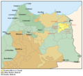
Eastern Morocco Zenati map.PNG 686 × 627; 46 KB
-
Espace linguistique du Jebli au nord du Maroc.PNG 477 × 341; 3 KB
-
Espace linguistique du Jebli.PNG 477 × 341; 3 KB
-
Geographie linguistique au Maroc.PNG 683 × 637; 20 KB
-
Ghomara Berber - Details.PNG 459 × 444; 10 KB
-
Ghomara Berber - Localisation.PNG 517 × 370; 24 KB
-
Grandes-aires-linguistiques-berbères-v2.png 768 × 490; 74 KB
-
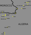
Ksours of Algeria.png 655 × 743; 30 KB
-
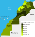
Languages speakers in Morocco.svg 596 × 453; 130 KB
-
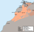
Linguistic map of 16th century Morocco.png 8,485 × 7,100; 885 KB
-
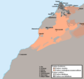
Map of Northern Saharan Berber dialects.PNG 607 × 600; 25 KB
-
Moroccan Arabic.png 604 × 428; 7 KB
-
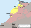
Morocco - Linguistic map.png 652 × 601; 19 KB
-
Morocco and Western Sahara Regions Amazigh Languages Speakers-es.svg 596 × 629; 54 KB
-
Morocco Berber Speakers By Region Neutral.png 1,000 × 1,055; 123 KB
-
Morocco regions Amazigh languages speakers.svg 596 × 629; 191 KB
-
Nord du Maroc, carte ethno-linguistique.PNG 630 × 509; 43 KB
-
Percent of Berber speakers in Morocco by census 2004.png 734 × 684; 39 KB
-
Percent of Tamazight speakers in Morocco by census 2004.png 734 × 684; 39 KB
-
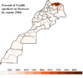
Percent of Tarifit speakers in Morocco by census 2004.png 734 × 684; 39 KB
-
Percent of Tashlhit speakers in Morocco by census 2004.png 734 × 684; 39 KB
-
Percentage of Arabic speakers in Morocco.png 2,483 × 1,185; 114 KB
-
Percentage of tachelhit speakers.png 758 × 758; 114 KB
-
Riffian Dialects in Morocco.PNG 496 × 411; 21 KB
-
Riffian Language Map.PNG 448 × 347; 19 KB
-
Riffian-speaking areas.png 686 × 504; 35 KB
-
Sanhaja de Srayr - Localization map.png 686 × 504; 35 KB
-
South Oranie and Figuig Berber.PNG 502 × 484; 18 KB
-
Taal-tachelhit-marokko.png 810 × 848; 103 KB
-
Tachelhit.png 480 × 454; 13 KB
-
Takaṛḍa taclḥiyt.png 480 × 454; 22 KB
-
Tamazight de l'Atlas Central - FR.PNG 480 × 545; 15 KB
-
TamazightCentral.PNG 502 × 416; 3 KB
-
Varieties of Arabic in Morocco-2.png 446 × 350; 11 KB
-
Varieties of Arabic in Morocco.png 446 × 350; 10 KB
-
Western Moroccan Arabic Map.PNG 538 × 484; 17 KB
-
Атласские-языки-с-границами.png 1,200 × 1,106; 772 KB
-
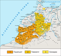
Атласские-языки.png 1,200 × 1,106; 663 KB


