Category:Linguistic maps of Niger
Appearance
Media in category "Linguistic maps of Niger"
The following 21 files are in this category, out of 21 total.
-
Baggara belt.png 3,417 × 1,683; 1.65 MB
-
Hausa language map.png 3,571 × 4,519; 447 KB
-
Hausa language niger.png 2,410 × 1,901; 116 KB
-
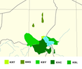
Kanuri languages map 001.png 415 × 349; 33 KB
-
Karte Niger - Nationalsprache Arabisch.png 956 × 734; 75 KB
-
Karte Niger - Nationalsprache Buduma.png 956 × 734; 68 KB
-
Karte Niger - Nationalsprache Fulfulde.png 956 × 734; 73 KB
-
Karte Niger - Nationalsprache Gourmanchéma.png 956 × 734; 69 KB
-
Karte Niger - Nationalsprache Hausa.png 956 × 734; 72 KB
-
Karte Niger - Nationalsprache Kanuri.png 956 × 734; 72 KB
-
Karte Niger - Nationalsprache Songhai-Zarma.png 956 × 734; 71 KB
-
Karte Niger - Nationalsprache Tamasheq.png 956 × 734; 75 KB
-
Karte Niger - Nationalsprache Tasawaq, Tagdal.png 956 × 734; 69 KB
-
Karte Niger - Nationalsprache Tubu.png 956 × 734; 72 KB
-
Karte Niger - Nationalsprachen.png 2,095 × 1,586; 515 KB
-
Langues nationales du Niger.jpg 1,099 × 840; 268 KB
-
Niger Nationalsprachen.jpg 1,099 × 840; 339 KB
-
Peul du Niger occidental (fuh).svg 1,028 × 780; 213 KB
-
Saharan languages.png 572 × 368; 10 KB
-
Tawellemmet.svg 400 × 400; 36 KB
-
Toubou map.svg 1,000 × 1,000; 240 KB


