Category:Linguistic maps of Cameroon
Appearance
Countries of Africa: Algeria · Angola · Benin · Burkina Faso · Cameroon · Central African Republic · Chad · Democratic Republic of the Congo · Republic of the Congo · Equatorial Guinea · Eritrea · Ethiopia · Gabon · The Gambia · Ghana · Guinea · Ivory Coast · Kenya · Libya · Malawi · Mali · Morocco · Namibia · Niger · Nigeria · Senegal · South Africa · Sudan · Tanzania · Togo · Tunisia · Uganda · Zambia · Zimbabwe
Limited recognition: Ambazonia
Limited recognition: Ambazonia
Media in category "Linguistic maps of Cameroon"
The following 32 files are in this category, out of 32 total.
-
African Pygmies (labeled).png 1,026 × 726; 296 KB
-
African Pygmies blank.png 1,026 × 726; 239 KB
-
African Pygmies-en.png 1,026 × 726; 236 KB
-
Baggara belt.png 3,417 × 1,683; 1.65 MB
-
Cameroon.jpg 905 × 1,556; 204 KB
-
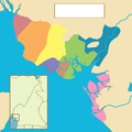
Duala ethnic groups (no words).png 1,000 × 998; 197 KB
-
Duala ethnic groups.png 1,000 × 998; 325 KB
-
Gyelimap.svg 167 × 139; 156 KB
-
Idioma batanga.png 636 × 632; 6 KB
-
Idioma kwasio.png 636 × 686; 7 KB
-
Language map of the Littoral region in Cameroon by arrondissement.svg 744 × 889; 920 KB
-
Langues du Cameroun Carte.png 500 × 656; 71 KB
-
Lenguas bubi-benga.png 636 × 632; 12 KB
-
Lenguas de Guinea Ecuatorial.png 636 × 890; 29 KB
-
Main distribution area of Kamtok (Cameroonian Pidgin) in Cameroon.svg 586 × 769; 1.14 MB
-
Map of the Bantoid languages of Nigeria and Cameroon.svg 1,362 × 1,188; 16.48 MB
-
Map of the Beboid languages.svg 1,362 × 1,188; 22.26 MB
-
Map of the Ekoid languages.svg 1,362 × 1,188; 19.57 MB
-
Map of the Grassfields languages.svg 1,362 × 1,188; 30.07 MB
-
Map of the Jarawan languages.svg 1,362 × 1,188; 19.58 MB
-
Map of the Jukunoid languages.svg 1,362 × 1,188; 19.94 MB
-
Map of the Mambiloid languages.svg 1,362 × 1,188; 19.74 MB
-
Map of the Mamfe languages.svg 1,362 × 1,188; 19.79 MB
-
Map of the Mbam languages.svg 1,362 × 1,188; 18.89 MB
-
Map of the Momo languages.svg 1,362 × 1,188; 22.77 MB
-
Map of the Southern Bantoid languages of Nigeria and Cameroon.svg 1,362 × 1,188; 16.57 MB
-
Map of the Tivoid languages.svg 1,362 × 1,188; 20.2 MB
-
Nigeria Benin Cameroon languages.png 1,522 × 1,388; 83 KB
-
Nigeria Benin Kamerun Sprachen.png 1,522 × 1,388; 65 KB
-
Pygmy languages (Bahuchet).png 1,253 × 687; 307 KB
-
Pygmy peoples (Hewlett & Fancher).png 1,253 × 687; 323 KB
-
West Province ethnic groups.png 1,000 × 856; 1.43 MB


