Category:Geomorphological diagrams
Jump to navigation
Jump to search
Subcategories
This category has the following 19 subcategories, out of 19 total.
*
C
- Coral reef diagrams (15 F)
D
- Debris flow diagrams (2 F)
G
M
P
- Permafrost diagrams (29 F)
R
- Rock glacier diagrams (2 F)
S
W
Media in category "Geomorphological diagrams"
The following 63 files are in this category, out of 63 total.
-
104 of 'The Geological Observer' (11230292404).jpg 1,320 × 1,052; 223 KB
-
105 of 'The Geological Observer' (11013177603).jpg 828 × 710; 127 KB
-
Adjinçna askepiaedje fondreye.jpg 564 × 415; 27 KB
-
Base level (geology).png 1,280 × 720; 51 KB
-
Bedforms under various flow regimes.pdf 1,183 × 822; 23 KB
-
Bloque diagrama, Heraclio, Madrid, 2016.svg 1,052 × 744; 263 KB
-
Bousinesseq0001.jpg 1,661 × 1,288; 161 KB
-
Britannica Niagara.jpg 445 × 435; 83 KB
-
Coupe-section d'un méandre.png 780 × 405; 15 KB
-
Decreasing wind gap elevation modified.svg 1,200 × 700; 35 KB
-
Decreasing wind gap elevation-01 mod.jpg 3,362 × 2,893; 859 KB
-
Decreasing wind gap elevation-01.jpg 3,362 × 2,893; 886 KB
-
Decreasing wind gap elevation.svg 1,200 × 700; 33 KB
-
Deflected stream schematic.gif 1,280 × 1,280; 119 KB
-
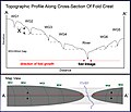
Deflected streams lateral fold growth.jpg 332 × 291; 77 KB
-
Doorsnede IJsseldal.png 720 × 540; 6 KB
-
Fagypúp.PNG 420 × 288; 5 KB
-
Fig lulworth formation.png 524 × 188; 5 KB
-
Geoviden 2005-2-side14.png 1,290 × 887; 330 KB
-
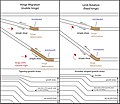
Hinge migration vs limb rotation mod 2.jpg 2,596 × 2,242; 789 KB
-
Icestream onset-thermal-transition.png 3,197 × 2,040; 382 KB
-
Icestream onset-thermal-transition.svg 1,052 × 744; 40 KB
-
Interactions and feedback pathways for tectonics and erosional processes.pdf 1,500 × 843; 129 KB
-
Internal Structure of Marine Terrace.jpg 1,014 × 601; 143 KB
-
Jehlovitý led.svg 800 × 564; 9 KB
-
JMLeb demi-orange 11.jpg 2,629 × 1,350; 578 KB
-
Kaptaz-schemat.svg 1,280 × 491; 32 KB
-
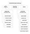
Klasifikacija geomorfoloskih agenasa.jpg 835 × 941; 185 KB
-
Klueftung Oberflaechenausdehnung.jpg 520 × 300; 146 KB
-
Laterite-saprolite cross section.PNG 443 × 474; 79 KB
-
Linear fold linkage.gif 1,500 × 861; 173 KB
-
Longshore.jpg 960 × 437; 30 KB
-
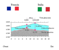
MonteBiancoVettaBis.png 1,483 × 1,254; 831 KB
-
Motoki br Seppomen Fig03 c SeppomenIndication.jpg 939 × 612; 69 KB
-
Mount Adams orographic schema-fr.png 1,221 × 693; 191 KB
-
No fold linkage mod mod.gif 601 × 345; 56 KB
-
No fold linkage mod.gif 1,500 × 861; 200 KB
-
No fold linkage.gif 1,500 × 861; 207 KB
-
Ostrogiwisla.png 1,270 × 1,270; 940 KB
-
Riverbed excavation effect.png 1,040 × 720; 61 KB
-
Rock shelter formation by frost weathering.svg 1,700 × 1,180; 28 KB
-
Rock shelter formation by karst gallery cutting.svg 2,400 × 740; 48 KB
-
Rock shelter formation by river erosion.svg 3,660 × 1,050; 54 KB
-
RuisseauC.PNG 1,302 × 566; 18 KB
-
Seepage Basin.jpg 2,100 × 825; 764 KB
-
Shelf and Deep Marine Depositional Environment.jpg 2,736 × 1,824; 1.1 MB
-
Slip-off slope diagram.svg 512 × 396; 35 KB
-
Slumppit.001.png 800 × 600; 93 KB
-
Soil Creep.tif 2,004 × 1,787; 10.27 MB
-
Strickler's equation.png 2,604 × 1,875; 74 KB
-
SuffosionSinkholeFormation.jpg 2,480 × 1,748; 146 KB
-
Sufoze.svg 800 × 564; 4 KB
-
Swamp and Desert Depositional Environment.jpg 2,736 × 1,824; 1.16 MB
-
Système torrentiel - schématisation.png 335 × 400; 328 KB
-
Terrasses alluviales Fig. 1 et 2, T. emboîtées Fig. 3, T. étagées.pdf 1,275 × 1,627; 465 KB
-
The Great Escarpment.jpg 9,910 × 6,960; 1.62 MB
-
Verwitterung Permafrost.jpg 540 × 340; 276 KB
-
Weathering of joint blocks and stages in the formation of corestones.jpg 2,138 × 2,374; 374 KB
-
Wheeler ridge rivers-01-01.jpg 3,759 × 2,742; 4.92 MB
-
Wheeler ridge rivers-01.jpg 1,884 × 2,742; 575 KB
-
Wiki Fig.jpg 1,404 × 1,587; 170 KB
-
Wing gap river gap longitudinal profile.jpg 744 × 363; 46 KB


