Category:Diagrams of landforms
Jump to navigation
Jump to search
Subcategories
This category has the following 27 subcategories, out of 27 total.
*
+
A
- Atoll diagrams (6 F)
C
- Carr diagrams (2 F)
D
- Diagrams of beaches (1 F)
E
- Diagrams of escarpments (5 F)
I
K
M
- Mudflat diagrams (3 F)
P
- Diagrams of plains (4 F)
R
- Reedbed diagrams (8 F)
- Diagrams of ridges (2 F)
S
V
Media in category "Diagrams of landforms"
The following 9 files are in this category, out of 9 total.
-
1893 chromolithograph - Geographical Definitions Illustrated.jpg 2,837 × 1,900; 1.11 MB
-
1893 chromolithograph - View of Nature in Ascending Regions.jpg 3,166 × 2,100; 1.39 MB
-
Criptodepression.pdf 1,754 × 1,239; 393 KB
-
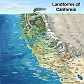
Landforms of California - blank.jpg 2,928 × 2,928; 2.7 MB
-
Landforms of California - with English text.jpg 2,928 × 2,928; 3.28 MB
-
Landforms of California - with English text.png 2,928 × 2,928; 6.46 MB
-
Physical Map Legend bn.jpg 5,308 × 2,124; 648 KB
-
Relief Forms Bul.png 8,000 × 1,464; 127 KB
-
Uplaz.svg 225 × 355; 23 KB


