Category:Glacial geomorphology diagrams
Jump to navigation
Jump to search
Subcategories
This category has the following 3 subcategories, out of 3 total.
*
- Glacial landscape diagrams (14 F)
D
Media in category "Glacial geomorphology diagrams"
The following 52 files are in this category, out of 52 total.
-
 Antarctic shelf ice fr.svg 2,657 × 1,640; 113 KB
-
 Antarctic shelf ice hg.png 2,834 × 1,749; 196 KB
-
 Carbon stores and fluxes in present day ice sheets.webp 2,052 × 1,074; 101 KB
-
 Crepaccio-01.jpg 400 × 280; 19 KB
-
 Crepaccio-02.jpg 400 × 280; 17 KB
-
 Entstehung eines Toteissees.svg 508 × 1,035; 132 KB
-

-
 Gamburtsev mountains Overdeepened basins A.jpg 480 × 312; 23 KB
-
 Glac modelled glacier change animation.gif 750 × 500; 1.21 MB
-
 Glacial Cirque Formation EN.svg 960 × 512; 34 KB
-
 Glacial Depositional Environment.jpg 1,824 × 2,736; 949 KB
-
 Glaciar moulin.jpg 720 × 556; 26 KB
-
 Glaciar moulin.svg 720 × 556; 57 KB
-
 Glacier diagram-ca.svg 1,600 × 1,000; 480 KB
-
 Glacier diagram.svg 1,600 × 1,000; 400 KB
-
 Glacier diagramCS.svg 1,600 × 1,000; 278 KB
-
 Glacier drainage system.png 1,280 × 720; 634 KB
-
 Glacio-marine deposits.png 1,280 × 720; 263 KB
-
 Image Cirque Glacier.svg 642 × 499; 87 KB
-
 Krapotkin, drawing.jpg 702 × 603; 76 KB
-
 Lake Vostok drill 2011.jpg 2,390 × 1,506; 550 KB
-
 Les trois types de taliks.png 2,474 × 1,306; 101 KB
-
 Mollisoldiapirismus.png 941 × 1,791; 21 KB
-
 MonteBiancoVettaBis.png 1,483 × 1,254; 831 KB
-
 Nunataker-ice hg.jpg 2,560 × 1,510; 218 KB
-
 Page 353-cruiseofcorwin.jpg 1,068 × 167; 105 KB
-
 Pine Island Glacier ice shelf rift (6299113040).jpg 1,598 × 803; 160 KB
-
 Pressure ridge (ice) Formation Drawing.svg 333 × 186; 122 KB
-
 Pressure ridge (ice) Geometry Drawing.svg 214 × 108; 18 KB
-
 PSM V12 D077 Soil layer composition 1.jpg 946 × 702; 209 KB
-
 PSM V12 D077 Soil layer composition 2.jpg 552 × 501; 83 KB
-
 PSM V12 D079 Actual soil layer of glacial activity found.jpg 2,245 × 441; 65 KB
-
 PSM V12 D079 Theoretical glacial soil layer by author.jpg 2,234 × 439; 151 KB
-
 PSM V12 D079 Theoretical soil layer of glacial activity.jpg 2,229 × 448; 193 KB
-
 PSM V12 D080 Soil layers of glacial activity.jpg 571 × 503; 51 KB
-
 PSM V12 D081 Soil layers of glacial activity.jpg 547 × 560; 44 KB
-
 PSM V12 D082 Soil layers of glacial activity.jpg 834 × 672; 48 KB
-
 PSM V12 D083 Soil layers of glacial activity.jpg 338 × 609; 27 KB
-
 PSM V37 D319 View on the glacier of sermitsialik near ivigtut.jpg 3,729 × 2,104; 2.43 MB
-
 PSM V37 D320 Front of the glacier of sermitsialik.jpg 3,679 × 2,045; 2.31 MB
-
 PSM V37 D321 Movement of the kanderdlug suak glacier in umanak district.jpg 2,228 × 1,777; 788 KB
-
 PSM V38 D761 Differences of unglaciated and glaciated lands.jpg 1,772 × 1,120; 591 KB
-
 Ribbon lake2.png 1,305 × 711; 51 KB
-
 SchnittUTal.jpg 800 × 600; 53 KB
-
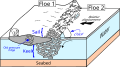
 Seabed gouging by ice 2D Pipeline Fr2.svg 675 × 365; 24 KB
-
 Seabed gouging ice ridge approaching pipeline.svg 402 × 254; 53 KB
-
 SeabedScouringByIce1.svg 455 × 305; 22 KB
-
 SeabedScouringByIce2.svg 928 × 662; 29 KB
-
 SeabedScouringByRidge1.svg 498 × 336; 58 KB
-
 Stores and fluxes in present day ice sheets.png 1,000 × 555; 231 KB
-
 Wurzacher-Ried Riss-Wuerm-Glaziale.jpg 1,200 × 800; 231 KB
-
 Zero-curtain-effect.svg 876 × 361; 8 KB


.jpg)
_Formation_Drawing.svg)
_Geometry_Drawing.svg)


