Category:Stratigraphical diagrams
Jump to navigation
Jump to search
layers of rocks | |||||
| Upload media | |||||
| |||||
Subcategories
This category has the following 14 subcategories, out of 14 total.
C
- Cross-bedding diagrams (8 F)
D
- Diagrams of unconformities (24 F)
G
S
- Sedimentary log (7 F)
- Stratigraphic charts (35 F)
T
- Turbidite diagrams (7 F)
Media in category "Stratigraphical diagrams"
The following 147 files are in this category, out of 147 total.
-
2021 Revised NPS Geologic Stratigraphic Column of the Grand Canyon.jpg 1,300 × 867; 357 KB
-
5198 1.display.gif 307 × 300; 74 KB
-
5209 1.display.gif 407 × 300; 90 KB
-
Aggradation.png 1,700 × 1,700; 69 KB
-
Aggradation.svg 600 × 600; 509 KB
-
Aluskord, pealiskord, aluspõhi, pinnakate2.png 1,600 × 535; 27 KB
-
Aluspealiskordskeem.gif 834 × 500; 21 KB
-
Asset 1Stratigraphy.png 495 × 873; 186 KB
-
Asset 2Stratigraphy.png 495 × 873; 189 KB
-
Batholite-Bloc-diagrame.png 500 × 300; 5 KB
-
Batolito.png 652 × 226; 5 KB
-
BillingsleyOthers1985 Redwall SurpiseCanyon Stratigraphic Column.png 1,348 × 986; 1.81 MB
-
Biostratigraphic index fossils 01.svg 842 × 595; 2.76 MB
-
Biostratigraphic index fossils 02.jpg 6,217 × 7,684; 3.47 MB
-
Biozones types EN.svg 493 × 715; 32 KB
-
Bulletins of American paleontology (1982) (20314653170).jpg 3,676 × 1,469; 696 KB
-
Un modelo clásico de afloramiento.png 976 × 476; 110 KB
-
Capa inclinada.png 484 × 428; 34 KB
-
Capa que buza río abajo con menor ángulo que el gradiente del valle.png 996 × 476; 110 KB
-
Capa que buza río abajo.png 976 × 476; 110 KB
-
Capa valle con la misma inclinación.png 997 × 476; 110 KB
-
Capa vertical.png 979 × 476; 90 KB
-
Carbonate Parasequence Architecture.jpg 4,662 × 3,643; 942 KB
-
CarbonatePlatform.png 9,921 × 10,539; 17.44 MB
-
Chronosomes.png 1,264 × 893; 154 KB
-
Clastic Parasquences.jpg 4,663 × 3,663; 1.23 MB
-
Clay Smear.png 3,950 × 3,185; 304 KB
-
COASTAL TRANSGRESSION-REGRESSION SEQUENCE STRATIGRAPHY.png 1,280 × 720; 116 KB
-
Creation by Evolution (1928) p105 section exposed in a city street.png 1,869 × 1,000; 1.03 MB
-
Creation by Evolution (1928) p106 section across London basin.png 1,950 × 400; 175 KB
-
Cyclic step formation over time.jpg 1,971 × 904; 363 KB
-
Density of Mardin Formations.jpg 711 × 348; 111 KB
-
DEPOSITIONAL SEQUENCE CLASSIC.png 1,280 × 720; 139 KB
-
DEPOSITIONAL SEQUENCE REVIEW.png 1,280 × 720; 149 KB
-
Diorama de extratos fossilíferos.jpg 3,264 × 4,912; 3.98 MB
-
Disconformidad.png 689 × 410; 14 KB
-
Discordancia Angular.png 546 × 287; 20 KB
-
DiscordanciaAngularErosiva.png 1,043 × 543; 53 KB
-
Discornformidad.png 745 × 340; 13 KB
-
Dolina Wisły w Warszawie - taras zalewowy i in.gif 800 × 477; 42 KB
-
Espace d'accommodation.png 1,133 × 492; 52 KB
-
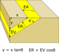
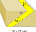
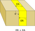
Espesor aparente.png 485 × 424; 27 KB
-
Espesor de capa.png 484 × 424; 18 KB
-
ETH-BIB-Erdöl-Antiklinalen-Dia 247-Z-00271.tif 3,652 × 2,830; 29.69 MB
-
Faunal sucession.jpg 717 × 525; 56 KB
-
Fenster.JPG 475 × 95; 9 KB
-
Fig2-Lyell.jpg 336 × 100; 11 KB
-
Fig4-Lyell.jpg 338 × 114; 10 KB
-
Fish localities and lithological columns of the fish-bearing stratigraphy.tif 2,010 × 2,570; 1.44 MB
-
Flussterasser.png 802 × 251; 126 KB
-
FluvialTerraces.jpg 1,104 × 327; 227 KB
-
FluvialTerraces2.jpg 4,611 × 1,360; 3.05 MB
-
Formación turboglifo (flute cast).jpg 1,887 × 2,230; 318 KB
-
Formation of cross-bedding.jpg 688 × 215; 47 KB
-
Formation of cross-stratification.png 618 × 380; 26 KB
-
Fossils.png 1,480 × 1,104; 431 KB
-
FOWLER (1932) p 211.tif 1,674 × 2,030; 9.75 MB
-
Geiseltal-stratigraphy of fossil sites.png 2,460 × 2,100; 70 KB
-
Genesee Formation Members NY State.jpg 592 × 386; 73 KB
-
Geologic Principles.jpg 267 × 600; 33 KB
-
Grabeau off-lap.jpg 1,329 × 428; 95 KB
-
Grabeau on-lap.jpg 1,259 × 428; 140 KB
-
Graded bed.png 253 × 372; 239 KB
-
Grand Canyon Uncomformities and Missing Time.jpg 1,926 × 1,311; 305 KB
-
Herschel 1836 letter to Lyell.jpg 561 × 565; 122 KB
-
Herschel 1836 sketch annotated.jpg 842 × 596; 133 KB
-
Hiatus4.jpg 1,038 × 708; 62 KB
-
Horizontal beds.png 457 × 222; 22 KB
-
Inconformidad erosiva ignia.png 721 × 355; 26 KB
-
Inconformidad erosiva.png 721 × 355; 27 KB
-
Inconformidad.png 718 × 354; 26 KB
-
Key for geologic cross section.jpg 199 × 651; 34 KB
-
Klippe.JPG 490 × 120; 10 KB
-
Laterite-saprolite cross section.PNG 443 × 474; 79 KB
-
Law cross.gif 248 × 110; 4 KB
-
Law of superposition.png 272 × 158; 2 KB
-
Law pos.gif 247 × 110; 3 KB
-
Lithocorrelation.png 281 × 505; 32 KB
-
Lithostratigraphy and Sequence Stratigraphy.jpg 5,553 × 4,258; 1.95 MB
-
Lithostratigraphy.jpg 5,476 × 3,477; 1.34 MB
-
Lyell Frontispiece 1837.png 1,064 × 674; 1.19 MB
-
Maria Matilda Ogilvie Gordon Langkofelgruppe.jpg 1,000 × 498; 104 KB
-
Measures of Sea Level.jpg 4,219 × 2,133; 472 KB
-
Modelo estratigráfico - Exposição Ciências da Terra 01.jpg 2,048 × 1,536; 608 KB
-
Nonconformity.jpg 400 × 300; 65 KB
-
Ocepechelon bouyai geography stratigraphy.png 4,528 × 3,008; 4.19 MB
-
Offlap & onlap EN.svg 680 × 450; 84 KB
-
Offlap & onlap es.svg 680 × 450; 99 KB
-
Offlap & onlap NL.svg 680 × 450; 84 KB
-
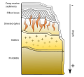
Ofiolite sequence EN.svg 1,200 × 1,090; 102 KB
-
Ofiolite sequence ES.svg 759 × 887; 93 KB
-
Ophiolite suite scheme.jpg 826 × 634; 150 KB
-
Order of Formations.jpg 166 × 259; 10 KB
-
Orighoriz.jpg 408 × 169; 14 KB
-
Origin of Salpausselka typical ridge.gif 401 × 165; 122 KB
-
Overschuiving systeem.jpg 3,828 × 1,583; 294 KB
-
Parasequence Architecture.jpg 3,626 × 5,500; 797 KB
-
Payún Matrú, stratigraphy (cropped).jpg 530 × 286; 31 KB
-
Payún Matrú, stratigraphy.jpg 530 × 308; 31 KB
-
Post Depositional and Erosional Structures.jpg 4,220 × 4,526; 2.48 MB
-
Principle of horizontal continuity.svg 1,100 × 450; 219 KB
-
PSM V08 D373 Section of a sand hill blasted by wind.jpg 999 × 945; 132 KB
-
PSM V08 D373 Section of strata of sandstone.jpg 1,160 × 230; 45 KB
-
PSM V22 D332 Soil covering paleolithic gravel.png 1,621 × 936; 1.02 MB
-
PSM V53 D026 Cross section of a complex valley in the appalachians.png 1,709 × 442; 79 KB
-
Relative dating of fossils.png 2,400 × 2,017; 141 KB
-
Sanfranciscana basin stratigraphy.png 2,010 × 1,546; 513 KB
-
Sedimentación discordante.png 631 × 236; 3 KB
-
Sequence Architecture.jpg 5,550 × 3,788; 1.6 MB
-
Sequence Strat onlap and offlap Illustrations.jpg 654 × 735; 90 KB
-
Sequence Stratigraphic Nomenclature.jpg 3,151 × 2,455; 1.63 MB
-
Shoreface2.png 986 × 469; 25 KB
-
ShorefaceLog.png 1,548 × 2,364; 138 KB
-
Spaink-1975 - Mollusken biozonering.png 2,059 × 688; 107 KB
-
Stacked unconformities.png 2,220 × 1,352; 206 KB
-
Strat Col.jpg 440 × 622; 84 KB
-
Stratigraphic Column Owambo Basin.jpg 659 × 840; 208 KB
-
Stratigraphic model.jpg 652 × 715; 91 KB
-
Stratigraphic Table1.jpg 611 × 761; 62 KB
-
Stratigraphic Table2.jpg 605 × 766; 44 KB
-
StratigraphicTrap.png 5,293 × 3,454; 257 KB
-
StratigraphicTrap5.png 5,313 × 3,288; 217 KB
-
Stratigraphy of Nam Con Son Basin.png 582 × 1,084; 274 KB
-
Stratigraphy of the wernecke mountain area.png 1,014 × 644; 27 KB
-
Stratigraphy.jpg 604 × 635; 106 KB
-
Stratigraphy3.jpg 480 × 317; 25 KB
-
Stratum (PSF).png 2,074 × 1,184; 1.08 MB
-
Sub-group matrix showing the approach to subgrouping and preliminary phasing.png 2,048 × 1,152; 53 KB
-
Tectonic window and cap-diagram-it.svg 705 × 479; 8 KB
-
Tectonic window and cap-diagram.svg 705 × 521; 7 KB
-
Tectonics and Relative Sea Level.jpg 5,500 × 2,660; 618 KB
-
Terrig Cycle.jpg 792 × 1,100; 252 KB
-
The difference between a sill and a dike.jpg 512 × 384; 11 KB
-
Thickness.svg 274 × 142; 7 KB
-
Tilted Blocks.png 944 × 1,393; 18 KB
-
Tipos de biozonas.svg 493 × 740; 31 KB
-
Transgressions and Regression.jpg 5,220 × 4,370; 1.16 MB
-
Turbidite.png 2,414 × 1,451; 260 KB
-
Vail Sequence.jpg 1,168 × 544; 145 KB
-
Verzahnung.svg 331 × 121; 3 KB
-
Wildmannlisloch Profil.jpg 1,347 × 661; 234 KB
-
Wrangellia LIP during the CPE.jpg 1,050 × 1,047; 208 KB
-
Zementmergelschüsseln+Flüsse Schwäbische Alb.jpg 1,800 × 1,431; 725 KB
-
隨手寫 2.jpg 1,498 × 1,661; 573 KB
-
隨手寫 3.jpg 1,621 × 881; 358 KB


