Category:Election maps of Surrey
Jump to navigation
Jump to search
Ceremonial counties of England: Bedfordshire · Berkshire · Buckinghamshire · Cambridgeshire · Cheshire · Cornwall · Cumbria · Derbyshire · Devon · Dorset · Durham · East Riding of Yorkshire · East Sussex · Essex · Gloucestershire · Greater London · Greater Manchester · Hampshire · Herefordshire · Hertfordshire · Isle of Wight · Kent · Lancashire · Leicestershire · Lincolnshire · Merseyside · North Yorkshire · Northamptonshire · Northumberland · Nottinghamshire · Oxfordshire · Shropshire · Somerset · South Yorkshire · Staffordshire · Suffolk · Surrey · Tyne and Wear · Warwickshire · West Midlands · West Sussex · West Yorkshire · Wiltshire · Worcestershire
City-counties: Bristol ·
Former historic counties: Middlesex ·
Other former counties: Cleveland ·
City-counties: Bristol ·
Former historic counties: Middlesex ·
Other former counties: Cleveland ·
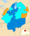
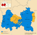
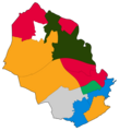
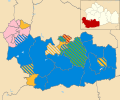
This category contains election result maps of Surrey County Council (1889-date).
Subcategories
This category has the following 4 subcategories, out of 4 total.
Media in category "Election maps of Surrey"
The following 79 files are in this category, out of 79 total.
-
2019 election Guildford Borough Council.png 1,342 × 1,266; 247 KB
-
2022 Woking Borough Council Election Map.png 1,600 × 1,000; 167 KB
-
2023 election Guildford Borough Council.png 2,548 × 1,992; 431 KB
-
ELMBRIDGE (29372292708).png 1,200 × 1,000; 192 KB
-
Elmbridge UK local election 2021 map.svg 1,075 × 1,266; 342 KB
-
Elmbridge UK ward map 2016.svg 1,075 × 1,266; 346 KB
-
Elmbridge UK ward map 2018.svg 1,075 × 1,266; 342 KB
-
Elmbridge UK ward map 2019.svg 1,075 × 1,266; 342 KB
-
Elmbridge UK ward map 2022.svg 1,075 × 1,266; 342 KB
-
Elmbridge UK ward map 2023.svg 1,075 × 1,266; 342 KB
-
Elmbridge UK ward map 2024.svg 1,075 × 1,266; 342 KB
-
Epsom and Ewell UK local election 2019 map.svg 1,029 × 1,266; 150 KB
-
Epsom and Ewell UK ward map 2023.svg 427 × 679; 90 KB
-
GUILDFORD (49911037597).png 2,160 × 1,080; 445 KB
-
Guildford UK ward map 2010 (blank).svg 1,342 × 1,266; 427 KB
-
Guildford UK ward map 2023 (blank).svg 1,052 × 922; 437 KB
-
Guildfordbc2003e.png 2,000 × 1,887; 419 KB
-
Guildfordbc2007.png 2,000 × 1,887; 400 KB
-
Guildfordbc2007e.png 2,000 × 1,887; 450 KB
-
Guildfordbc2008.png 2,000 × 1,887; 378 KB
-
Guildfordbc2011e.png 2,000 × 1,887; 466 KB
-
Guildfordbc2015e.png 2,000 × 1,887; 442 KB
-
Mole Valley (42140585985).png 1,186 × 1,168; 228 KB
-
Mole Valley District Council election results 2023.svg 976 × 1,365; 338 KB
-
Mole Valley District Council election results 2024.svg 976 × 1,365; 338 KB
-
Mole Valley UK local election 2021 map.svg 990 × 1,266; 417 KB
-
Mole Valley UK local election 2022 map.svg 990 × 1,266; 417 KB
-
Reigate and Banstead UK ward map 2024.svg 389 × 760; 174 KB
-
Runnymede Borough election 2024.png 2,384 × 2,616; 226 KB
-
Spelthorne UK ward map 2023.svg 620 × 577; 74 KB
-
Surrey County Council 2009 election map.svg 1,425 × 1,081; 2.12 MB
-
Surrey County Council election 2013 Map.png 853 × 565; 74 KB
-
Surrey Heath UK ward map 2023.svg 687 × 554; 96 KB
-
Surrey UK local election 2013 map.svg 1,425 × 1,081; 1.3 MB
-
Surrey UK local election 2017 map.svg 1,425 × 1,081; 1.3 MB
-
Surrey UK local election 2021 map.svg 512 × 388; 929 KB
-
SurreyParliamentaryConstituency1885Results.svg 1,827 × 1,350; 37 KB
-
SurreyParliamentaryConstituency1906Results.svg 1,827 × 1,350; 37 KB
-
SurreyParliamentaryConstituency1918Results.svg 1,827 × 1,348; 65 KB
-
SurreyParliamentaryConstituency1922Results.svg 1,827 × 1,348; 65 KB
-
SurreyParliamentaryConstituency1945Results.svg 1,827 × 1,348; 71 KB
-
SurreyParliamentaryConstituency1950Results.svg 2,056 × 1,518; 78 KB
-
SurreyParliamentaryConstituency1955Results.svg 2,056 × 1,514; 76 KB
-
SurreyParliamentaryConstituency1966Results.svg 2,056 × 1,514; 76 KB
-
SurreyParliamentaryConstituency2005Results2.png 200 × 150; 27 KB
-
SurreyParliamentaryConstituency2010Results2.png 213 × 154; 26 KB
-
SurreyParliamentaryConstituency2024Results.svg 356 × 267; 84 KB
-
Tandridge (43042943491).png 1,386 × 1,270; 128 KB
-
Tandridge District Council Election Results 2022.svg 956 × 1,266; 379 KB
-
Tandridge District Council Election Results 2023.svg 956 × 1,266; 379 KB
-
Tandridge UK local election 2002 map.svg 956 × 1,266; 378 KB
-
Tandridge UK local election 2003 map.svg 956 × 1,266; 378 KB
-
Tandridge UK local election 2004 map.svg 956 × 1,266; 378 KB
-
Tandridge UK local election 2006 map.svg 956 × 1,266; 378 KB
-
Tandridge UK local election 2007 map.svg 956 × 1,266; 378 KB
-
Tandridge UK local election 2008 map.svg 956 × 1,266; 378 KB
-
Tandridge UK local election 2010 map.svg 956 × 1,266; 378 KB
-
Tandridge UK local election 2011 map.svg 956 × 1,266; 378 KB
-
Tandridge UK local election 2012 map.svg 956 × 1,266; 378 KB
-
Tandridge UK local election 2021 map.svg 956 × 1,266; 379 KB
-
Tandridge UK ward map 2024.svg 498 × 752; 247 KB
-
Waverley UK ward map 2023.svg 707 × 443; 418 KB
-
Waverley wards 2019.svg 1,425 × 1,190; 560 KB
-
WOKING (29372293518).png 1,200 × 1,000; 174 KB
-
Woking 2006 election map.png 667 × 480; 73 KB
-
Woking 2007 election map.png 667 × 480; 70 KB
-
Woking 2008 election map.png 667 × 480; 70 KB
-
Woking 2010 election map.png 667 × 480; 72 KB
-
Woking UK local election 2000 map.svg 1,425 × 1,086; 231 KB
-
Woking UK local election 2002 map.svg 1,425 × 1,086; 230 KB
-
Woking UK local election 2003 map.svg 1,425 × 1,086; 230 KB
-
Woking UK local election 2004 map.svg 1,425 × 1,086; 230 KB
-
Woking UK local election 2010 map.svg 1,425 × 1,086; 230 KB
-
Woking UK local election 2018 map.svg 1,425 × 1,086; 296 KB
-
Woking UK local election 2019 map.svg 1,425 × 1,086; 296 KB
-
Woking UK local election 2021 map.svg 1,425 × 1,086; 297 KB
-
Woking UK local election 2022 map.svg 1,425 × 1,086; 297 KB
-
Woking UK local election 2023 map.svg 1,425 × 1,086; 296 KB
-
Woking UK ward map 2024.svg 1,425 × 1,086; 297 KB


