Category:Election maps of Kent
Jump to navigation
Jump to search
Ceremonial counties of England: Bedfordshire · Berkshire · Buckinghamshire · Cambridgeshire · Cheshire · Cornwall · Cumbria · Derbyshire · Devon · Dorset · Durham · East Riding of Yorkshire · East Sussex · Essex · Gloucestershire · Greater London · Greater Manchester · Hampshire · Herefordshire · Hertfordshire · Isle of Wight · Kent · Lancashire · Leicestershire · Lincolnshire · Merseyside · North Yorkshire · Northamptonshire · Northumberland · Nottinghamshire · Oxfordshire · Shropshire · Somerset · South Yorkshire · Staffordshire · Suffolk · Surrey · Tyne and Wear · Warwickshire · West Midlands · West Sussex · West Yorkshire · Wiltshire · Worcestershire
City-counties: Bristol ·
Former historic counties: Middlesex ·
Other former counties: Cleveland ·
City-counties: Bristol ·
Former historic counties: Middlesex ·
Other former counties: Cleveland ·
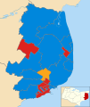
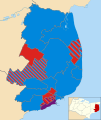
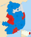
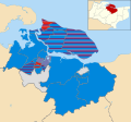
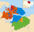
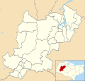
This category contains election maps for the ceremonial county of Kent.
Media in category "Election maps of Kent"
The following 126 files are in this category, out of 126 total.
-
2018 Maidstone local election results.png 575 × 450; 52 KB
-
2021 Kent County Election.svg 1,500 × 1,100; 1.45 MB
-
2021 Kent PCC Election.svg 161 × 107; 343 KB
-
ASHFORD (49910224528).png 2,160 × 1,080; 269 KB
-
Ashford Borough Council election 2011 map.svg 1,199 × 1,266; 641 KB
-
Ashford UK local election 2003 map.svg 1,199 × 1,266; 641 KB
-
Ashford UK local election 2007 map.svg 1,199 × 1,266; 640 KB
-
Ashford UK local election 2015 map.svg 1,199 × 1,266; 648 KB
-
Ashford UK parish map 2011 (blank).svg 1,199 × 1,266; 669 KB
-
Ashford UK ward map 2010 (blank).svg 1,199 × 1,266; 640 KB
-
Ashford UK ward map 2019.svg 656 × 678; 385 KB
-
Ashford UK ward map 2023.svg 656 × 678; 385 KB
-
Canterbury UK local election 2003 map.svg 1,076 × 1,266; 458 KB
-
Canterbury UK local election 2007 map.svg 1,076 × 1,266; 458 KB
-
Canterbury UK local election 2011 map.svg 1,076 × 1,266; 459 KB
-
Canterbury UK local election 2015 map.svg 1,076 × 1,266; 505 KB
-
Canterbury UK local election 2019 map.svg 1,076 × 1,266; 505 KB
-
Canterbury UK ward map 2023.svg 1,076 × 1,266; 508 KB
-
Dartford borough council 2019.png 772 × 587; 90 KB
-
Dartford UK ward map 2010 (blank).svg 1,279 × 1,266; 279 KB
-
Dartford UK ward map 2019.svg 845 × 643; 113 KB
-
Dartford UK ward map 2023.svg 845 × 643; 113 KB
-
Dover UK local election 2003 map.svg 1,066 × 1,266; 424 KB
-
Dover UK local election 2007 map.svg 1,066 × 1,266; 424 KB
-
Dover UK local election 2011 map.svg 1,066 × 1,266; 425 KB
-
Dover UK local election 2015 map.svg 1,066 × 1,266; 425 KB
-
Dover UK local election 2019 map.svg 1,066 × 1,266; 406 KB
-
Dover UK ward map 2019 (blank).svg 1,066 × 1,266; 405 KB
-
Dover UK ward map 2023.svg 1,066 × 1,266; 410 KB
-
Folkestone and the Hythe UK ward map 2019.svg 1,199 × 1,266; 416 KB
-
Folkestone and the Hythe UK ward map 2023.svg 1,199 × 1,266; 417 KB
-
Gravesham UK local election 2003 map.svg 1,055 × 1,266; 347 KB
-
Gravesham UK local election 2007 map.svg 1,055 × 1,266; 350 KB
-
Gravesham UK local election 2011 map.svg 1,055 × 1,266; 347 KB
-
Gravesham UK local election 2015 map.svg 1,055 × 1,266; 350 KB
-
Gravesham UK local election 2019 map.svg 1,055 × 1,266; 351 KB
-
Gravesham UK ward map 2010 (blank).svg 1,055 × 1,266; 347 KB
-
Gravesham ward map 2023.png 761 × 933; 90 KB
-
Kent UK division map 2021.svg 1,500 × 1,100; 1.27 MB
-
Kent UK local election 2005 map.svg 1,425 × 1,000; 1.66 MB
-
Kent UK local election 2009 map.svg 1,425 × 1,000; 1.66 MB
-
Kent UK local election 2013 map.svg 1,425 × 1,000; 1.66 MB
-
Kent UK local election 2017 map.svg 1,425 × 1,000; 1.69 MB
-
Kent UK local election 2021 map.svg 1,425 × 1,000; 1.7 MB
-
KentParliamentaryConstituency1885Results.svg 3,479 × 2,176; 110 KB
-
KentParliamentaryConstituency1886Results.svg 3,479 × 2,176; 110 KB
-
KentParliamentaryConstituency1895Results.svg 3,479 × 2,176; 110 KB
-
KentParliamentaryConstituency1900Results.svg 3,479 × 2,176; 110 KB
-
KentParliamentaryConstituency1906Results.svg 3,479 × 2,176; 110 KB
-
KentParliamentaryConstituency1910DResults.svg 3,479 × 2,176; 110 KB
-
KentParliamentaryConstituency1918Results.svg 3,464 × 2,174; 132 KB
-
KentParliamentaryConstituency1923Results.svg 3,464 × 2,174; 132 KB
-
KentParliamentaryConstituency1924Results.svg 3,464 × 2,174; 132 KB
-
KentParliamentaryConstituency1929Results.svg 3,464 × 2,174; 132 KB
-
KentParliamentaryConstituency1945Results.svg 3,468 × 2,182; 135 KB
-
KentParliamentaryConstituency1950Results.svg 3,459 × 2,182; 59 KB
-
KentParliamentaryConstituency1955Results.svg 3,461 × 2,186; 59 KB
-
KentParliamentaryConstituency1959Results.svg 3,461 × 2,186; 59 KB
-
KentParliamentaryConstituency1964Results.svg 3,461 × 2,186; 59 KB
-
KentParliamentaryConstituency1966Results.svg 3,461 × 2,186; 59 KB
-
KentParliamentaryConstituency1970Results.svg 3,461 × 2,186; 59 KB
-
KentParliamentaryConstituency2005Results2.png 300 × 200; 36 KB
-
KentParliamentaryConstituency2010Results2.png 312 × 205; 37 KB
-
KentParliamentaryConstituency2017Results.png 312 × 205; 38 KB
-
Maidstone (42140585825).png 2,140 × 1,394; 188 KB
-
Maidstone 2006 election map.png 613 × 480; 81 KB
-
Maidstone 2007 election map.png 613 × 480; 81 KB
-
Maidstone 2008 election map.png 613 × 480; 81 KB
-
Maidstone 2010 election map.png 613 × 480; 81 KB
-
Maidstone 2011 election map.png 613 × 480; 66 KB
-
Maidstone 2014 election map.png 613 × 480; 68 KB
-
Maidstone UK local election 2021 map.svg 1,392 × 1,266; 533 KB
-
Maidstone UK ward map 2010 (blank).svg 1,392 × 1,266; 531 KB
-
Maidstone UK ward map 2022.svg 1,392 × 1,266; 532 KB
-
Maidstone UK ward map 2023.svg 1,392 × 1,266; 533 KB
-
Maidstone UK ward map 2024.svg 769 × 602; 385 KB
-
Medway UK ward map 2011.svg 1,425 × 1,233; 556 KB
-
Medway UK ward map 2015.svg 1,425 × 1,233; 556 KB
-
Medway UK ward map 2019.svg 1,425 × 1,233; 556 KB
-
Medway UK ward map 2023.svg 610 × 518; 235 KB
-
Sevenoaks UK local election 2019.svg 512 × 705; 566 KB
-
Sevenoaks UK ward map 2015.svg 478 × 715; 315 KB
-
Sevenoaks UK ward map 2023.svg 478 × 715; 315 KB
-
Shepway UK ward map 2010 (blank).svg 1,199 × 1,266; 429 KB
-
Shepway UK ward map 2015 (blank).svg 1,199 × 1,266; 412 KB
-
Shepway UK ward map 2015.svg 1,199 × 1,266; 416 KB
-
Swale UK local election 2002 map.svg 1,357 × 1,266; 594 KB
-
Swale UK local election 2003 map.svg 1,357 × 1,266; 593 KB
-
Swale UK local election 2004 map.svg 1,357 × 1,266; 593 KB
-
Swale UK local election 2006 map.svg 1,357 × 1,266; 593 KB
-
Swale UK local election 2007 map.svg 1,357 × 1,266; 593 KB
-
Swale UK local election 2008 map.svg 1,357 × 1,266; 593 KB
-
Swale UK local election 2010 map.svg 1,357 × 1,266; 593 KB
-
Swale UK local election 2011 map.svg 1,357 × 1,266; 593 KB
-
Swale UK ward map 2010 (blank).svg 1,357 × 1,266; 593 KB
-
Swale UK ward map 2015 (blank).svg 1,357 × 1,266; 642 KB
-
Swale UK ward map 2015.svg 1,357 × 1,266; 654 KB
-
Swale UK ward map 2019.svg 1,357 × 1,266; 649 KB
-
Swale UK ward map 2023.svg 1,357 × 1,266; 656 KB
-
Thanet UK local election 2003 map.svg 1,425 × 929; 333 KB
-
Thanet UK local election 2007 map.svg 1,425 × 929; 331 KB
-
Thanet UK local election 2011 map.svg 1,425 × 929; 331 KB
-
Thanet UK local election 2015 map.svg 1,425 × 929; 330 KB
-
Thanet UK ward map 2010 (blank).svg 1,425 × 929; 301 KB
-
Thanet UK ward map 2019.svg 1,425 × 929; 335 KB
-
Thanet UK ward map 2023.svg 1,425 × 929; 337 KB
-
Thanet wards 2019.svg 1,425 × 929; 304 KB
-
Tonbridge and Malling UK ward map 2010 (blank).svg 1,318 × 1,266; 500 KB
-
Tonbridge and Malling UK ward map 2015 (blank).svg 1,318 × 1,266; 624 KB
-
Tonbridge and Malling UK ward map 2023.svg 727 × 712; 389 KB
-
TUNBRIDGE WELLS (43193614652).png 1,200 × 1,000; 205 KB
-
Tunbridge Wells UK local election 2021 map.svg 1,425 × 1,053; 567 KB
-
Tunbridge Wells UK ward map 2011.svg 1,425 × 1,053; 567 KB
-
Tunbridge Wells UK ward map 2012.svg 1,425 × 1,053; 568 KB
-
Tunbridge Wells UK ward map 2014.svg 1,425 × 1,053; 567 KB
-
Tunbridge Wells UK ward map 2015.svg 1,425 × 1,053; 567 KB
-
Tunbridge Wells UK ward map 2016.svg 1,425 × 1,053; 567 KB
-
Tunbridge Wells UK ward map 2018.svg 1,425 × 1,053; 567 KB
-
Tunbridge Wells UK ward map 2019.svg 1,425 × 1,053; 568 KB
-
Tunbridge Wells UK ward map 2022.svg 1,425 × 1,053; 567 KB
-
Tunbridge Wells UK ward map 2023.svg 1,425 × 1,053; 567 KB
-
Tunbridge Wells UK ward map 2024.svg 981 × 606; 284 KB
-
Tunbridge-Wells 2006 election map.png 777 × 480; 76 KB
-
Tunbridge-Wells 2007 election map.png 777 × 480; 72 KB
-
Tunbridge-Wells 2008 election map.png 777 × 480; 71 KB
-
Tunbridge-Wells 2010 election map.png 777 × 480; 77 KB


