Category:Election maps of Hertfordshire
Jump to navigation
Jump to search
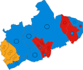
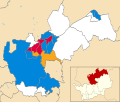
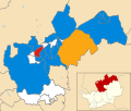
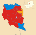
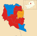
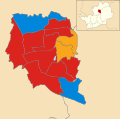
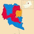
This category contains election maps for the ceremonial county of Hertfordshire.
Media in category "Election maps of Hertfordshire"
The following 146 files are in this category, out of 146 total.
-
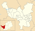
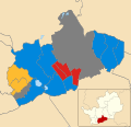
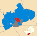
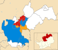
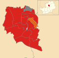
2016 Welwyn Hatfield Borough Council election results.svg 512 × 677; 269 KB
-
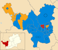
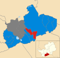
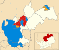
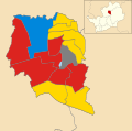
2018 Welwyn Hatfield Borough Council election results.svg 512 × 677; 264 KB
-
2021 Three Rivers District Council election.svg 931 × 1,266; 246 KB
-
2023 EHERTS.svg 744 × 1,052; 885 KB
-
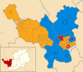
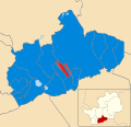
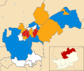
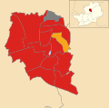
2023 Welwyn Hatfield Borough Council election map.png 958 × 1,266; 170 KB
-
2024 Hertfordshire Police and Crime Commissioner Election.svg 1,425 × 992; 278 KB
-
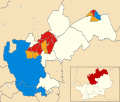
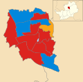
2024 Welwyn Hatfield Borough Council election map.svg 958 × 1,266; 263 KB
-
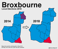
BROXBOURNE (41433229030).png 1,200 × 1,000; 162 KB
-
Broxbourne Borough Council election Results Both 2023 and 2024.svg 924 × 1,266; 176 KB
-
Broxbourne UK local election 2014.svg 924 × 1,266; 178 KB
-
Broxbourne UK local election 2021.svg 924 × 1,266; 178 KB
-
Broxbourne UK ward map 2010 (blank).svg 924 × 1,266; 153 KB
-
Broxbourne UK ward map 2012 (blank).svg 924 × 1,266; 176 KB
-
Dacorum 2019 ward results.svg 1,425 × 1,233; 365 KB
-
Dacorum UK ward map 2007.svg 1,425 × 1,233; 371 KB
-
Dacorum UK ward map 2010 (blank).svg 1,425 × 1,233; 363 KB
-
Dacorum UK ward map 2011.svg 1,425 × 1,233; 371 KB
-
Dacorum UK ward map 2015.svg 1,425 × 1,233; 371 KB
-
Dacorum UK ward map 2023.svg 1,425 × 1,233; 371 KB
-
EAST HERTFORDSHIRE (49910223098).png 2,160 × 1,080; 504 KB
-
East Hertfordshire UK ward map 2010 (blank).svg 1,283 × 1,266; 531 KB
-
East Hertfordshire UK ward map 2015.svg 1,283 × 1,266; 537 KB
-
East Hertfordshire UK ward map 2019.svg 1,283 × 1,266; 537 KB
-
East Hertfordshire wards 2019.svg 1,283 × 1,266; 532 KB
-
East Herts 2019 Results By Party.svg 1,283 × 1,266; 624 KB
-
Hertfordshire local election 2021 map.svg 1,425 × 992; 1.26 MB
-
Hertfordshire UK local election 2013 map.svg 1,425 × 992; 1.18 MB
-
Hertfordshire UK local election 2017 map.svg 1,425 × 992; 1.26 MB
-
Hertfordshire wards 2001.svg 1,425 × 992; 1.18 MB
-
Hertfordshire wards 2005.svg 1,425 × 992; 1.18 MB
-
Hertfordshire wards 2009.svg 1,425 × 992; 1.18 MB
-
HertfordshireParliamentaryConstituency1885Results.svg 1,908 × 1,571; 42 KB
-
HertfordshireParliamentaryConstituency1906Results.svg 1,907 × 1,571; 42 KB
-
HertfordshireParliamentaryConstituency1918Results.svg 1,922 × 1,569; 46 KB
-
HertfordshireParliamentaryConstituency1922Results.svg 1,922 × 1,570; 46 KB
-
HertfordshireParliamentaryConstituency1923Results.svg 1,922 × 1,570; 46 KB
-
HertfordshireParliamentaryConstituency1945Results.svg 1,922 × 1,571; 53 KB
-
HertfordshireParliamentaryConstituency1950Results.svg 2,134 × 1,774; 41 KB
-
HertfordshireParliamentaryConstituency1955Results.svg 2,132 × 1,776; 41 KB
-
HertfordshireParliamentaryConstituency1964Results.svg 2,132 × 1,776; 41 KB
-
HertfordshireParliamentaryConstituency2005Results2.png 197 × 165; 13 KB
-
HertfordshireParliamentaryConstituency2010Results2.png 212 × 179; 27 KB
-
Hertsmere UK local election 2002 map.svg 1,319 × 1,266; 201 KB
-
Hertsmere UK local election 2003 map.svg 1,319 × 1,266; 201 KB
-
Hertsmere UK local election 2004 map.svg 1,319 × 1,266; 201 KB
-
Hertsmere UK local election 2006 map.svg 1,319 × 1,266; 201 KB
-
Hertsmere UK local election 2007 map.svg 1,319 × 1,266; 201 KB
-
Hertsmere UK local election 2008 map.svg 1,319 × 1,266; 201 KB
-
Hertsmere UK local election 2010 map.svg 1,319 × 1,266; 201 KB
-
Hertsmere UK local election 2011 map.svg 1,319 × 1,266; 201 KB
-
Hertsmere UK local election 2012 map.svg 1,319 × 1,266; 201 KB
-
Hertsmere UK local election 2014 map.svg 1,319 × 1,266; 201 KB
-
Hertsmere UK local election 2015 map.svg 1,319 × 1,266; 202 KB
-
Hertsmere UK ward map 2010 (blank).svg 1,319 × 1,266; 201 KB
-
Hertsmere UK ward map 2019.svg 686 × 576; 101 KB
-
Hertsmere UK ward map 2023.svg 686 × 576; 101 KB
-
NORTH HERTFORDSHIER (28373757627).png 1,200 × 1,000; 199 KB
-
North Hertfordshire 2019 ward results.svg 1,425 × 1,207; 394 KB
-
North Hertfordshire UK local election 2021 map.svg 1,425 × 1,207; 394 KB
-
North Hertfordshire UK ward map 2010 (blank).svg 1,425 × 1,207; 393 KB
-
North Hertfordshire UK ward map 2015.svg 1,425 × 1,207; 395 KB
-
North Hertfordshire UK ward map 2016.svg 1,425 × 1,207; 394 KB
-
North Hertfordshire UK ward map 2018.svg 1,425 × 1,207; 394 KB
-
North Hertfordshire UK ward map 2019.svg 1,425 × 1,207; 395 KB
-
North Hertfordshire UK ward map 2022.svg 1,425 × 1,207; 394 KB
-
North Hertfordshire UK ward map 2023.svg 1,425 × 1,207; 394 KB
-
North Hertfordshire UK ward map 2024.svg 756 × 636; 333 KB
-
ST ALBANS (43193614812).png 1,200 × 1,000; 83 KB
-
St Albans UK local election 1999 map.svg 990 × 1,266; 284 KB
-
St Albans UK local election 2000 map.svg 990 × 1,266; 282 KB
-
St Albans UK local election 2002 map.svg 990 × 1,266; 282 KB
-
St Albans UK local election 2003 map.svg 990 × 1,266; 282 KB
-
St Albans UK local election 2004 map.svg 990 × 1,266; 282 KB
-
St Albans UK local election 2006 map.svg 990 × 1,266; 282 KB
-
St Albans UK local election 2007 map.svg 990 × 1,266; 282 KB
-
St Albans UK local election 2008 map.svg 990 × 1,266; 282 KB
-
St Albans UK local election 2010 map.svg 990 × 1,266; 282 KB
-
St Albans UK local election 2011 map.svg 990 × 1,266; 282 KB
-
St Albans UK local election 2012 map.svg 990 × 1,266; 282 KB
-
St Albans UK local election 2014 map.svg 990 × 1,266; 282 KB
-
St Albans UK political composition map.svg 990 × 1,266; 284 KB
-
St Albans UK ward map 2010 (blank).svg 990 × 1,266; 282 KB
-
St Albans UK ward map 2022.svg 551 × 719; 199 KB
-
St Albans UK ward map 2023.svg 551 × 719; 190 KB
-
St Albans UK ward map 2024.svg 588 × 767; 191 KB
-
St Albans wards 2015.svg 990 × 1,266; 282 KB
-
St Albans wards 2016.svg 990 × 1,266; 282 KB
-
St. Alban's 2016 ward results.svg 990 × 1,266; 283 KB
-
St. Alban's 2018 ward results.svg 990 × 1,266; 283 KB
-
St. Alban's 2019 ward results.svg 990 × 1,266; 283 KB
-
St. Alban's 2021 ward results.svg 990 × 1,266; 283 KB
-
STEVENAGE (28373756817).png 1,200 × 1,000; 254 KB
-
Stevenage UK local election 1979 map.svg 1,286 × 1,266; 111 KB
-
Stevenage UK local election 1980,88,90,94 map.svg 1,286 × 1,266; 110 KB
-
Stevenage UK local election 1982 map.svg 1,286 × 1,266; 110 KB
-
Stevenage UK local election 1983 map.svg 1,286 × 1,266; 110 KB
-
Stevenage UK local election 1984 map.svg 1,286 × 1,266; 110 KB
-
Stevenage UK local election 1986 map.svg 1,286 × 1,266; 110 KB
-
Stevenage UK local election 1987 map.svg 1,286 × 1,266; 110 KB
-
Stevenage UK local election 1991 map.svg 1,286 × 1,266; 110 KB
-
Stevenage UK local election 1992 map.svg 1,286 × 1,266; 110 KB
-
Stevenage UK local election 1994 map.svg 1,286 × 1,266; 111 KB
-
Stevenage UK local election 1995 map.svg 1,286 × 1,266; 110 KB
-
Stevenage UK local election 1996 and 1998 map.svg 1,286 × 1,266; 110 KB
-
Stevenage UK local election 2004 map.svg 1,286 × 1,266; 129 KB
-
Stevenage UK local election 2008 map.svg 1,286 × 1,266; 129 KB
-
Stevenage UK local election 2012 map.svg 1,286 × 1,266; 129 KB
-
Stevenage UK local election 2015 map.svg 1,286 × 1,266; 129 KB
-
Stevenage UK local election 2016 map.svg 1,286 × 1,266; 129 KB
-
Stevenage UK local election 2018 map.svg 1,286 × 1,266; 129 KB
-
Stevenage UK local election 2019 map.svg 1,286 × 1,266; 129 KB
-
Stevenage UK local election 2021 map.svg 1,286 × 1,266; 129 KB
-
Stevenage UK local election 2022 map.svg 1,286 × 1,266; 128 KB
-
Stevenage UK local election 2023 map.svg 1,286 × 1,266; 128 KB
-
Stevenage UK ward map 2024.svg 571 × 649; 108 KB
-
Three Rivers (42140587925).png 1,658 × 1,220; 103 KB
-
Three Rivers UK local election 2018 map.svg 931 × 1,266; 246 KB
-
Three Rivers UK local election 2019 map.svg 931 × 1,266; 246 KB
-
Three Rivers UK local election 2022 map.svg 931 × 1,266; 245 KB
-
Three Rivers UK ward map 2010 (blank).svg 931 × 1,266; 238 KB
-
Three Rivers UK ward map 2014 (blank).svg 931 × 1,266; 244 KB
-
Three Rivers UK ward map 2023.svg 931 × 1,266; 245 KB
-
Three Rivers UK ward map 2024.svg 931 × 1,266; 245 KB
-
Three Rivers wards 2014.svg 931 × 1,266; 245 KB
-
Three Rivers wards 2015.svg 931 × 1,266; 245 KB
-
Three Rivers wards 2016.svg 931 × 1,266; 245 KB
-
Watford (42140588615).png 1,112 × 1,068; 95 KB
-
Watford UK local election 2021 map.svg 990 × 1,266; 169 KB
-
Watford UK local election 2022 map.svg 990 × 1,266; 168 KB
-
Watford UK ward map 2010 (blank).svg 990 × 1,266; 109 KB
-
Watford UK ward map 2016 (blank).svg 990 × 1,266; 167 KB
-
Watford UK ward map 2018.svg 990 × 1,266; 168 KB
-
Watford UK ward map 2019.svg 990 × 1,266; 168 KB
-
Watford UK ward map 2023.svg 990 × 1,266; 168 KB
-
Watford UK ward map 2024.svg 990 × 1,266; 168 KB
-
Watford wards 2010.svg 990 × 1,266; 109 KB
-
Watford wards 2012.svg 990 × 1,266; 109 KB
-
Watford wards 2014.svg 990 × 1,266; 109 KB
-
Watford wards 2015.svg 990 × 1,266; 109 KB
-
Watford wards 2016.svg 990 × 1,266; 170 KB
-
Welwyn Hatfield (42993277072).png 1,376 × 1,210; 121 KB
-
Welwyn Hatfield 2019 ward results.svg 958 × 1,266; 265 KB
-
Welwyn Hatfield UK local election 2021 map.svg 958 × 1,266; 266 KB
-
Welwyn Hatfield UK ward map 2010 (blank).svg 958 × 1,266; 240 KB
-
Welwyn Hatfield UK ward map 2016 (blank).svg 958 × 1,266; 263 KB
-
Welwyn Hatfield UK ward map 2022.svg 958 × 1,266; 265 KB


