Category:Election maps of Cumbria
Jump to navigation
Jump to search
This category contains election maps for the ceremonial county of Cumbria.
Media in category "Election maps of Cumbria"
The following 84 files are in this category, out of 84 total.
-
 2013 Cumbria County Council Election Results Map.png 3,154 × 2,068; 645 KB
-
 2017 Cumbria County Council Election Results Map.png 3,154 × 2,068; 663 KB
-
 2019 Barrow-in-Furness Borough Council Election Results Map.png 1,616 × 1,320; 271 KB
-
 2019 Eden District Council election.svg 2,548 × 1,424; 829 KB
-
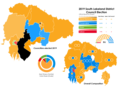 2019 South lakeland District Council Election Results Map.png 2,319 × 1,728; 517 KB
-
 2021 Cumbria PCC Election.svg 157 × 208; 304 KB
-
 2022 Cumberland Council Election Results Map.png 2,853 × 3,916; 706 KB
-
 2022 Westmorland and Furness Council Election Results Map.png 3,487 × 2,390; 808 KB
-
 ALLERDALE (49911039857).png 2,160 × 1,080; 448 KB
-
 Allerdale UK local election 1999 map.svg 1,015 × 1,345; 883 KB
-
 Allerdale UK local election 2003 map.svg 1,015 × 1,345; 883 KB
-
 Allerdale UK local election 2007 map.svg 1,015 × 1,345; 883 KB
-
 Allerdale UK local election 2011 map.svg 1,015 × 1,345; 883 KB
-
 Allerdale UK local election 2015 map.svg 1,015 × 1,345; 889 KB
-
 Allerdale UK ward map 2019.svg 545 × 806; 477 KB
-
 Barrow 2006 election map.png 312 × 480; 33 KB
-
 Barrow 2007 election map.png 312 × 480; 32 KB
-
 BARROW-IN-FURNESS (49911039662).png 2,160 × 1,080; 182 KB
-
 Barrow-in-Furness UK local election 2008 map.svg 833 × 1,345; 367 KB
-
 Barrow-in-Furness UK local election 2010 map.svg 833 × 1,345; 366 KB
-
 Barrow-in-Furness UK local election 2011 map.svg 833 × 1,345; 366 KB
-
 Barrow-in-Furness UK local election 2015 map.svg 833 × 1,345; 368 KB
-
 Barrow-in-Furness UK local election 2019 map.svg 833 × 1,345; 368 KB
-
 Carlisle (42140583245).png 1,812 × 1,296; 146 KB
-
 Carlisle UK local election 2002 map.svg 1,252 × 1,346; 666 KB
-
 Carlisle UK local election 2003 map.svg 1,252 × 1,346; 666 KB
-
 Carlisle UK local election 2004 map.svg 1,252 × 1,346; 666 KB
-
 Carlisle UK local election 2006 map.svg 1,252 × 1,346; 666 KB
-
 Carlisle UK local election 2007 map.svg 1,252 × 1,346; 666 KB
-
 Carlisle UK local election 2008 map.svg 1,252 × 1,346; 666 KB
-
 Carlisle UK local election 2010 map.svg 1,252 × 1,346; 666 KB
-
 Carlisle UK local election 2011 map.svg 1,252 × 1,346; 666 KB
-
 Carlisle UK local election 2012 map.svg 1,252 × 1,346; 666 KB
-
 Carlisle UK local election 2014 map.svg 1,252 × 1,346; 666 KB
-
 Carlisle UK local election 2015 map.svg 1,252 × 1,346; 667 KB
-
 Carlisle UK ward map 2019.svg 1,035 × 1,050; 309 KB
-
 Carlisle wards 2016.svg 1,252 × 1,346; 666 KB
-
 Carlisle wards 2018.svg 1,252 × 1,346; 667 KB
-
 Copeland UK local election 2003 map.svg 1,044 × 1,346; 653 KB
-
 Copeland UK local election 2007 map.svg 1,044 × 1,346; 652 KB
-
 Copeland UK local election 2011 map.svg 1,044 × 1,346; 653 KB
-
 Copeland UK local election 2015 map.svg 1,044 × 1,346; 659 KB
-
 Copeland UK ward map 2019.svg 546 × 791; 328 KB
-
 CumberlandWestmorlandParliamentaryConstituency1885Results.svg 1,779 × 2,067; 82 KB
-
 CumberlandWestmorlandParliamentaryConstituency1886Results.svg 1,779 × 2,067; 82 KB
-
 CumberlandWestmorlandParliamentaryConstituency1892Results.svg 1,779 × 2,067; 82 KB
-
 CumberlandWestmorlandParliamentaryConstituency1895Results.svg 1,779 × 2,067; 82 KB
-
 CumberlandWestmorlandParliamentaryConstituency1900Results.svg 1,779 × 2,067; 82 KB
-
 CumberlandWestmorlandParliamentaryConstituency1906Results.svg 1,779 × 2,067; 82 KB
-
 CumberlandWestmorlandParliamentaryConstituency1910DResults.svg 1,779 × 2,067; 82 KB
-
 CumberlandWestmorlandParliamentaryConstituency1910JResults.svg 1,779 × 2,067; 82 KB
-
 CumberlandWestmorlandParliamentaryConstituency1918Results.svg 1,768 × 2,083; 80 KB
-
 CumberlandWestmorlandParliamentaryConstituency1922Results.svg 1,768 × 2,083; 80 KB
-
 CumberlandWestmorlandParliamentaryConstituency1923Results.svg 1,768 × 2,083; 80 KB
-
 CumberlandWestmorlandParliamentaryConstituency1924Results.svg 1,768 × 2,083; 80 KB
-
 CumberlandWestmorlandParliamentaryConstituency1935Results.svg 1,768 × 2,083; 80 KB
-
 CumberlandWestmorlandParliamentaryConstituency1945Results.svg 1,768 × 2,083; 80 KB
-
 CumberlandWestmorlandParliamentaryConstituency1950Results.svg 1,808 × 2,110; 23 KB
-
 CumberlandWestmorlandParliamentaryConstituency1955Results.svg 1,808 × 2,110; 23 KB
-
 CumberlandWestmorlandParliamentaryConstituency1964Results.svg 1,808 × 2,110; 23 KB
-
 Cumbria UK local election 2001 map.svg 1,140 × 1,345; 2.05 MB
-
 Cumbria UK local election 2005 map.svg 1,140 × 1,345; 2.05 MB
-
 Cumbria UK local election 2013 map.svg 1,140 × 1,345; 1.58 MB
-
 Cumbria UK local election 2017 map.svg 1,140 × 1,345; 1.59 MB
-
 Cumbria wards 2009.svg 1,140 × 1,345; 2.05 MB
-
 CumbriaParliamentaryConstituency2005Results2.png 200 × 260; 29 KB
-
 CumbriaParliamentaryConstituency2015Results2.png 208 × 275; 32 KB
-
 CumbriaParliamentaryConstituency2017Results.png 208 × 275; 32 KB
-
 CumbriaParliamentaryConstituency2024Results.svg 435 × 603; 115 KB
-
 Eden UK ward map 2015.svg 903 × 836; 712 KB
-
 Eden UK ward map 2019.svg 903 × 836; 712 KB
-
 South Lakeland 2006 election.png 796 × 640; 162 KB
-
 South Lakeland 2007 election.png 796 × 640; 158 KB
-
 South Lakeland UK local election 2008 map.svg 1,425 × 1,174; 1.06 MB
-
 South Lakeland UK local election 2010 map.svg 1,425 × 1,174; 1.06 MB
-
 South Lakeland UK local election 2011 map.svg 1,425 × 1,174; 1.06 MB
-
 South Lakeland UK local election 2012 map.svg 1,425 × 1,174; 1.06 MB
-
 South Lakeland UK local election 2014 map.svg 1,425 × 1,174; 1.06 MB
-
 South Lakeland UK local election 2015 map.svg 1,425 × 1,174; 1.06 MB
-
 South Lakeland UK local election 2016 map.svg 1,425 × 1,174; 1.06 MB
-
 South Lakeland UK local election 2018 map.svg 1,425 × 1,174; 949 KB
-
 South Lakeland UK local election 2019 map.svg 1,425 × 1,174; 948 KB
-
 South Lakeland wards 2016.svg 1,425 × 1,174; 1.06 MB
-
 South Lakelands (42140587255).png 1,886 × 1,360; 167 KB


.png)


.png)


.png)


.png)