Category:19th-century maps of Dominica
Jump to navigation
Jump to search
Countries of North America: Antigua and Barbuda · The Bahamas · Barbados · Belize · Canada · Costa Rica · Cuba · Dominica · Dominican Republic · Grenada · Guatemala · Haiti · Honduras · Jamaica · Mexico · Nicaragua · Panama · Saint Kitts and Nevis · Saint Vincent and the Grenadines · Trinidad and Tobago‡ · United States of America‡
Other territories: Bermuda · Greenland · Guadeloupe · Martinique · Puerto Rico
‡: partly located in North America
Other territories: Bermuda · Greenland · Guadeloupe · Martinique · Puerto Rico
‡: partly located in North America
Subcategories
This category has the following 8 subcategories, out of 8 total.
1
D
Media in category "19th-century maps of Dominica"
The following 7 files are in this category, out of 7 total.
-

-
 Map of Dominica (1888).jpg 651 × 981; 391 KB
-
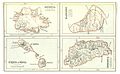 Map of Antigua, Barbados, St.Kitts and Dominica (1888).jpg 1,935 × 1,201; 1.43 MB
-

-
 Admiralty Chart No 697 Dominica, Published 1876, New Edition 1914.jpg 11,265 × 16,510; 43.47 MB
-
 Admiralty Chart No 956 Guadeloupe to Trinidad, Published 1886.jpg 11,283 × 16,450; 28.44 MB
-

_-_Geographicus_-_MartiniqueDominica-thomson-1814.jpg)
.jpg)
.jpg)
.jpg)


%27_(16402878558).jpg)