Category:18th-century maps of Dominica
Jump to navigation
Jump to search
Countries of North America: Antigua and Barbuda · The Bahamas · Barbados · Belize · Canada · Costa Rica · Cuba · Dominica · Guatemala · Haiti · Honduras · Jamaica · Mexico · Nicaragua · Panama · Saint Kitts and Nevis · Saint Vincent and the Grenadines · Trinidad and Tobago‡ · United States of America‡
Other territories: Bermuda · Greenland · Guadeloupe · Martinique · Puerto Rico
‡: partly located in North America
Other territories: Bermuda · Greenland · Guadeloupe · Martinique · Puerto Rico
‡: partly located in North America
Media in category "18th-century maps of Dominica"
The following 29 files are in this category, out of 29 total.
-
-

-

-

-
-

-

-

-

-

-

-

-

-

-
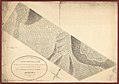
 A plan of the Rosalij Compy. Estates showing the impracticable lands LOC 74695809.jpg 5,500 × 8,136; 5.09 MB
-
 A plan of the Rosalij Compy. Estates showing the impracticable lands LOC 74695809.tif 5,500 × 8,136; 128.03 MB
-

-

-

-
-
 Dominica from an actual survey compleated in the year 1773 (4587173766).jpg 1,558 × 2,000; 2.88 MB
-
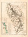
 Dominica, from an actual survey compleated in the year 1773. LOC 74690596.jpg 5,630 × 7,263; 5.67 MB
-
 Dominica, from an actual survey compleated in the year 1773. LOC 74690596.tif 5,630 × 7,263; 116.99 MB
-
 Dominica1778.jpg 3,354 × 4,361; 1.91 MB
-
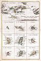
 Jean-Henri Hassenfratz. Carte de l'Ile de la Dominique, 1779.png 512 × 651; 482 KB
-

-

-

-
 Prince Rupert's Head, Dominica 1799 MPHH1-18-1.jpg 2,000 × 1,187; 1.85 MB

.jpg)


.jpg)

.jpg)


