Category:19th-century maps of Guatemala
Jump to navigation
Jump to search
Subcategories
This category has the following 3 subcategories, out of 3 total.
- 1860s maps of Guatemala (2 F)
- 1880s maps of Guatemala (3 F)
- 1890s maps of Guatemala (3 F)
Media in category "19th-century maps of Guatemala"
The following 29 files are in this category, out of 29 total.
-
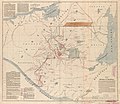
(Guatemala-boundary-Mexico). LOC 86693877.jpg 4,745 × 5,771; 3.67 MB
-
(Guatemala-boundary-Mexico). LOC 86693877.tif 4,745 × 5,771; 78.34 MB
-
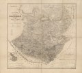
Guatemala, ou Provinces-Unies de L'Amérique Centrale.jpg 11,705 × 8,336; 15.44 MB
-
Partie du Guatemala. Amer. Sep. 72.jpg 9,076 × 6,731; 10.26 MB
-
469 of 'Die Culturländer des alten America' (11127908974).jpg 3,158 × 2,885; 2.07 MB
-
Admiralty Chart No 1049 Elena Bay to San Jose, Published1888.jpg 16,406 × 11,248; 28.19 MB
-
Barclay's Dictionary Mexico and Guatamala.jpg 5,935 × 4,776; 18.72 MB
-
Catherwood - Santa Cruz del Quiche - Qumarkaj map.jpg 497 × 360; 143 KB
-
Estadoguatemala1832 2014-06-22 10-02.jpg 1,280 × 950; 381 KB
-
Guatemala land quetzal Brigham 1887 10.jpeg 572 × 555; 102 KB
-
Map of Guatemala - reduced from the survey in the archives of that country, 1826. LOC 2004629011.tif 7,485 × 5,967; 127.78 MB
-
Map of Guatemala- Reduced from the Survey in the Archives of that Country, 1826 WDL146.png 1,284 × 1,024; 2.06 MB
-
Map of the republic of Guatemala LOC 2007627461.jpg 9,919 × 8,577; 9.86 MB
-
Map of the republic of Guatemala LOC 2007627461.tif 9,919 × 8,577; 243.4 MB
-
Mapa carrera.jpg 720 × 627; 286 KB
-
Mapa general de la Republica de la Guatemala. LOC 2012586638.jpg 12,451 × 11,040; 18.95 MB
-
Mapa general de la Republica de la Guatemala. LOC 2012586638.tif 12,451 × 11,040; 393.27 MB
-
Mapa1868.jpg 960 × 720; 354 KB
-
Mapaciudad1.jpg 454 × 403; 115 KB
-
SantoTomasdeCastilla.jpg 863 × 866; 773 KB
-
Soconusco in 1853 Map of Mexico Gaspar y Roig.jpg 644 × 556; 321 KB
-
West-Indien und Centro-America.jpg 5,742 × 4,629; 7.17 MB


