Category:19th-century maps of Jamaica
Jump to navigation
Jump to search
Countries of North America: Antigua and Barbuda · The Bahamas · Barbados · Belize · Canada · Costa Rica · Cuba · Dominica · Dominican Republic · Grenada · Guatemala · Haiti · Honduras · Jamaica · Mexico · Nicaragua · Panama · Saint Kitts and Nevis · Saint Vincent and the Grenadines · Trinidad and Tobago‡ · United States‡
Other territories: Bermuda · Greenland · Guadeloupe · Martinique · Puerto Rico
‡: partly located in North America
Other territories: Bermuda · Greenland · Guadeloupe · Martinique · Puerto Rico
‡: partly located in North America
Subcategories
This category has the following 4 subcategories, out of 4 total.
- 1850s maps of Jamaica (10 F)
Media in category "19th-century maps of Jamaica"
The following 23 files are in this category, out of 23 total.
-

-
 Atlas moderne portatif 1804 (84189614).jpg 6,395 × 5,235; 3.86 MB
-
 Mesopotamia plantation, Jamaica.jpg 909 × 817; 291 KB
-
 Trinity plantation on James Robertson's map of 1804.png 661 × 720; 896 KB
-

-
 Jamaica1822carreylea.jpg 3,726 × 3,522; 497 KB
-
 1825 Carez Map of Jamaica ( West Indies ) - Geographicus - Jamaica-carez-1825.jpg 20,222 × 15,333; 35.64 MB
-

-
 Island of Jamaica, by W. Heather, revised by J. W. Norie - btv1b550111981.jpg 15,639 × 10,636; 17.25 MB
-
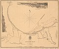
 Admiralty Chart No 448 St. Lucea harbour, Published 1836.jpg 3,720 × 4,822; 2.19 MB
-
 Admiralty Chart No 1379 Annatto Bay, Published 1841.jpg 4,532 × 3,786; 3.04 MB
-
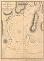
 Rough sketch of country round Kingston Jamaica... - btv1b53029109b.jpg 10,793 × 8,426; 12.92 MB
-
 Rough Sketch of country round Kinston, Jamaica... - btv1b53029051f.jpg 10,452 × 8,332; 12.56 MB
-
 PSM V40 D802 Port royal before the 1692 earthquake and the dotted area after.jpg 1,739 × 820; 163 KB
-
 Geological map of part of Jamaica (2675473578).jpg 2,000 × 1,286; 2.16 MB
-
 Admiralty Chart No 449 Mosquito Cove, on the north side of Jamaica, Published 1816.jpg 2,706 × 4,922; 2.92 MB
-
 Admiralty Chart No 450 Montego Bay, Jamaica, Published 1815.jpg 3,408 × 4,654; 3.53 MB
-
 Admiralty Chart No 451 Martha Brae, Jamaica, Published 1815.jpg 4,478 × 3,938; 3.66 MB
-
 Admiralty Chart No 453 Port Antonio Jamaica, Published 1815.jpg 4,461 × 3,008; 3.33 MB
-
 Admiralty Chart No 454 Port Morant, Published 1815.jpg 3,339 × 4,663; 3.28 MB
-

-
 Admiralty Chart No 458 The anchorage at Blewfields, Jamaica, Published 1815.jpg 3,452 × 4,655; 3.55 MB
-
 The Graphic 1883, p. 63.jpg 1,250 × 1,717; 359 KB

.jpg)


_-_Geographicus_-_Jamaica-carez-1825.jpg)


.jpg)


