
Category:1980s maps of Boston
Most populous urban areas of the world: Boston [US] · Paris [FR] · Philadelphia [US] · San Francisco [US] · Toronto [CA] · Washington, D.C. [US]
- 100 most populous cities of the United States
- 1–25
- Boston
- Philadelphia
- San Francisco
- Washington, D.C.
- 26–50
- 51–75
- 76–100
State capitals of the United States: Boston [MA] · Federal district: Washington, D.C. [DC] · Insular area of the United States
Media in category "1980s maps of Boston"
The following 10 files are in this category, out of 10 total.
-
-
 Boston National Historical Park, Massachusetts LOC 83690286.jpg 5,024 × 9,432; 7.05 MB
-
 Boston National Historical Park, Massachusetts LOC 83690286.tif 5,024 × 9,432; 135.57 MB
-
 Boston National Historical Park, Massachusetts LOC 83695667.jpg 4,986 × 9,406; 7.07 MB
-
 Boston National Historical Park, Massachusetts LOC 83695667.tif 4,986 × 9,406; 134.18 MB
-
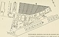
 Boston National Historical Park, Massachusetts LOC 83695668.jpg 4,928 × 4,686; 4.1 MB
-
 Boston National Historical Park, Massachusetts LOC 83695668.tif 4,928 × 4,686; 66.07 MB
-
 Boston National Historical Park, Massachusetts LOC 88693019.jpg 5,024 × 9,483; 7.32 MB
-
 Boston National Historical Park, Massachusetts LOC 88693019.tif 5,024 × 9,483; 136.31 MB
-
 Mandela precincts.svg 1,440 × 1,080; 385 KB
.jpg)


