
Category:1930s maps of Boston
Most populous urban areas of the world: Boston [US] · Chicago [US] · Istanbul [TR] · London [GB] · New York City [US] · Paris [FR] · Philadelphia [US] · San Francisco [US] · São Paulo [BR] · Tokyo [JP] · Toronto [CA] · Washington, D.C. [US]
State capitals of the United States: Boston [MA] · Denver [CO] · Federal district: Washington, D.C. [DC] · Insular area of the United States
Subcategories
This category has only the following subcategory.
Media in category "1930s maps of Boston"
The following 5 files are in this category, out of 5 total.
-

-
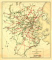
 1934 Boston Elevated Railway bus routes map.png 2,689 × 3,500; 2.9 MB
-
 Motor routes that intersect the Bay Circuit (2675092604).jpg 1,458 × 2,000; 2.37 MB
-
 1937 Boston Elevated Railway system map.png 3,037 × 3,500; 16.8 MB
-
 1938 Map of Greater Boston.jpg 1,500 × 928; 760 KB
_(14777287521).jpg)

.jpg)

